TopoQuest Logo
Do you find TopoQuest useful?
Help keep TopoQuest running and adding new maps/features by donating!
Bitcoin:  19c7KJd3qBynnjoSw5npx9KScwjBe4ifkT
Litecoin:  LXs6TkuXGGXo1vDsWCkWVdjQX94eUKd6ui
Home View Maps Find Maps Find Places Resources & Links


Dana Ranch, Montana Topographic Map

USGS Map Title: Dana Ranch, MT
USGS Map MRC: 47111A5
DRG (GeoTIFF) Download: o47111a5.tif


Neighboring USGS Topographic Map Quads:


  Rocky Reef, MT  
47111B6
 

  Schrammeck Lake, MT  
47111B5
 

  Spanish Coulee School, MT  
47111B4
 

  Hound Creek Reservoir, MT  
47111A6
 

  Dana Ranch, MT  
47111A5
 

  Conway Ridge, MT  
47111A4
 

  Middle Creek Lake, MT  
46111H6
 

  B K Ranch, MT  
46111H5
 

  Lingshire NW, MT  
46111H4


Map MRC Location:

N48°
W112°
N48°
W111°
H8 H7 H6 H5 H4 H3 H2 H1
G8 G7 G6 G5 G4 G3 G2 G1
F8 F7 F6 F5 F4 F3 F2 F1
E8 E7 E6 E5 E4 E3 E2 E1
D8 D7 D6 D5 D4 D3 D2 D1
C8 C7 C6 C5 C4 C3 C2 C1
B8 B7 B6 B5 B4 B3 B2 B1
A8 A7 A6 A5 A4 A3 A2 A1
N47°
W112°
N47°
W111°

Dana Ranch, MT USGS 1:24K Topographic Map Preview:
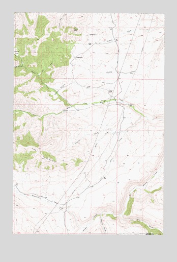
Dana Ranch, MT USGS Topographic Map
Click on map above to begin viewing in our Map Viewer.

This topographic map contains these locations and features:
Feature Name Type Latitude Longitude GNIS ID View Map
AdelPopulated PlaceN47.0277°W111.6239°768124View Map
Adel Post Office (historical)Post OfficeN47.0277°W111.6239°1762290View Map
Allen CreekStreamN47.0672°W111.5183°768204View Map
Castle RockSummitN47.1152°W111.5769°769660View Map
Crooked CreekStreamN47.0113°W111.5522°781910View Map
Dana RanchLocaleN47.0569°W111.5394°770448View Map
Encampment CreekStreamN47.0047°W111.5644°771225View Map
Fourteen CreekStreamN47.0599°W111.5308°771571View Map
Gordon RanchLocaleN47.1074°W111.5616°771873View Map
Mill CouleeStreamN47.0891°W111.6047°774222View Map
Parsons RanchLocaleN47.0827°W111.5641°775097View Map
Pine CouleeValleyN47.0122°W111.5347°775233View Map
Richardson CreekStreamN47.1149°W111.5286°775748View Map
Soldier Creek School (historical)SchoolN47.1166°W111.5411°1761935View Map
Spring CreekStreamN47.0577°W111.5372°777004View Map
Staunton RanchLocaleN47.0730°W111.5297°777174View Map
Thompson RanchLocaleN47.0999°W111.5755°777588View Map
Too-nah-hin CreekStreamN47.0725°W111.5750°777125View Map
Too-nah-hin HollowValleyN47.0794°W111.5886°777132View Map
Turtle ButteSummitN47.0802°W111.5447°777814View Map
Wade CouleeValleyN47.0947°W111.6183°778055View Map
Wosinek FlatsFlatN47.1024°W111.6241°778700View Map

Note: Coordinates in the location and feature list above are referenced to NAD83 datum.


Copyright (C) 2008-2024 Ryan Niemi / Sunset Dynamics ... All Rights Reserved