TopoQuest Logo
Do you find TopoQuest useful?
Help keep TopoQuest running and adding new maps/features by donating!
Bitcoin:  19c7KJd3qBynnjoSw5npx9KScwjBe4ifkT
Litecoin:  LXs6TkuXGGXo1vDsWCkWVdjQX94eUKd6ui
Home View Maps Find Maps Find Places Resources & Links


Davisboro SE, Georgia Topographic Map

USGS Map Title: Davisboro SE, GA
USGS Map MRC: 32082G5
DRG (GeoTIFF) Download: o32082g5.tif


Neighboring USGS Topographic Map Quads:


  Riddleville, GA  
32082H6
 

  Davisboro, GA  
32082H5
 

  Louisville South, GA  
32082H4
 

  Harrison, GA  
32082G6
 

  Davisboro SE, GA  
32082G5
 

  Wadley, GA  
32082G4
 

  Wrightsville, GA  
32082F6
 

  Kite, GA  
32082F5
 

  Dellwood, GA  
32082F4


Map MRC Location:

N33°
W83°
N33°
W82°
H8 H7 H6 H5 H4 H3 H2 H1
G8 G7 G6 G5 G4 G3 G2 G1
F8 F7 F6 F5 F4 F3 F2 F1
E8 E7 E6 E5 E4 E3 E2 E1
D8 D7 D6 D5 D4 D3 D2 D1
C8 C7 C6 C5 C4 C3 C2 C1
B8 B7 B6 B5 B4 B3 B2 B1
A8 A7 A6 A5 A4 A3 A2 A1
N32°
W83°
N32°
W82°

Davisboro SE, GA USGS 1:24K Topographic Map Preview:
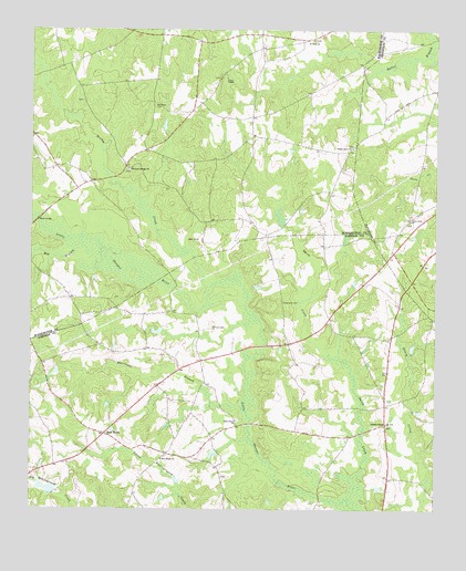
Davisboro SE, GA USGS Topographic Map
Click on map above to begin viewing in our Map Viewer.

This topographic map contains these locations and features:
Feature Name Type Latitude Longitude GNIS ID View Map
Big BranchStreamN32.8185°W82.6082°311343View Map
Dukes LakeReservoirN32.8505°W82.5836°348312View Map
Greenway CemeteryCemeteryN32.8043°W82.5465°314873View Map
Hurricane BranchStreamN32.7765°W82.5587°315841View Map
Jones ChapelChurchN32.8627°W82.5635°316219View Map
King-Mason CemeteryCemeteryN32.7771°W82.5304°346668View Map
Lewis LakeReservoirN32.8152°W82.5315°336385View Map
Lewis Lake DamDamN32.8152°W82.5315°336384View Map
Nails Creek ChurchChurchN32.8257°W82.5076°319192View Map
Nealey CreekStreamN32.8079°W82.5687°319224View Map
New HomeLocaleN32.7696°W82.6018°319334View Map
New Home ChurchChurchN32.7632°W82.5837°319341View Map
New Home Community Volunteer Fire DepartmentBuildingN32.7700°W82.5791°2604501View Map
News BridgeBridgeN32.8254°W82.6229°319579View Map
Oaky Grove ChurchChurchN32.7735°W82.5610°319875View Map
Pleasant Springs CemeteryCemeteryN32.8385°W82.5946°348378View Map
Pleasant Springs ChurchChurchN32.8388°W82.5946°320928View Map
Powells ChapelChurchN32.7727°W82.5149°321117View Map
Price CemeteryCemeteryN32.7977°W82.5679°321134View Map
Saint Pauls ChurchChurchN32.8727°W82.5374°322269View Map
Smith CreekStreamN32.7529°W82.5265°323128View Map
Talbot Grove ChurchChurchN32.8443°W82.5251°323886View Map
Tarvers Grove School (historical)SchoolN32.8457°W82.5243°345768View Map
West CemeteryCemeteryN32.8204°W82.5726°325041View Map
Whitfield CemeteryCemeteryN32.8557°W82.5862°325232View Map
Whittmer PondReservoirN32.7552°W82.6165°341452View Map
Whittmer Pond DamDamN32.7552°W82.6165°341451View Map

Note: Coordinates in the location and feature list above are referenced to NAD83 datum.


Copyright (C) 2008-2024 Ryan Niemi / Sunset Dynamics ... All Rights Reserved