TopoQuest Logo
Do you find TopoQuest useful?
Help keep TopoQuest running and adding new maps/features by donating!
Bitcoin:  19c7KJd3qBynnjoSw5npx9KScwjBe4ifkT
Litecoin:  LXs6TkuXGGXo1vDsWCkWVdjQX94eUKd6ui
Home View Maps Find Maps Find Places Resources & Links


Dawson, Pennsylvania Topographic Map

USGS Map Title: Dawson, PA
USGS Map MRC: 40079A6
DRG (GeoTIFF) Download: o40079a6.tif


Neighboring USGS Topographic Map Quads:


  Donora, PA  
40079B7
 

  Smithton, PA  
40079B6
 

  Mount Pleasant, PA  
40079B5
 

  Fayette City, PA  
40079A7
 

  Dawson, PA  
40079A6
 

  Connellsville, PA  
40079A5
 

  New Salem, PA  
39079H7
 

  Uniontown, PA  
39079H6
 

  South Connellsville, PA  
39079H5


Map MRC Location:

N41°
W80°
N41°
W79°
H8 H7 H6 H5 H4 H3 H2 H1
G8 G7 G6 G5 G4 G3 G2 G1
F8 F7 F6 F5 F4 F3 F2 F1
E8 E7 E6 E5 E4 E3 E2 E1
D8 D7 D6 D5 D4 D3 D2 D1
C8 C7 C6 C5 C4 C3 C2 C1
B8 B7 B6 B5 B4 B3 B2 B1
A8 A7 A6 A5 A4 A3 A2 A1
N40°
W80°
N40°
W79°

Dawson, PA USGS 1:24K Topographic Map Preview:
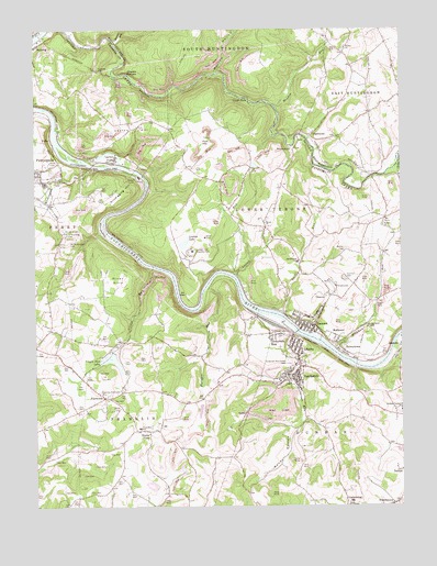
Dawson, PA USGS Topographic Map
Click on map above to begin viewing in our Map Viewer.

This topographic map contains these locations and features:
Feature Name Type Latitude Longitude GNIS ID View Map
Alliance FurnacePopulated PlaceN40.1140°W79.7187°1202967View Map
Arnold Farm DamDamN40.0267°W79.6931°1194494View Map
Barren RunStreamN40.1212°W79.7223°1168759View Map
Bethel CemeteryCemeteryN40.0666°W79.6444°1169355View Map
Borough of DawsonCivilN40.0472°W79.6572°1215225View Map
Borough of VanderbiltCivilN40.0339°W79.6631°1215240View Map
Bowman - Flatwoods CemeteryCemeteryN40.0295°W79.7252°1170070View Map
Brownfield Elementary SchoolSchoolN40.0640°W79.6603°1210522View Map
Bryan ChurchChurchN40.0742°W79.6712°1170480View Map
Buena VistaPopulated PlaceN40.0198°W79.7109°1203184View Map
ChaintownPopulated PlaceN40.0970°W79.6553°1203244View Map
Cochran CemeteryCemeteryN40.0597°W79.6441°1172107View Map
Creek FallsFallsN40.1073°W79.6778°1172668View Map
Cunningham School (historical)SchoolN40.0626°W79.6673°1205945View Map
DawsonPopulated PlaceN40.0470°W79.6545°1172998View Map
Dawson Post OfficePost OfficeN40.0457°W79.6540°2773115View Map
Dawson Volunteer Fire Company Station 11BuildingN40.0476°W79.6565°2645766View Map
Dawson-Vanderbilt SchoolSchoolN40.0251°W79.6250°1192332View Map
Dickerson RunPopulated PlaceN40.0456°W79.6664°1173246View Map
Dickerson RunStreamN40.0459°W79.6614°1173247View Map
Dickerson Run Liberty and Vanderbilt Volunteer Fire Department Station 10BuildingN40.0322°W79.6615°2644861View Map
Dickerson Run Post OfficePost OfficeN40.0421°W79.6605°2772668View Map
Dickerson Run-Union CemeteryCemeteryN40.0381°W79.6631°1173248View Map
Emergency Medical Services Southwest PerryopolisBuildingN40.0868°W79.7492°2719596View Map
Fayette Emergency Medical Services Tri - Town StationBuildingN40.0336°W79.6764°2719620View Map
FlatwoodsPopulated PlaceN40.0284°W79.7259°1203596View Map
Flatwoods Volunteer Fire Department Station 48BuildingN40.0294°W79.7271°2645199View Map
Fort HillSummitN40.0954°W79.6900°1198759View Map
Franklin Elementary SchoolSchoolN40.0206°W79.7139°1211563View Map
FullerPopulated PlaceN40.0973°W79.7453°1203642View Map
Furnace RunStreamN40.0570°W79.6912°1198777View Map
Gault SchoolSchoolN40.0809°W79.6567°1205952View Map
Hickman RunStreamN40.0406°W79.6475°1176945View Map
HulltownPopulated PlaceN40.0429°W79.6475°1177577View Map
Jackson School (historical)SchoolN40.0465°W79.7431°1205949View Map
Jefferson SchoolSchoolN40.0392°W79.6917°1205947View Map
KierPopulated PlaceN40.0859°W79.7123°1201598View Map
Kilndigging HillSummitN40.0826°W79.7170°1178454View Map
Laurel RunStreamN40.0604°W79.6823°1178974View Map
LaytonPopulated PlaceN40.0904°W79.7234°1179069View Map
Layton HillSummitN40.0979°W79.7164°1179070View Map
LibertyPopulated PlaceN40.0426°W79.6606°1179253View Map
Linden Hall Country ClubLocaleN40.0667°W79.6959°1213269View Map
Linden LakeLakeN40.0691°W79.6987°1179412View Map
Meadow RunStreamN40.1048°W79.6678°1180834View Map
Morrow HollowValleyN40.1138°W79.6874°1181590View Map
Mount Washington CemeteryCemeteryN40.0701°W79.7392°1181884View Map
NelliePopulated PlaceN40.0251°W79.6778°1204269View Map
Perryopolis Post OfficePost OfficeN40.0865°W79.7489°2779882View Map
Pleasant Grove School (historical)SchoolN40.0984°W79.7164°1205950View Map
Quay School (historical)SchoolN40.0876°W79.6939°1205951View Map
RaineytownPopulated PlaceN40.0404°W79.6439°1184607View Map
River HillsRangeN40.0595°W79.7192°1185129View Map
RogerstownPopulated PlaceN40.0015°W79.6264°1185395View Map
RoundbottomBendN40.0731°W79.7264°1185558View Map
RoundtopSummitN40.0931°W79.6670°1185560View Map
Saint Johns CemeteryCemeteryN40.0723°W79.7403°1186057View Map
Saint Nicholas CemeteryCemeteryN40.0709°W79.7392°1186510View Map
Sandy HollowValleyN40.0203°W79.6627°1186949View Map
Smiley RunStreamN40.0504°W79.6650°1187853View Map
Spring Grove ChapelChurchN40.0467°W79.6364°1188230View Map
State Game Lands Number 296ParkN40.1167°W79.7081°1208379View Map
Stickel HollowValleyN40.0800°W79.7472°1188659View Map
Township of FranklinCivilN40.0099°W79.7319°1216433View Map
Township of Lower TyroneCivilN40.0741°W79.6691°1215230View Map
Township of PerryCivilN40.0592°W79.7473°1729684View Map
Tunnel HillSummitN40.1145°W79.7281°1189924View Map
Tyrone ChurchChurchN40.0734°W79.6309°1190054View Map
Tyrone School (historical)SchoolN40.0745°W79.6303°1205953View Map
Unity SchoolSchoolN40.0248°W79.7373°1205946View Map
VanderbiltPopulated PlaceN40.0331°W79.6614°1190349View Map
Vanderbilt Post OfficePost OfficeN40.0334°W79.6610°2773279View Map
Virgin RunStreamN40.0626°W79.7098°1190442View Map
Virgin Run DamDamN40.0334°W79.7164°1194505View Map
Virgin Run LakeReservoirN40.0334°W79.7164°1194504View Map
Virgin School (historical)SchoolN40.0465°W79.7239°1205948View Map
Washington RunStreamN40.0887°W79.7289°1190633View Map
Wesley ChurchChurchN40.1201°W79.6434°1190861View Map

Note: Coordinates in the location and feature list above are referenced to NAD83 datum.


Copyright (C) 2008-2024 Ryan Niemi / Sunset Dynamics ... All Rights Reserved