TopoQuest Logo
Do you find TopoQuest useful?
Help keep TopoQuest running and adding new maps/features by donating!
Bitcoin:  19c7KJd3qBynnjoSw5npx9KScwjBe4ifkT
Litecoin:  LXs6TkuXGGXo1vDsWCkWVdjQX94eUKd6ui
Home View Maps Find Maps Find Places Resources & Links


Dawson Draw, Colorado Topographic Map

USGS Map Title: Dawson Draw, CO
USGS Map MRC: 37108H6
DRG (GeoTIFF) Download: o37108h6.tif


Neighboring USGS Topographic Map Quads:


  Hamm Canyon, CO  
38108A7
 

  Gypsum Gap, CO  
38108A6
 

  Basin, CO  
38108A5
 

  Joe Davis Hill, CO  
37108H7
 

  Dawson Draw, CO  
37108H6
 

  McKenna Peak, CO  
37108H5
 

  Secret Canyon, CO  
37108G7
 

  The Glade, CO  
37108G6
 

  Glade Mountain, CO  
37108G5


Map MRC Location:

N38°
W109°
N38°
W108°
H8 H7 H6 H5 H4 H3 H2 H1
G8 G7 G6 G5 G4 G3 G2 G1
F8 F7 F6 F5 F4 F3 F2 F1
E8 E7 E6 E5 E4 E3 E2 E1
D8 D7 D6 D5 D4 D3 D2 D1
C8 C7 C6 C5 C4 C3 C2 C1
B8 B7 B6 B5 B4 B3 B2 B1
A8 A7 A6 A5 A4 A3 A2 A1
N37°
W109°
N37°
W108°

Dawson Draw, CO USGS 1:24K Topographic Map Preview:
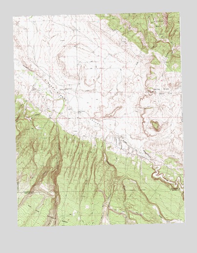
Dawson Draw, CO USGS Topographic Map
Click on map above to begin viewing in our Map Viewer.

This topographic map contains these locations and features:
Feature Name Type Latitude Longitude GNIS ID View Map
Andy DrawValleyN37.9669°W108.6607°176325View Map
Box CanyonValleyN37.9429°W108.7306°203932View Map
Brown Mule MineMineN37.9994°W108.6762°1745481View Map
Custer DitchCanalN37.9564°W108.6254°202373View Map
Daddy Williams BridgeBridgeN37.9425°W108.7029°176321View Map
Dawson DrawValleyN37.9331°W108.6870°176318View Map
Hidden Treasure MineMineN37.9314°W108.6909°1734205View Map
Hornet MineMineN37.9980°W108.6945°1734197View Map
Horseshoe DitchCanalN37.9869°W108.7320°176320View Map
Indian ValleyValleyN37.8855°W108.6490°176323View Map
Klondike BasinBasinN37.9933°W108.6420°176322View Map
Margaret C. 1-6 MineMineN37.9994°W108.6751°1745484View Map
McCulloch Creek DitchCanalN37.9150°W108.6368°176405View Map
Middle Branch Pine ArroyoValleyN37.8807°W108.7227°176327View Map
North Continent MineMineN37.9314°W108.6909°1734206View Map
Pat CanyonValleyN37.8990°W108.6780°176324View Map
Pine ArroyoValleyN37.9420°W108.7171°176326View Map
Pole CanyonValleyN37.9177°W108.7188°176314View Map
Spring CreekStreamN37.9514°W108.7168°176317View Map
Still CanyonValleyN37.9537°W108.6406°176316View Map
Victor MineMineN37.9994°W108.6762°1745491View Map
West Branch Pine ArroyoValleyN37.8807°W108.7224°176328View Map
Windy Day MineMineN37.9983°W108.6582°1745494View Map
Wolf Den CanyonValleyN37.9022°W108.6761°176319View Map

Note: Coordinates in the location and feature list above are referenced to NAD83 datum.


Copyright (C) 2008-2025 Ryan Niemi / Sunset Dynamics ... All Rights Reserved