TopoQuest Logo
Do you find TopoQuest useful?
Help keep TopoQuest running and adding new maps/features by donating!
Bitcoin:  19c7KJd3qBynnjoSw5npx9KScwjBe4ifkT
Litecoin:  LXs6TkuXGGXo1vDsWCkWVdjQX94eUKd6ui
Home View Maps Find Maps Find Places Resources & Links


De Smet, South Dakota Topographic Map

USGS Map Title: De Smet, SD
USGS Map MRC: 44097D5
DRG (GeoTIFF) Download: o44097d5.tif


Neighboring USGS Topographic Map Quads:


  Willow Lake SW, SD  
44097E6
 

  Cherry Lake, SD  
44097E5
 

  Bryant, SD  
44097E4
 

  Bancroft East, SD  
44097D6
 

  De Smet, SD  
44097D5
 

  Erwin, SD  
44097D4
 

  Manchester, SD  
44097C6
 

  De Smet SE, SD  
44097C5
 

  Lake Preston West, SD  
44097C4


Map MRC Location:

N45°
W98°
N45°
W97°
H8 H7 H6 H5 H4 H3 H2 H1
G8 G7 G6 G5 G4 G3 G2 G1
F8 F7 F6 F5 F4 F3 F2 F1
E8 E7 E6 E5 E4 E3 E2 E1
D8 D7 D6 D5 D4 D3 D2 D1
C8 C7 C6 C5 C4 C3 C2 C1
B8 B7 B6 B5 B4 B3 B2 B1
A8 A7 A6 A5 A4 A3 A2 A1
N44°
W98°
N44°
W97°

De Smet, SD USGS 1:24K Topographic Map Preview:
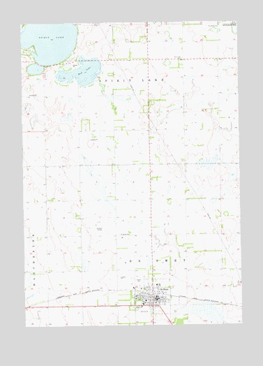
De Smet, SD USGS Topographic Map
Click on map above to begin viewing in our Map Viewer.

This topographic map contains these locations and features:
Feature Name Type Latitude Longitude GNIS ID View Map
Avera De Smet Memorial HospitalHospitalN44.3859°W97.5613°2610944View Map
Brookings County Farm (historical)LocaleN44.4200°W97.5759°1263820View Map
City of De SmetCivilN44.3861°W97.5497°1267353View Map
De SmetPopulated PlaceN44.3875°W97.5504°1265178View Map
De Smet City HallBuildingN44.3855°W97.5490°2724707View Map
De Smet Emergency Rescue UnitBuildingN44.3872°W97.5504°2658994View Map
De Smet High SchoolSchoolN44.3854°W97.5558°2728563View Map
De Smet Middle SchoolSchoolN44.3854°W97.5558°2728564View Map
De Smet Post OfficePost OfficeN44.3866°W97.5494°2709814View Map
De Smet Volunteer Fire DepartmentBuildingN44.3870°W97.5504°2580713View Map
Hazel L Meyer Memorial LibraryBuildingN44.3875°W97.5483°2723452View Map
Kingsbury County CourthouseBuildingN44.3862°W97.5464°2712671View Map
Kingsbury County SheriffBuildingN44.3864°W97.5464°2755549View Map
Laura Ingalls Wilder Elementary SchoolSchoolN44.3836°W97.5569°2728566View Map
Mud LakeLakeN44.4794°W97.5905°1256597View Map
School Number 10 (historical)SchoolN44.4916°W97.5734°1263778View Map
School Number 11 (historical)SchoolN44.4541°W97.5937°1263785View Map
School Number 12 (historical)SchoolN44.4564°W97.5329°1263784View Map
School Number 2 (historical)SchoolN44.4261°W97.5934°1263822View Map
School Number 3 (historical)SchoolN44.4258°W97.5312°1263821View Map
School Number 5 (historical)SchoolN44.4852°W97.5206°1263783View Map
Spirit LakeLakeN44.4933°W97.6087°1258236View Map
Spirt Lake CemeteryCemeteryN44.4850°W97.5323°1258239View Map
Township of De SmetCivilN44.3770°W97.5270°1268541View Map
Township of Spirit LakeCivilN44.4926°W97.5822°1268537View Map
West Bethany ChurchChurchN44.4986°W97.5112°1258875View Map
West Bethany Lutheran Church CemeteryCemeteryN44.4986°W97.5121°2779165View Map
Wilder AirportAirportN44.4336°W97.5566°1260234View Map

Note: Coordinates in the location and feature list above are referenced to NAD83 datum.


Copyright (C) 2008-2024 Ryan Niemi / Sunset Dynamics ... All Rights Reserved