TopoQuest Logo
Do you find TopoQuest useful?
Help keep TopoQuest running and adding new maps/features by donating!
Bitcoin:  19c7KJd3qBynnjoSw5npx9KScwjBe4ifkT
Litecoin:  LXs6TkuXGGXo1vDsWCkWVdjQX94eUKd6ui
Home View Maps Find Maps Find Places Resources & Links


Erwin, South Dakota Topographic Map

USGS Map Title: Erwin, SD
USGS Map MRC: 44097D4
DRG (GeoTIFF) Download: o44097d4.tif


Neighboring USGS Topographic Map Quads:


  Cherry Lake, SD  
44097E5
 

  Bryant, SD  
44097E4
 

  Gertson Slough, SD  
44097E3
 

  De Smet, SD  
44097D5
 

  Erwin, SD  
44097D4
 

  Lake Preston NE, SD  
44097D3
 

  De Smet SE, SD  
44097C5
 

  Lake Preston West, SD  
44097C4
 

  Lake Preston East, SD  
44097C3


Map MRC Location:

N45°
W98°
N45°
W97°
H8 H7 H6 H5 H4 H3 H2 H1
G8 G7 G6 G5 G4 G3 G2 G1
F8 F7 F6 F5 F4 F3 F2 F1
E8 E7 E6 E5 E4 E3 E2 E1
D8 D7 D6 D5 D4 D3 D2 D1
C8 C7 C6 C5 C4 C3 C2 C1
B8 B7 B6 B5 B4 B3 B2 B1
A8 A7 A6 A5 A4 A3 A2 A1
N44°
W98°
N44°
W97°

Erwin, SD USGS 1:24K Topographic Map Preview:
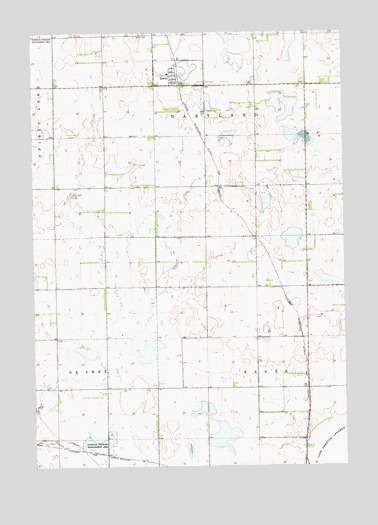
Erwin, SD USGS Topographic Map
Click on map above to begin viewing in our Map Viewer.

This topographic map contains these locations and features:
Feature Name Type Latitude Longitude GNIS ID View Map
Clyde (historical)LocaleN44.4550°W97.4498°1263767View Map
Danish Church (historical)ChurchN44.4772°W97.3892°1263791View Map
ErwinPopulated PlaceN44.4875°W97.4451°1254958View Map
Erwin CemeteryCemeteryN44.4988°W97.4584°1254959View Map
Erwin Public LibraryBuildingN44.4876°W97.4422°2723471View Map
School Number 1 (historical)SchoolN44.4258°W97.4717°1263823View Map
School Number 2 (historical)SchoolN44.3975°W97.4117°1263829View Map
School Number 3 (historical)SchoolN44.4272°W97.3920°1263830View Map
School Number 31 (historical)SchoolN44.4733°W97.3890°1263790View Map
School Number 32 (historical)SchoolN44.4547°W97.4523°1263789View Map
School Number 38 (historical)SchoolN44.4422°W97.4920°1263840View Map
School Number 4 (historical)SchoolN44.3983°W97.4906°1263824View Map
Town of ErwinCivilN44.4880°W97.4409°1267381View Map
Township of HartlandCivilN44.4924°W97.4004°1268538View Map

Note: Coordinates in the location and feature list above are referenced to NAD83 datum.


Copyright (C) 2008-2025 Ryan Niemi / Sunset Dynamics ... All Rights Reserved