TopoQuest Logo
Do you find TopoQuest useful?
Help keep TopoQuest running and adding new maps/features by donating!
Bitcoin:  19c7KJd3qBynnjoSw5npx9KScwjBe4ifkT
Litecoin:  LXs6TkuXGGXo1vDsWCkWVdjQX94eUKd6ui
Home View Maps Find Maps Find Places Resources & Links


Deadman Pass, Montana Topographic Map

USGS Map Title: Deadman Pass, MT
USGS Map MRC: 44113G2
DRG (GeoTIFF) Download: o44113g2.tif


Neighboring USGS Topographic Map Quads:


  Everson Creek, MT  
44113H3
 

  Jeff Davis Peak, MT  
44113H2
 

  Hansen Ranch, MT  
44113H1
 

  Bannock Pass, MT  
44113G3
 

  Deadman Pass, MT  
44113G2
 

  Medicine Lodge Peak, MT  
44113G1
 

  Leadore, ID  
44113F3
 

  Reservoir Creek, ID  
44113F2
 

  Tepee Mountain, MT  
44113F1


Map MRC Location:

N45°
W114°
N45°
W113°
H8 H7 H6 H5 H4 H3 H2 H1
G8 G7 G6 G5 G4 G3 G2 G1
F8 F7 F6 F5 F4 F3 F2 F1
E8 E7 E6 E5 E4 E3 E2 E1
D8 D7 D6 D5 D4 D3 D2 D1
C8 C7 C6 C5 C4 C3 C2 C1
B8 B7 B6 B5 B4 B3 B2 B1
A8 A7 A6 A5 A4 A3 A2 A1
N44°
W114°
N44°
W113°

Deadman Pass, MT USGS 1:24K Topographic Map Preview:
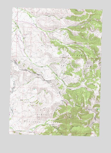
Deadman Pass, MT USGS Topographic Map
Click on map above to begin viewing in our Map Viewer.

This topographic map contains these locations and features:
Feature Name Type Latitude Longitude GNIS ID View Map
Cayton RanchLocaleN44.8580°W113.2411°794562View Map
Cayton RanchLocaleN44.8560°W113.2411°794866View Map
Chippie CreekStreamN44.7730°W113.2478°379316View Map
Dad Creek LakeLakeN44.7768°W113.1273°782033View Map
Deadhorse CanyonValleyN44.7652°W113.1953°380314View Map
Deadman PassGapN44.8035°W113.2025°782158View Map
Divide CreekStreamN44.8571°W113.2436°782404View Map
Elk MountainSummitN44.7596°W113.1375°783095View Map
Frank Hall CreekStreamN44.7613°W113.2009°382012View Map
Horse Prairie MountainSummitN44.7599°W113.1381°399066View Map
L-Diamond RanchLocaleN44.8463°W113.2348°785864View Map
Maiden Creek MineMineN44.8624°W113.1411°802479View Map
Middle Fork Maiden CreekStreamN44.8524°W113.2048°787288View Map
Rough CanyonValleyN44.7652°W113.1959°389629View Map
South Fork Maiden CreekStreamN44.8524°W113.2048°791010View Map
Whiskey Spring CreekStreamN44.7916°W113.2489°400170View Map
Wildcat CreekStreamN44.7533°W113.2264°393436View Map
Wyno (historical)LocaleN44.8485°W113.2442°1797251View Map

Note: Coordinates in the location and feature list above are referenced to NAD83 datum.


Copyright (C) 2008-2025 Ryan Niemi / Sunset Dynamics ... All Rights Reserved