TopoQuest Logo
Do you find TopoQuest useful?
Help keep TopoQuest running and adding new maps/features by donating!
Bitcoin:  19c7KJd3qBynnjoSw5npx9KScwjBe4ifkT
Litecoin:  LXs6TkuXGGXo1vDsWCkWVdjQX94eUKd6ui
Home View Maps Find Maps Find Places Resources & Links


Leadore, Idaho Topographic Map

USGS Map Title: Leadore, ID
USGS Map MRC: 44113F3
DRG (GeoTIFF) Download: o44113f3.tif


Neighboring USGS Topographic Map Quads:


  Goat Mountain, ID  
44113G4
 

  Bannock Pass, MT  
44113G3
 

  Deadman Pass, MT  
44113G2
 

  West of Leadore, ID  
44113F4
 

  Leadore, ID  
44113F3
 

  Reservoir Creek, ID  
44113F2
 

  Sheephorn Peak, ID  
44113E4
 

  Purcell Spring, ID  
44113E3
 

  Powderhorn Gulch, ID  
44113E2


Map MRC Location:

N45°
W114°
N45°
W113°
H8 H7 H6 H5 H4 H3 H2 H1
G8 G7 G6 G5 G4 G3 G2 G1
F8 F7 F6 F5 F4 F3 F2 F1
E8 E7 E6 E5 E4 E3 E2 E1
D8 D7 D6 D5 D4 D3 D2 D1
C8 C7 C6 C5 C4 C3 C2 C1
B8 B7 B6 B5 B4 B3 B2 B1
A8 A7 A6 A5 A4 A3 A2 A1
N44°
W114°
N44°
W113°

Leadore, ID USGS 1:24K Topographic Map Preview:
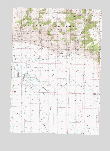
Leadore, ID USGS Topographic Map
Click on map above to begin viewing in our Map Viewer.

This topographic map contains these locations and features:
Feature Name Type Latitude Longitude GNIS ID View Map
Baby Joe GulchValleyN44.7030°W113.3261°376798View Map
Big Timber CreekStreamN44.6924°W113.3695°377610View Map
Canyon CreekStreamN44.6916°W113.3675°378871View Map
Cedar GulchValleyN44.6985°W113.2598°379106View Map
City of LeadoreCivilN44.6800°W113.3592°2411640View Map
Eighteenmile CreekStreamN44.6819°W113.3561°381275View Map
Hawley CreekStreamN44.6674°W113.3242°382974View Map
Italian GulchValleyN44.7063°W113.2948°383790View Map
Jakes CanyonValleyN44.7166°W113.3650°383848View Map
JunctionPopulated PlaceN44.7008°W113.3706°399080View Map
Junction CemeteryCemeteryN44.7126°W113.3737°398519View Map
LeadorePopulated PlaceN44.6802°W113.3581°396775View Map
Leadore AirportAirportN44.6728°W113.3528°400856View Map
Leadore Post OfficePost OfficeN44.6803°W113.3580°2781778View Map
Leadore Ranger StationLocaleN44.6969°W113.3448°384501View Map
Leadore SchoolSchoolN44.6780°W113.3609°401537View Map
Leadore Volunteer Fire DepartmentBuildingN44.6795°W113.3573°2619038View Map
LeadvillePopulated PlaceN44.7058°W113.3081°396776View Map
McRea CemeteryCemeteryN44.6972°W113.3521°386666View Map
Railroad CanyonValleyN44.7060°W113.2878°389028View Map
Salt CreekStreamN44.7355°W113.2767°389866View Map
Smokeys Cubs Recreation SiteLocaleN44.7027°W113.2942°394467View Map
Texas CreekStreamN44.6821°W113.3561°391952View Map
Thompson GulchValleyN44.7121°W113.3353°392040View Map
Waugh GulchValleyN44.7446°W113.2700°392951View Map

Note: Coordinates in the location and feature list above are referenced to NAD83 datum.


Copyright (C) 2008-2025 Ryan Niemi / Sunset Dynamics ... All Rights Reserved