TopoQuest Logo
Do you find TopoQuest useful?
Help keep TopoQuest running and adding new maps/features by donating!
Bitcoin:  19c7KJd3qBynnjoSw5npx9KScwjBe4ifkT
Litecoin:  LXs6TkuXGGXo1vDsWCkWVdjQX94eUKd6ui
Home View Maps Find Maps Find Places Resources & Links


Deadmans Hill, Texas Topographic Map

USGS Map Title: Deadmans Hill, TX
USGS Map MRC: 28100G4
DRG (GeoTIFF) Download: o28100g4.tif


Neighboring USGS Topographic Map Quads:


  Quemado East, TX  
28100H5
 

  Paloma, TX  
28100H4
 

  Trosado Tank, TX  
28100H3
 

  Quemado SE, TX  
28100G5
 

  Deadmans Hill, TX  
28100G4
 

  Indian Tank, TX  
28100G3
 

  Eagle Pass West, TX  
28100F5
 

  Eagle Pass East, TX  
28100F4
 

  Eagle Pass NE, TX  
28100F3


Map MRC Location:

N29°
W101°
N29°
W100°
H8 H7 H6 H5 H4 H3 H2 H1
G8 G7 G6 G5 G4 G3 G2 G1
F8 F7 F6 F5 F4 F3 F2 F1
E8 E7 E6 E5 E4 E3 E2 E1
D8 D7 D6 D5 D4 D3 D2 D1
C8 C7 C6 C5 C4 C3 C2 C1
B8 B7 B6 B5 B4 B3 B2 B1
A8 A7 A6 A5 A4 A3 A2 A1
N28°
W101°
N28°
W100°

Deadmans Hill, TX USGS 1:24K Topographic Map Preview:
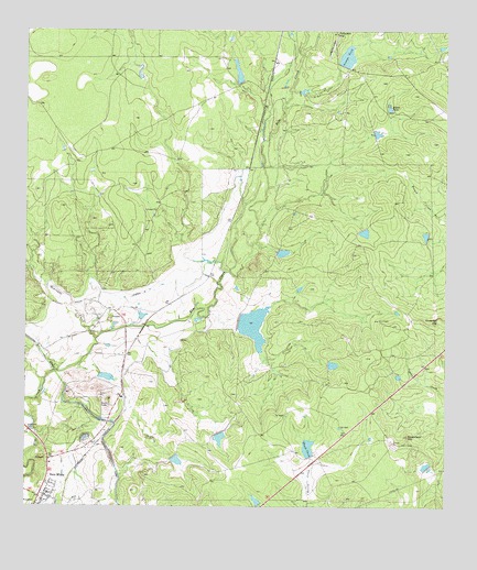
Deadmans Hill, TX USGS Topographic Map
Click on map above to begin viewing in our Map Viewer.

This topographic map contains these locations and features:
Feature Name Type Latitude Longitude GNIS ID View Map
Chapotal HillSummitN28.7989°W100.3762°1354314View Map
Consuelo HillSummitN28.8741°W100.4070°1373185View Map
Deadmans HillSummitN28.7689°W100.3862°1355778View Map
Deer Run Number 1 ColoniaPopulated PlaceN28.7733°W100.4842°2011395View Map
Deer Run Number 2 ColoniaPopulated PlaceN28.7741°W100.4892°2011396View Map
Deer Run Number 3 ColoniaPopulated PlaceN28.7714°W100.4792°2011397View Map
Deer Run Number 4 ColoniaPopulated PlaceN28.7683°W100.4884°2011398View Map
Deer Run Number 5 ColoniaPopulated PlaceN28.7672°W100.4934°2011399View Map
Elm CreekPopulated PlaceN28.7744°W100.4917°1852704View Map
Elm Creek Census Designated PlaceCensusN28.7782°W100.4910°2408077View Map
George TankReservoirN28.8677°W100.4056°1357953View Map
Hediondo CreekStreamN28.7944°W100.4790°1358992View Map
Kincaid Lake Number 2ReservoirN28.7753°W100.4420°1861504View Map
Kincaid Lake Number 2 DamDamN28.7753°W100.4420°1861503View Map
King TankReservoirN28.7976°W100.4325°1861502View Map
King Tank DamDamN28.8003°W100.4337°1861501View Map
Lateral TwentyoneCanalN28.8047°W100.4712°1360967View Map
Mangum Lake Number 2 DamDamN28.8669°W100.4070°1861487View Map
Middle TankReservoirN28.8543°W100.3922°1362752View Map
Paula TankReservoirN28.7633°W100.4151°1364896View Map
Paula Tank DamDamN28.7636°W100.4154°1861505View Map
Sauz Creek ColoniaPopulated PlaceN28.7664°W100.4842°2011333View Map
Siesta AcresPopulated PlaceN28.7580°W100.4902°2652416View Map
Siesta Acres Census Designated PlaceCensusN28.7564°W100.4910°2586991View Map
South Elm Creek Number 1 ColoniaPopulated PlaceN28.7733°W100.4934°2011334View Map
South Elm Creek Number 2 ColoniaPopulated PlaceN28.7714°W100.4954°2011335View Map
South Elm Creek Number 3 ColoniaPopulated PlaceN28.7764°W100.4923°2011336View Map
South Elm Creek Number 4 ColoniaPopulated PlaceN28.7764°W100.4934°2011337View Map
Taylor LakeReservoirN28.8619°W100.4387°1861490View Map
Taylor Lake DamDamN28.8619°W100.4387°1861489View Map

Note: Coordinates in the location and feature list above are referenced to NAD83 datum.


Copyright (C) 2008-2025 Ryan Niemi / Sunset Dynamics ... All Rights Reserved