TopoQuest Logo
Do you find TopoQuest useful?
Help keep TopoQuest running and adding new maps/features by donating!
Bitcoin:  19c7KJd3qBynnjoSw5npx9KScwjBe4ifkT
Litecoin:  LXs6TkuXGGXo1vDsWCkWVdjQX94eUKd6ui
Home View Maps Find Maps Find Places Resources & Links


Decker, Michigan Topographic Map

USGS Map Title: Decker, MI
USGS Map MRC: 43083D1
DRG (GeoTIFF) Download: o43083d1.tif


Neighboring USGS Topographic Map Quads:


  Cass City, MI  
43083E2
 

  Shabbona, MI  
43083E1
 

  Argyle, MI  
43082E8
 

  Kingston, MI  
43083D2
 

  Decker, MI  
43083D1
 

  Snover, MI  
43082D8
 

  Clifford, MI  
43083C2
 

  Marlette, MI  
43083C1
 

  Juhl, MI  
43082C8


Map MRC Location:

N44°
W84°
N44°
W83°
H8 H7 H6 H5 H4 H3 H2 H1
G8 G7 G6 G5 G4 G3 G2 G1
F8 F7 F6 F5 F4 F3 F2 F1
E8 E7 E6 E5 E4 E3 E2 E1
D8 D7 D6 D5 D4 D3 D2 D1
C8 C7 C6 C5 C4 C3 C2 C1
B8 B7 B6 B5 B4 B3 B2 B1
A8 A7 A6 A5 A4 A3 A2 A1
N43°
W84°
N43°
W83°

Decker, MI USGS 1:24K Topographic Map Preview:
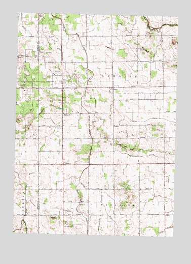
Decker, MI USGS Topographic Map
Click on map above to begin viewing in our Map Viewer.

This topographic map contains these locations and features:
Feature Name Type Latitude Longitude GNIS ID View Map
Daunt BranchCanalN43.4825°W83.0161°1619665View Map
DeckerPopulated PlaceN43.4589°W83.0508°624436View Map
Decker Post OfficePost OfficeN43.4592°W83.0494°2554424View Map
Decker United Methodist ChurchChurchN43.4564°W83.0525°2554423View Map
Fox SchoolSchoolN43.4811°W83.0522°626389View Map
Frost DrainCanalN43.4420°W83.0147°626526View Map
Germania CemeteryCemeteryN43.4014°W83.0238°626757View Map
Germania Post Office (historical)Post OfficeN43.4314°W83.0083°2554232View Map
HemansPopulated PlaceN43.4617°W83.0894°1617617View Map
Hemans Post Office (historical)Post OfficeN43.4617°W83.0894°2554228View Map
Innes Acres Airport (historical)AirportN43.4500°W83.0274°1623858View Map
Lamotte ChurchChurchN43.4153°W83.0852°630110View Map
Lamotte Post Office (historical)Post OfficeN43.4592°W83.0889°2554231View Map
Lamotte Township Fire DepartmentBuildingN43.4577°W83.0808°2626764View Map
Lamotte United Missionary ChurchChurchN43.4434°W83.0877°630111View Map
McLish and Carpenter DrainCanalN43.3967°W83.0569°631984View Map
Moshier CemeteryCemeteryN43.4617°W83.0894°632746View Map
Moshier SchoolSchoolN43.4800°W83.0911°632747View Map
Neuman DrainCanalN43.3867°W83.0783°633308View Map
Parker SchoolSchoolN43.4353°W83.0886°634393View Map
Pidd SchoolSchoolN43.4370°W83.0480°634821View Map
RC Zauel Memorial LibraryBuildingN43.4519°W83.0144°2558630View Map
Schoolhouse DrainCanalN43.4706°W83.0869°637423View Map
Township of LamotteCivilN43.4590°W83.0492°1626586View Map
Zion ChurchChurchN43.3875°W83.0058°1616958View Map

Note: Coordinates in the location and feature list above are referenced to NAD83 datum.


Copyright (C) 2008-2025 Ryan Niemi / Sunset Dynamics ... All Rights Reserved