TopoQuest Logo
Do you find TopoQuest useful?
Help keep TopoQuest running and adding new maps/features by donating!
Bitcoin:  19c7KJd3qBynnjoSw5npx9KScwjBe4ifkT
Litecoin:  LXs6TkuXGGXo1vDsWCkWVdjQX94eUKd6ui
Home View Maps Find Maps Find Places Resources & Links


Snover, Michigan Topographic Map

USGS Map Title: Snover, MI
USGS Map MRC: 43082D8
DRG (GeoTIFF) Download: o43082d8.tif


Neighboring USGS Topographic Map Quads:


  Shabbona, MI  
43083E1
 

  Argyle, MI  
43082E8
 

  Palms, MI  
43082E7
 

  Decker, MI  
43083D1
 

  Snover, MI  
43082D8
 

  Sandusky, MI  
43082D7
 

  Marlette, MI  
43083C1
 

  Juhl, MI  
43082C8
 

  Peck, MI  
43082C7


Map MRC Location:

N44°
W83°
N44°
W82°
H8 H7 H6 H5 H4 H3 H2 H1
G8 G7 G6 G5 G4 G3 G2 G1
F8 F7 F6 F5 F4 F3 F2 F1
E8 E7 E6 E5 E4 E3 E2 E1
D8 D7 D6 D5 D4 D3 D2 D1
C8 C7 C6 C5 C4 C3 C2 C1
B8 B7 B6 B5 B4 B3 B2 B1
A8 A7 A6 A5 A4 A3 A2 A1
N43°
W83°
N43°
W82°

Snover, MI USGS 1:24K Topographic Map Preview:
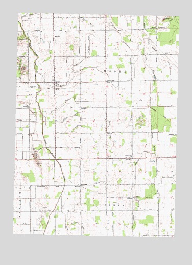
Snover, MI USGS Topographic Map
Click on map above to begin viewing in our Map Viewer.

This topographic map contains these locations and features:
Feature Name Type Latitude Longitude GNIS ID View Map
Babcock DrainCanalN43.4784°W82.8877°620400View Map
Badgero Extension DrainCanalN43.4175°W82.9049°620430View Map
Beaver CreekStreamN43.4331°W82.9788°620903View Map
Brethren in Christ ChurchChurchN43.4625°W82.9310°621931View Map
Davis DrainCanalN43.3792°W82.9591°624336View Map
ElmerPopulated PlaceN43.4197°W82.9291°625519View Map
Elmer Post Office (historical)Post OfficeN43.4197°W82.9292°2554239View Map
Elmer SchoolSchoolN43.4331°W82.9291°625521View Map
Gerstenberger DrainCanalN43.4028°W82.9730°626763View Map
Harrison SchoolSchoolN43.4039°W82.9483°627865View Map
Hendrickson DrainCanalN43.4170°W82.9974°628106View Map
Heritage United Methodist ChurchChurchN43.4611°W82.9633°2554401View Map
Hyslop CemeteryCemeteryN43.3970°W82.9063°628911View Map
Hyslop DrainCanalN43.3897°W82.9047°628912View Map
Hyslop SchoolSchoolN43.3970°W82.9083°628913View Map
Johnson CemeteryCemeteryN43.4847°W82.9933°629322View Map
Kirby DrainStreamN43.4920°W82.9974°629756View Map
Minard DrainCanalN43.4039°W82.9422°632438View Map
Minard SchoolSchoolN43.4247°W82.9541°632440View Map
Moore CemeteryCemeteryN43.4233°W82.9869°632635View Map
Moore ChurchChurchN43.4470°W82.9497°632636View Map
Moore Township Fire DepartmentBuildingN43.4621°W82.9704°2554400View Map
Pattie DrainCanalN43.3811°W82.9974°634477View Map
Ryder DrainStreamN43.4753°W82.9477°636441View Map
Sandusky Community of Christ ChurchChurchN43.4206°W82.8775°2554008View Map
SnoverPopulated PlaceN43.4611°W82.9708°638195View Map
Snover Census Designated PlaceCensusN43.4653°W82.9709°2628672View Map
Snover Memorial ParkParkN43.4197°W82.9094°638197View Map
Snover Post OfficePost OfficeN43.4611°W82.9708°2554399View Map
Taft DrainCanalN43.4967°W82.9466°1614536View Map
Tank DrainStreamN43.4450°W82.9811°1614582View Map
Temple DrainStreamN43.4425°W82.9797°1614673View Map
Township of ElmerCivilN43.3750°W82.9267°1626232View Map
Township of MooreCivilN43.4626°W82.9307°1626764View Map
Turtle CreekStreamN43.4681°W82.9858°1615195View Map
Urban ChurchChurchN43.4911°W82.9330°1615427View Map
Urban Post Office (historical)Post OfficeN43.4917°W82.9333°2554187View Map
Urban SchoolSchoolN43.4839°W82.9327°1615428View Map
Wilson SchoolSchoolN43.4867°W82.9716°1616598View Map

Note: Coordinates in the location and feature list above are referenced to NAD83 datum.


Copyright (C) 2008-2024 Ryan Niemi / Sunset Dynamics ... All Rights Reserved