TopoQuest Logo
Do you find TopoQuest useful?
Help keep TopoQuest running and adding new maps/features by donating!
Bitcoin:  19c7KJd3qBynnjoSw5npx9KScwjBe4ifkT
Litecoin:  LXs6TkuXGGXo1vDsWCkWVdjQX94eUKd6ui
Home View Maps Find Maps Find Places Resources & Links


Dedham, Iowa Topographic Map

USGS Map Title: Dedham, IA
USGS Map MRC: 41094H7
DRG (GeoTIFF) Download: o41094h7.tif


Neighboring USGS Topographic Map Quads:


  Carroll West, IA  
42094A8
 

  Carroll East, IA  
42094A7
 

  Glidden, IA  
42094A6
 

  Templeton, IA  
41094H8
 

  Dedham, IA  
41094H7
 

  Coon Rapids North, IA  
41094H6
 

  Gray, IA  
41094G8
 

  Viola Center, IA  
41094G7
 

  Coon Rapids South, IA  
41094G6


Map MRC Location:

N42°
W95°
N42°
W94°
H8 H7 H6 H5 H4 H3 H2 H1
G8 G7 G6 G5 G4 G3 G2 G1
F8 F7 F6 F5 F4 F3 F2 F1
E8 E7 E6 E5 E4 E3 E2 E1
D8 D7 D6 D5 D4 D3 D2 D1
C8 C7 C6 C5 C4 C3 C2 C1
B8 B7 B6 B5 B4 B3 B2 B1
A8 A7 A6 A5 A4 A3 A2 A1
N41°
W95°
N41°
W94°

Dedham, IA USGS 1:24K Topographic Map Preview:
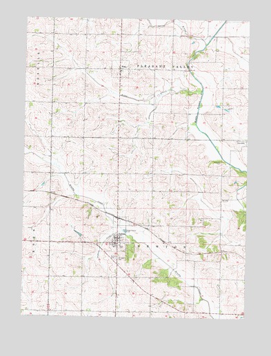
Dedham, IA USGS Topographic Map
Click on map above to begin viewing in our Map Viewer.

This topographic map contains these locations and features:
Feature Name Type Latitude Longitude GNIS ID View Map
City of DedhamCivilN41.9087°W94.8232°2394484View Map
City of WilleyCivilN41.9787°W94.8224°2397315View Map
Daniel Davis TimberParkN41.8986°W94.7989°1994632View Map
DedhamLocaleN41.9164°W94.8217°1994681View Map
DedhamPopulated PlaceN41.9061°W94.8222°455840View Map
Dedham CemeteryCemeteryN41.8994°W94.8228°455841View Map
Dedham City HallBuildingN41.9061°W94.8222°1994677View Map
Dedham Co-op Association ElevatorLocaleN41.9061°W94.8222°1994678View Map
Dedham CreekStreamN41.9111°W94.8194°455842View Map
Dedham Fire Department First Responders Station 1BuildingN41.9082°W94.8232°2577457View Map
Dedham Fire Department First Responders Station 2BuildingN41.9077°W94.8238°1994679View Map
Dedham Post OfficePost OfficeN41.9061°W94.8222°1994676View Map
McCurdy CemeteryCemeteryN41.9403°W94.7654°458901View Map
Middle Racoon River AccessLocaleN41.9153°W94.7508°1994631View Map
Saint Joseph's Catholic ChurchChurchN41.9061°W94.8222°1994680View Map
Saint Josephs CemeteryCemeteryN41.8995°W94.8216°461114View Map
Saint Mary's Catholic CemeteryCemeteryN41.9783°W94.8211°1994797View Map
Spring BranchStreamN41.9894°W94.7744°461864View Map
Stangl AirportAirportN41.8786°W94.7775°2677118View Map
Township of NewtonCivilN41.9063°W94.8026°468438View Map
Township of Pleasant ValleyCivilN41.9924°W94.8026°468543View Map
WilleyPopulated PlaceN41.9792°W94.8222°463049View Map
Willey BranchStreamN41.9700°W94.7758°463050View Map
Willey First RespondersBuildingN41.9783°W94.8220°2599961View Map
Willey Post Office (historical)Post OfficeN41.9792°W94.8222°1994642View Map

Note: Coordinates in the location and feature list above are referenced to NAD83 datum.


Copyright (C) 2008-2025 Ryan Niemi / Sunset Dynamics ... All Rights Reserved