TopoQuest Logo
Do you find TopoQuest useful?
Help keep TopoQuest running and adding new maps/features by donating!
Bitcoin:  19c7KJd3qBynnjoSw5npx9KScwjBe4ifkT
Litecoin:  LXs6TkuXGGXo1vDsWCkWVdjQX94eUKd6ui
Home View Maps Find Maps Find Places Resources & Links


Carroll West, Iowa Topographic Map

USGS Map Title: Carroll West, IA
USGS Map MRC: 42094A8
DRG (GeoTIFF) Download: o42094a8.tif


Neighboring USGS Topographic Map Quads:


  Vail NE, IA  
42095B1
 

  Breda, IA  
42094B8
 

  Carroll NE, IA  
42094B7
 

  Arcadia, IA  
42095A1
 

  Carroll West, IA  
42094A8
 

  Carroll East, IA  
42094A7
 

  Manning, IA  
41095H1
 

  Templeton, IA  
41094H8
 

  Dedham, IA  
41094H7


Map MRC Location:

N43°
W95°
N43°
W94°
H8 H7 H6 H5 H4 H3 H2 H1
G8 G7 G6 G5 G4 G3 G2 G1
F8 F7 F6 F5 F4 F3 F2 F1
E8 E7 E6 E5 E4 E3 E2 E1
D8 D7 D6 D5 D4 D3 D2 D1
C8 C7 C6 C5 C4 C3 C2 C1
B8 B7 B6 B5 B4 B3 B2 B1
A8 A7 A6 A5 A4 A3 A2 A1
N42°
W95°
N42°
W94°

Carroll West, IA USGS 1:24K Topographic Map Preview:
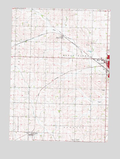
Carroll West, IA USGS Topographic Map
Click on map above to begin viewing in our Map Viewer.

This topographic map contains these locations and features:
Feature Name Type Latitude Longitude GNIS ID View Map
City of HalburCivilN42.0051°W94.9720°2394267View Map
First Assembly of God ChurchChurchN42.0842°W94.8772°1994743View Map
HalburPopulated PlaceN42.0069°W94.9700°457199View Map
Halbur (historical)LocaleN42.0078°W94.9747°1994790View Map
Halbur Community CenterBuildingN42.0069°W94.9700°1994794View Map
Halbur Fire DepartmentBuildingN42.0055°W94.9714°2577269View Map
Halbur First RespondersBuildingN42.0055°W94.9714°2599858View Map
Halbur Post OfficePost OfficeN42.0069°W94.9700°1994793View Map
Halbur Ridge Wildlife AreaParkN42.0028°W94.9794°1994637View Map
Halburn CreekStreamN42.0100°W94.9530°465381View Map
Holy Angels CemeteryCemeteryN42.0015°W94.9166°457571View Map
KCIM-AM (Carroll)TowerN42.0414°W94.8853°466999View Map
Kittyhawk Avenue BridgeBridgeN42.0300°W94.8980°1994805View Map
KKRL-FM (Carroll)TowerN42.0539°W94.8853°463704View Map
Koster Grain Incorporated ElevatorLocaleN42.1000°W94.9350°1994730View Map
Maple ParkParkN42.0680°W94.8808°1823178View Map
Maple RiverLocaleN42.0994°W94.9353°1994644View Map
Maple RiverPopulated PlaceN42.0980°W94.9353°458786View Map
Maple River Post Office (historical)Post OfficeN42.0980°W94.9367°1994645View Map
Mid-Prairie ParkParkN42.0694°W94.8975°1994638View Map
Northwest ParkParkN42.0778°W94.8761°1994759View Map
RosellePopulated PlaceN42.0003°W94.9155°460810View Map
Roselle Post Office (historical)Post OfficeN42.0003°W94.9178°1994646View Map
Saint Augustine CemeteryCemeteryN42.0067°W94.9755°460941View Map
Saint Augustine SchoolSchoolN42.0061°W94.9730°460943View Map
Saint Augustine's ChurchChurchN42.0058°W94.9750°1994792View Map
Saint Augustine's SchoolSchoolN42.0058°W94.9739°1994791View Map
Saint Francis CemeteryCemeteryN42.0971°W94.9386°460975View Map
Saint Paul Lutheran ChurchChurchN42.0800°W94.8755°1994739View Map
The Church of Jesus Christ of Latter Day SaintsChurchN42.0764°W94.8808°1994738View Map
Township of Maple RiverCivilN42.0806°W94.9227°468342View Map

Note: Coordinates in the location and feature list above are referenced to NAD83 datum.


Copyright (C) 2008-2025 Ryan Niemi / Sunset Dynamics ... All Rights Reserved