TopoQuest Logo
Do you find TopoQuest useful?
Help keep TopoQuest running and adding new maps/features by donating!
Bitcoin:  19c7KJd3qBynnjoSw5npx9KScwjBe4ifkT
Litecoin:  LXs6TkuXGGXo1vDsWCkWVdjQX94eUKd6ui
Home View Maps Find Maps Find Places Resources & Links


Deer Park, Wisconsin Topographic Map

USGS Map Title: Deer Park, WI
USGS Map MRC: 45092B4
DRG (GeoTIFF) Download: o45092b4.tif


Neighboring USGS Topographic Map Quads:


  Nye, WI  
45092C5
 

  Wapogasset Lake, WI  
45092C4
 

  Amery, WI  
45092C3
 

  New Richmond North, WI  
45092B5
 

  Deer Park, WI  
45092B4
 

  Forest, WI  
45092B3
 

  New Richmond South, WI  
45092A5
 

  Jewett, WI  
45092A4
 

  Emerald, WI  
45092A3


Map MRC Location:

N46°
W93°
N46°
W92°
H8 H7 H6 H5 H4 H3 H2 H1
G8 G7 G6 G5 G4 G3 G2 G1
F8 F7 F6 F5 F4 F3 F2 F1
E8 E7 E6 E5 E4 E3 E2 E1
D8 D7 D6 D5 D4 D3 D2 D1
C8 C7 C6 C5 C4 C3 C2 C1
B8 B7 B6 B5 B4 B3 B2 B1
A8 A7 A6 A5 A4 A3 A2 A1
N45°
W93°
N45°
W92°

Deer Park, WI USGS 1:24K Topographic Map Preview:
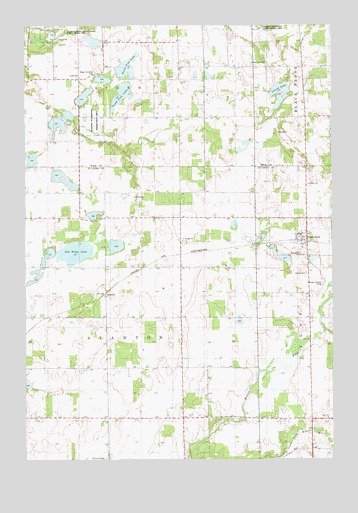
Deer Park, WI USGS Topographic Map
Click on map above to begin viewing in our Map Viewer.

This topographic map contains these locations and features:
Feature Name Type Latitude Longitude GNIS ID View Map
Alden TownhallBuildingN45.2355°W92.4785°1831789View Map
Bierbrauer LakeLakeN45.2051°W92.4837°2770902View Map
Calvary CemeteryCemeteryN45.1785°W92.3856°1581607View Map
Cylon ChurchChurchN45.1369°W92.3771°1581618View Map
Deer ParkPopulated PlaceN45.1880°W92.3855°1581620View Map
Deer Park Area Fire DepartmentBuildingN45.1882°W92.3874°2696716View Map
East Emanuel ChurchChurchN45.2394°W92.4069°1564315View Map
Grandview School (historical)SchoolN45.1875°W92.4360°1831654View Map
Island LakeLakeN45.2306°W92.3960°1567009View Map
Lakeside School (historical)SchoolN45.2344°W92.4263°1831822View Map
Lowland School (historical)SchoolN45.1461°W92.4257°1831670View Map
Meadowdale School (historical)SchoolN45.1439°W92.4677°1831672View Map
North Fish LakeLakeN45.2379°W92.4584°1570423View Map
Northview School (historical)SchoolN45.2233°W92.3766°1831831View Map
Oak Ridge LakeLakeN45.1846°W92.4799°1581689View Map
Polk County Waterfowl Production AreaParkN45.2363°W92.4108°2765455View Map
Saint Bridget ChurchChurchN45.1880°W92.4355°1581708View Map
Saint Croix County Waterfowl Production AreaParkN45.1831°W92.4828°2765511View Map
Skunk LakeLakeN45.2051°W92.4835°2746844View Map
South Fish LakeLakeN45.2300°W92.4607°1574433View Map
StantonPopulated PlaceN45.1730°W92.4671°1581734View Map
Town of StantonCivilN45.1672°W92.4643°1584212View Map
Village of Deer ParkCivilN45.1886°W92.3877°1583063View Map
Wagon Landing CemeteryCemeteryN45.2353°W92.4722°1576142View Map
Wagon Landing School (historical)SchoolN45.2355°W92.4785°1831856View Map
Wagon Landing Springs State Public Fishing AreaParkN45.2480°W92.4888°1576143View Map

Note: Coordinates in the location and feature list above are referenced to NAD83 datum.


Copyright (C) 2008-2025 Ryan Niemi / Sunset Dynamics ... All Rights Reserved