TopoQuest Logo
Do you find TopoQuest useful?
Help keep TopoQuest running and adding new maps/features by donating!
Bitcoin:  19c7KJd3qBynnjoSw5npx9KScwjBe4ifkT
Litecoin:  LXs6TkuXGGXo1vDsWCkWVdjQX94eUKd6ui
Home View Maps Find Maps Find Places Resources & Links


New Richmond South, Wisconsin Topographic Map

USGS Map Title: New Richmond South, WI
USGS Map MRC: 45092A5
DRG (GeoTIFF) Download: o45092a5.tif


Neighboring USGS Topographic Map Quads:


  Somerset North, WI  
45092B6
 

  New Richmond North, WI  
45092B5
 

  Deer Park, WI  
45092B4
 

  Somerset South, WI  
45092A6
 

  New Richmond South, WI  
45092A5
 

  Jewett, WI  
45092A4
 

  Northline, WI  
44092H6
 

  Roberts, WI  
44092H5
 

  Baldwin West, WI  
44092H4


Map MRC Location:

N46°
W93°
N46°
W92°
H8 H7 H6 H5 H4 H3 H2 H1
G8 G7 G6 G5 G4 G3 G2 G1
F8 F7 F6 F5 F4 F3 F2 F1
E8 E7 E6 E5 E4 E3 E2 E1
D8 D7 D6 D5 D4 D3 D2 D1
C8 C7 C6 C5 C4 C3 C2 C1
B8 B7 B6 B5 B4 B3 B2 B1
A8 A7 A6 A5 A4 A3 A2 A1
N45°
W93°
N45°
W92°

New Richmond South, WI USGS 1:24K Topographic Map Preview:
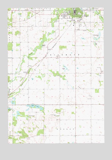
New Richmond South, WI USGS Topographic Map
Click on map above to begin viewing in our Map Viewer.

This topographic map contains these locations and features:
Feature Name Type Latitude Longitude GNIS ID View Map
Anderson SpringsSpringN45.0905°W92.5799°1581581View Map
BoardmanPopulated PlaceN45.0655°W92.5999°1581596View Map
Boardman CemeteryCemeteryN45.0716°W92.5935°1581597View Map
Brushy Mound LakeLakeN45.0961°W92.5090°1581601View Map
Carleton A Friday Memorial LibraryBuildingN45.1230°W92.5366°1831634View Map
Citizens FieldParkN45.1200°W92.5330°1831638View Map
City of New RichmondCivilN45.1225°W92.5341°1583816View Map
Clarendon School (historical)SchoolN45.0936°W92.6088°1581815View Map
Flying M Ranch Airport (historical)AirportN45.0080°W92.5946°1582188View Map
Glover ParkParkN45.1230°W92.5371°1831652View Map
Hennessey SpringSpringN45.0250°W92.5980°1581644View Map
Immaculate Conception Catholic ChurchChurchN45.1214°W92.5444°1831665View Map
Immaculate Conception Catholic Church CemeteryCemeteryN45.1211°W92.5454°2768253View Map
Lonesome Trail School (historical)SchoolN45.1164°W92.5891°1581821View Map
Long PondLakeN45.0916°W92.5117°1581670View Map
Lundy PondLakeN45.0685°W92.5490°1581672View Map
Monette ParkParkN45.1161°W92.5494°1831674View Map
New RichmondPopulated PlaceN45.1230°W92.5366°1581681View Map
New Richmond Area Ambulance and RescueBuildingN45.1178°W92.5554°2698386View Map
New Richmond East Elementary SchoolSchoolN45.1129°W92.5227°1831676View Map
New Richmond Fire Department Station 1BuildingN45.1224°W92.5357°2696790View Map
New Richmond Flowage 146ReservoirN45.1233°W92.5369°1792019View Map
New Richmond Golf CourseLocaleN45.1236°W92.5613°1831677View Map
New Richmond High SchoolSchoolN45.1135°W92.5301°1831678View Map
New Richmond Middle SchoolSchoolN45.1187°W92.5350°1831679View Map
New Richmond Mills DamDamN45.1233°W92.5369°1792018View Map
New Richmond Police DepartmentBuildingN45.1224°W92.5368°2759510View Map
New Richmond Post OfficePost OfficeN45.1189°W92.5372°1831680View Map
New Richmond West Elementary SchoolSchoolN45.1128°W92.5338°2713350View Map
NR4Kids Charter SchoolSchoolN45.1123°W92.5253°2713211View Map
Oak Hill School (historical)SchoolN45.0497°W92.5805°1581824View Map
Paper Jack ParkParkN45.1108°W92.5316°1831683View Map
Paperjack CreekStreamN45.1030°W92.5644°1581693View Map
RiversidePopulated PlaceN45.1231°W92.5197°2611825View Map
Rusmar Farms AirportAirportN45.0136°W92.5522°1582189View Map
Saint Mary's SchoolSchoolN45.1210°W92.5443°1831694View Map
Spring Brook School (historical)SchoolN45.0505°W92.5274°1581829View Map
Tenmile CreekStreamN45.0458°W92.6216°1581742View Map
Three LakesLakeN45.0337°W92.5876°1581743View Map
Town of RichmondCivilN45.0750°W92.5606°1584028View Map
Twin Pond School (historical)SchoolN45.0127°W92.5177°1581831View Map
Westfields HospitalHospitalN45.1178°W92.5555°1831661View Map
WIXK-AM (New Richmond)TowerN45.0861°W92.5721°1582335View Map
WIXK-FM (New Richmond)TowerN45.0861°W92.5721°1582435View Map

Note: Coordinates in the location and feature list above are referenced to NAD83 datum.


Copyright (C) 2008-2025 Ryan Niemi / Sunset Dynamics ... All Rights Reserved