TopoQuest Logo
Do you find TopoQuest useful?
Help keep TopoQuest running and adding new maps/features by donating!
Bitcoin:  19c7KJd3qBynnjoSw5npx9KScwjBe4ifkT
Litecoin:  LXs6TkuXGGXo1vDsWCkWVdjQX94eUKd6ui
Home View Maps Find Maps Find Places Resources & Links


Antioch South, California Topographic Map

USGS Map Title: Antioch South, CA
USGS Map MRC: 37121H7
DRG (GeoTIFF) Download: o37121h7.tif


Neighboring USGS Topographic Map Quads:


  Honker Bay, CA  
38121A8
 

  Antioch North, CA  
38121A7
 

  Jersey Island, CA  
38121A6
 

  Clayton, CA  
37121H8
 

  Antioch South, CA  
37121H7
 

  Brentwood, CA  
37121H6
 

  Diablo, CA  
37121G8
 

  Tassajara, CA  
37121G7
 

  Byron Hot Springs, CA  
37121G6


Map MRC Location:

N38°
W122°
N38°
W121°
H8 H7 H6 H5 H4 H3 H2 H1
G8 G7 G6 G5 G4 G3 G2 G1
F8 F7 F6 F5 F4 F3 F2 F1
E8 E7 E6 E5 E4 E3 E2 E1
D8 D7 D6 D5 D4 D3 D2 D1
C8 C7 C6 C5 C4 C3 C2 C1
B8 B7 B6 B5 B4 B3 B2 B1
A8 A7 A6 A5 A4 A3 A2 A1
N37°
W122°
N37°
W121°

Antioch South, CA USGS 1:24K Topographic Map Preview:
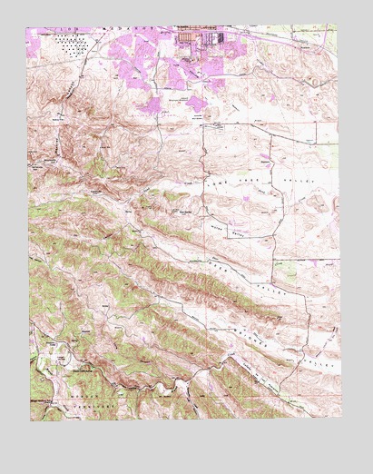
Antioch South, CA USGS Topographic Map
Click on map above to begin viewing in our Map Viewer.

This topographic map contains these locations and features:
Feature Name Type Latitude Longitude GNIS ID View Map
Antioch Community ParkParkN37.9788°W121.8194°1701723View Map
Antioch First Church of GodChurchN37.9969°W121.7938°1701725View Map
Antioch Municipal ReservoirReservoirN37.9751°W121.8079°218305View Map
Antioch Post OfficePost OfficeN37.9969°W121.8086°1701731View Map
Antioch Reservoir 3-000 DamDamN37.9749°W121.8061°1663272View Map
Belshaw Elementary SchoolSchoolN37.9959°W121.8005°1701735View Map
Canal ParkParkN37.9888°W121.8388°1701747View Map
Cattail Picnic AreaLocaleN37.9730°W121.8311°1701749View Map
Chichibu ParkParkN37.9860°W121.8147°1701751View Map
City of AntiochCivilN37.9789°W121.7957°2409715View Map
Coal Mine TunnelsTunnelN37.9413°W121.8141°221275View Map
Contra Costa County Fire Protection District Station 82BuildingN37.9775°W121.8006°2623930View Map
Contra Costa County Fire Protection District Station 83BuildingN37.9973°W121.8377°2623929View Map
Contra Costa County Fire Protection District Station 88BuildingN37.9840°W121.7643°2624484View Map
Contra Costa County Jail FarmLocaleN37.8946°W121.8647°1654211View Map
Contra Loma DamDamN37.9783°W121.8061°1664594View Map
Contra Loma Dike Number 2 DamDamN37.9749°W121.8211°1664761View Map
Contra Loma ReservoirReservoirN37.9744°W121.8258°221475View Map
Contra Loma ReservoirReservoirN37.9783°W121.8061°1664595View Map
Curry CanyonValleyN37.8791°W121.8675°221930View Map
Dark CanyonValleyN37.8863°W121.8241°222014View Map
Deer Creek 1007-003 DamDamN37.9249°W121.7594°1664125View Map
Deer ValleyValleyN37.9199°W121.7786°222213View Map
Delta Fair Shopping CenterLocaleN37.9994°W121.8372°1701758View Map
Department of Forestry and Fire Protection Station 16 SunshineBuildingN37.8997°W121.8608°2624336View Map
East Bay Regional Park District Ambulance Station 8BuildingN37.9723°W121.8308°2662309View Map
Exit 27ACrossingN37.9997°W121.8222°2107279View Map
Exit 27BCrossingN37.9981°W121.8164°2107280View Map
Exit 28CrossingN37.9981°W121.8058°2107281View Map
Exit 29CrossingN37.9961°W121.7856°2107282View Map
First Congregational Church of AntiochChurchN37.9969°W121.7947°1701771View Map
Gentrytown ParkParkN37.9944°W121.8330°1701772View Map
Harbour ParkParkN37.9908°W121.7938°1701773View Map
Hillcrest ParkParkN37.9902°W121.7741°1701774View Map
Hilltop Christian SchoolSchoolN37.9935°W121.8000°1701775View Map
Hog CanyonValleyN37.8863°W121.8125°234017View Map
Horse ValleyValleyN37.9419°W121.7708°225629View Map
Liberty School (historical)SchoolN37.8788°W121.7711°1701286View Map
Locust Grove Picnic AreaLocaleN37.9713°W121.8233°1701788View Map
Lone Tree Golf CourseLocaleN37.9705°W121.8075°1701790View Map
Lone Tree School (historical)SchoolN37.9619°W121.7505°1653168View Map
Long CanyonValleyN37.8874°W121.8169°227544View Map
Long ValleyValleyN37.9121°W121.8200°1701287View Map
Lupine Rock Picnic AreaLocaleN37.9721°W121.8291°1701792View Map
Markley CanyonValleyN37.9883°W121.8530°228127View Map
Marsh Creek SpringsPopulated PlaceN37.8927°W121.8538°1659067View Map
Memorial ParkParkN37.9910°W121.8130°1701797View Map
Mira Vista Hills ParkParkN37.9794°W121.8341°1701798View Map
Mira Vista ParkParkN37.9874°W121.8283°1701799View Map
Mission Elementary SchoolSchoolN37.9967°W121.8323°1701800View Map
Morgan Territory SchoolLocaleN37.8813°W121.8672°263829View Map
Mountaire ParkParkN37.9896°W121.8025°1701802View Map
Mustard Hill Picnic AreaLocaleN37.9713°W121.8244°1701803View Map
NerolyPopulated PlaceN37.9894°W121.7505°1653169View Map
NewlovePopulated PlaceN37.9938°W121.7627°1659220View Map
Nortonville PassGapN37.9563°W121.8744°229786View Map
Oil CanyonValleyN37.9438°W121.8347°229944View Map
Oil CreekStreamN37.9438°W121.8355°1701289View Map
Park Middle SchoolSchoolN37.9930°W121.8141°230344View Map
Perkins CanyonValleyN37.8960°W121.8700°230527View Map
Prewett Family ParkParkN37.9666°W121.7744°1701812View Map
Raleys Shopping CenterLocaleN37.9855°W121.8066°1701814View Map
Rose Hill CemeteryCemeteryN37.9577°W121.8711°1701817View Map
San Joaquin ValleyValleyN37.9833°W121.8677°1655000View Map
Sidney FlatFlatN37.9716°W121.8627°233079View Map
SomersvillePopulated PlaceN37.9569°W121.8644°253910View Map
Star MineMineN37.9449°W121.8233°1701292View Map
StewartvillePopulated PlaceN37.9463°W121.8486°252808View Map
Sunny Ridge ParkParkN37.9810°W121.8122°1701822View Map
Sunshine CampLocaleN37.8996°W121.8650°235822View Map
Sutter Delta Medical CenterHospitalN37.9824°W121.8031°1701759View Map
Sutter Elementary SchoolSchoolN37.9848°W121.8120°235850View Map
Sycamore CreekStreamN37.8860°W121.8125°235923View Map
Village East ParkParkN37.9949°W121.8400°1701829View Map
West HartleyPopulated PlaceN37.9405°W121.8127°252828View Map
Williamson Ranch ParkParkN37.9610°W121.7611°1701830View Map

Note: Coordinates in the location and feature list above are referenced to NAD83 datum.


Copyright (C) 2008-2024 Ryan Niemi / Sunset Dynamics ... All Rights Reserved