TopoQuest Logo
Do you find TopoQuest useful?
Help keep TopoQuest running and adding new maps/features by donating!
Bitcoin:  19c7KJd3qBynnjoSw5npx9KScwjBe4ifkT
Litecoin:  LXs6TkuXGGXo1vDsWCkWVdjQX94eUKd6ui
Home View Maps Find Maps Find Places Resources & Links


Byron Hot Springs, California Topographic Map

USGS Map Title: Byron Hot Springs, CA
USGS Map MRC: 37121G6
DRG (GeoTIFF) Download: o37121g6.tif


Neighboring USGS Topographic Map Quads:


  Antioch South, CA  
37121H7
 

  Brentwood, CA  
37121H6
 

  Woodward Island, CA  
37121H5
 

  Tassajara, CA  
37121G7
 

  Byron Hot Springs, CA  
37121G6
 

  Clifton Court Forebay, CA  
37121G5
 

  Livermore, CA  
37121F7
 

  Altamont, CA  
37121F6
 

  Midway, CA  
37121F5


Map MRC Location:

N38°
W122°
N38°
W121°
H8 H7 H6 H5 H4 H3 H2 H1
G8 G7 G6 G5 G4 G3 G2 G1
F8 F7 F6 F5 F4 F3 F2 F1
E8 E7 E6 E5 E4 E3 E2 E1
D8 D7 D6 D5 D4 D3 D2 D1
C8 C7 C6 C5 C4 C3 C2 C1
B8 B7 B6 B5 B4 B3 B2 B1
A8 A7 A6 A5 A4 A3 A2 A1
N37°
W122°
N37°
W121°

Byron Hot Springs, CA USGS 1:24K Topographic Map Preview:
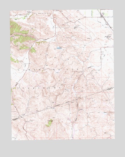
Byron Hot Springs, CA USGS Topographic Map
Click on map above to begin viewing in our Map Viewer.

This topographic map contains these locations and features:
Feature Name Type Latitude Longitude GNIS ID View Map
Altamont LandfillLocaleN37.7547°W121.6533°2726510View Map
Armstrong RanchLocaleN37.8255°W121.6416°1653163View Map
Brushy PeakSummitN37.7677°W121.7033°219956View Map
ByronPopulated PlaceN37.8671°W121.6380°238290View Map
Byron AirportAirportN37.8297°W121.6266°1653296View Map
Byron Hot SpringsSpringN37.8471°W121.6327°220333View Map
Byron Hot Springs Post Office (historical)Post OfficeN37.8471°W121.6316°2026830View Map
Byron Post OfficePost OfficeN37.8691°W121.6412°2650475View Map
Byron-Bethany Irrigation CanalCanalN37.8644°W121.6488°233592View Map
Caņada De Los VaquerosCivilN37.8099°W121.7011°233625View Map
East Contra Costa Fire Protection District Station 57BuildingN37.8663°W121.6412°2623954View Map
Forty-Five CanalCanalN37.8538°W121.6283°233891View Map
Johnson RanchLocaleN37.8096°W121.6330°1653167View Map
South Bay AqueductCanalN37.7619°W121.6758°234927View Map
Vasco Ranch (historical)LocaleN37.8235°W121.7322°1653170View Map
Vasco Road LandfillLocaleN37.7547°W121.7253°2726411View Map
Vasco School (historical)SchoolN37.8083°W121.7391°1682748View Map
Warm RanchLocaleN37.7624°W121.6558°1653161View Map

Note: Coordinates in the location and feature list above are referenced to NAD83 datum.


Copyright (C) 2008-2025 Ryan Niemi / Sunset Dynamics ... All Rights Reserved