TopoQuest Logo
Do you find TopoQuest useful?
Help keep TopoQuest running and adding new maps/features by donating!
Bitcoin:  19c7KJd3qBynnjoSw5npx9KScwjBe4ifkT
Litecoin:  LXs6TkuXGGXo1vDsWCkWVdjQX94eUKd6ui
Home View Maps Find Maps Find Places Resources & Links


Desert Hot Springs, California Topographic Map

USGS Map Title: Desert Hot Springs, CA
USGS Map MRC: 33116H5
DRG (GeoTIFF) Download: o33116h5.tif


Neighboring USGS Topographic Map Quads:


  Catclaw Flat, CA  
34116A6
 

  Morongo Valley, CA  
34116A5
 

  Yucca Valley South, CA  
34116A4
 

  White Water, CA  
33116H6
 

  Desert Hot Springs, CA  
33116H5
 

  Seven Palms Valley, CA  
33116H4
 

  San Jacinto Peak, CA  
33116G6
 

  Palm Springs, CA  
33116G5
 

  Cathedral City, CA  
33116G4


Map MRC Location:

N34°
W117°
N34°
W116°
H8 H7 H6 H5 H4 H3 H2 H1
G8 G7 G6 G5 G4 G3 G2 G1
F8 F7 F6 F5 F4 F3 F2 F1
E8 E7 E6 E5 E4 E3 E2 E1
D8 D7 D6 D5 D4 D3 D2 D1
C8 C7 C6 C5 C4 C3 C2 C1
B8 B7 B6 B5 B4 B3 B2 B1
A8 A7 A6 A5 A4 A3 A2 A1
N33°
W117°
N33°
W116°

Desert Hot Springs, CA USGS 1:24K Topographic Map Preview:
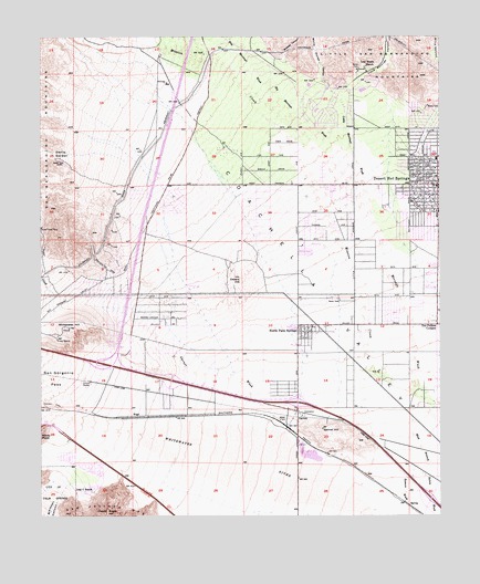
Desert Hot Springs, CA USGS Topographic Map
Click on map above to begin viewing in our Map Viewer.

This topographic map contains these locations and features:
Feature Name Type Latitude Longitude GNIS ID View Map
American Medical Response Desert Hot SpringsBuildingN33.9611°W116.5127°2665532View Map
Arroyo ParkParkN33.9553°W116.5081°1848779View Map
Big Morongo WashStreamN33.9606°W116.5250°239294View Map
Blaisdell CanyonValleyN33.8833°W116.6156°269910View Map
Blind CanyonValleyN33.9815°W116.5009°239477View Map
Bureau of Land Management - Palm Springs South Coast Field OfficeBuildingN33.9043°W116.5533°2664731View Map
Carefree Mobile VillagePopulated PlaceN33.9239°W116.5628°1848786View Map
City of Desert Hot SpringsCivilN33.9551°W116.5430°2410328View Map
Desert AngelSummitN33.8753°W116.6050°270843View Map
Desert Hot SpringsPopulated PlaceN33.9611°W116.5017°1656484View Map
Desert Hot Springs Branch Riverside City and County Public LibraryBuildingN33.9625°W116.5108°1848789View Map
Desert Hot Springs Chamber of CommerceBuildingN33.9617°W116.5103°1848790View Map
Desert Hot Springs City HallBuildingN33.9625°W116.5103°1848791View Map
Desert Hot Springs DivisionCivilN33.9306°W116.5076°1935071View Map
Desert Hot Springs Elementary SchoolSchoolN33.9639°W116.5111°1848792View Map
Desert Hot Springs Police DepartmentBuildingN33.9618°W116.5112°2756408View Map
Desert Hot Springs Post OfficePost OfficeN33.9463°W116.5049°2769538View Map
Desert Hot Springs Post OfficePost OfficeN33.9463°W116.5049°1848793View Map
Desert Hot Springs Town Center Shopping CenterLocaleN33.9458°W116.5003°1848887View Map
Devers HillSummitN33.9370°W116.5633°241446View Map
Devers Substation HeliportAirportN33.9397°W116.5756°1653398View Map
Devils GardenFlatN33.9695°W116.6208°241462View Map
Dos Palmas CornersPopulated PlaceN33.9247°W116.5020°1656488View Map
Dry Morongo WashStreamN33.9858°W116.5531°241650View Map
GarnetPopulated PlaceN33.9020°W116.5456°252894View Map
Garnet HillSummitN33.8975°W116.5378°242628View Map
Garnet WashStreamN33.8981°W116.5522°242631View Map
Hacienda Palms Shopping CenterLocaleN33.9536°W116.5003°1848800View Map
Lazy C RanchLocaleN33.8820°W116.6089°244686View Map
Little Morongo CanyonValleyN33.9892°W116.5253°272103View Map
Little Morongo CreekStreamN33.9892°W116.5253°272104View Map
Little Morongo WashStreamN33.9606°W116.5253°244929View Map
Lost Heads RanchLocaleN33.9922°W116.5242°245206View Map
Midway CanyonValleyN33.9931°W116.5483°245887View Map
Mission CreekStreamN33.8825°W116.5278°272500View Map
Mission Lakes Country ClubLocaleN33.9864°W116.5358°1848804View Map
North Palm SpringsPopulated PlaceN33.9228°W116.5431°1656584View Map
North Palm Springs Post OfficePost OfficeN33.9246°W116.5433°1848806View Map
Painted Hill TrailTrailN33.9392°W116.6053°247112View Map
Riverside County Fire Department Station 36 North Palm Springs SkyborneBuildingN33.9645°W116.5632°2664715View Map
Riverside County Fire Department Station 37 Desert Hot SpringsBuildingN33.9618°W116.5105°2664542View Map
Super CreekStreamN33.9328°W116.6214°273974View Map
Turnoff Continuation High SchoolSchoolN33.9620°W116.5108°1848817View Map
Wardman ParkParkN33.9692°W116.5064°1848820View Map
White House CanyonValleyN33.9875°W116.5353°251470View Map
Whitewater HillSummitN33.9239°W116.6170°251501View Map

Note: Coordinates in the location and feature list above are referenced to NAD83 datum.


Copyright (C) 2008-2025 Ryan Niemi / Sunset Dynamics ... All Rights Reserved