TopoQuest Logo
Do you find TopoQuest useful?
Help keep TopoQuest running and adding new maps/features by donating!
Bitcoin:  19c7KJd3qBynnjoSw5npx9KScwjBe4ifkT
Litecoin:  LXs6TkuXGGXo1vDsWCkWVdjQX94eUKd6ui
Home View Maps Find Maps Find Places Resources & Links


Morongo Valley, California Topographic Map

USGS Map Title: Morongo Valley, CA
USGS Map MRC: 34116A5
DRG (GeoTIFF) Download: o34116a5.tif


Neighboring USGS Topographic Map Quads:


  Onyx Peak, CA  
34116B6
 

  Rimrock, CA  
34116B5
 

  Yucca Valley North, CA  
34116B4
 

  Catclaw Flat, CA  
34116A6
 

  Morongo Valley, CA  
34116A5
 

  Yucca Valley South, CA  
34116A4
 

  White Water, CA  
33116H6
 

  Desert Hot Springs, CA  
33116H5
 

  Seven Palms Valley, CA  
33116H4


Map MRC Location:

N35°
W117°
N35°
W116°
H8 H7 H6 H5 H4 H3 H2 H1
G8 G7 G6 G5 G4 G3 G2 G1
F8 F7 F6 F5 F4 F3 F2 F1
E8 E7 E6 E5 E4 E3 E2 E1
D8 D7 D6 D5 D4 D3 D2 D1
C8 C7 C6 C5 C4 C3 C2 C1
B8 B7 B6 B5 B4 B3 B2 B1
A8 A7 A6 A5 A4 A3 A2 A1
N34°
W117°
N34°
W116°

Morongo Valley, CA USGS 1:24K Topographic Map Preview:
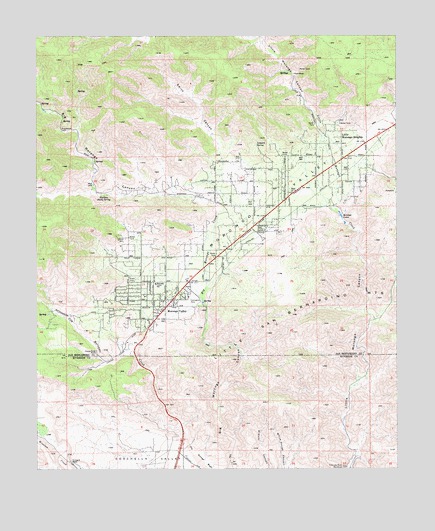
Morongo Valley, CA USGS Topographic Map
Click on map above to begin viewing in our Map Viewer.

This topographic map contains these locations and features:
Feature Name Type Latitude Longitude GNIS ID View Map
Big Morongo CanyonValleyN34.0014°W116.5586°269832View Map
Big Morongo CreekStreamN34.0017°W116.5589°269833View Map
Canyon House RanchLocaleN34.0339°W116.6053°240214View Map
Covington ParkParkN34.0495°W116.5731°241015View Map
Dry Morongo CreekStreamN34.0078°W116.5742°270931View Map
Leopard SpringSpringN34.0937°W116.5493°244747View Map
Little Morongo HeightsPopulated PlaceN34.0956°W116.5200°1660926View Map
Morongo LakesLakeN34.0726°W116.5197°246215View Map
Morongo ValleyPopulated PlaceN34.0470°W116.5808°1652755View Map
Morongo ValleyValleyN34.0448°W116.5940°246216View Map
Morongo Valley Census Designated PlaceCensusN34.0724°W116.5627°2408870View Map
Morongo Valley Elementary SchoolSchoolN34.0535°W116.5846°246217View Map
Morongo Valley Fire Department Station 461BuildingN34.0485°W116.5780°2665163View Map
Morongo Valley Post OfficePost OfficeN34.0450°W116.5821°1839659View Map
Palm WellsPopulated PlaceN34.0778°W116.5395°1667143View Map
Pierce RanchLocaleN34.1139°W116.5364°247455View Map
Sherman Shady SpringSpringN34.0789°W116.6022°254238View Map
Smith CanyonValleyN34.0895°W116.5617°249585View Map
T Cross K RanchLocaleN34.0022°W116.6139°250221View Map

Note: Coordinates in the location and feature list above are referenced to NAD83 datum.


Copyright (C) 2008-2024 Ryan Niemi / Sunset Dynamics ... All Rights Reserved