TopoQuest Logo
Do you find TopoQuest useful?
Help keep TopoQuest running and adding new maps/features by donating!
Bitcoin:  19c7KJd3qBynnjoSw5npx9KScwjBe4ifkT
Litecoin:  LXs6TkuXGGXo1vDsWCkWVdjQX94eUKd6ui
Home View Maps Find Maps Find Places Resources & Links


Devine, Colorado Topographic Map

USGS Map Title: Devine, CO
USGS Map MRC: 38104C4
DRG (GeoTIFF) Download: o38104c4.tif


Neighboring USGS Topographic Map Quads:


  Pinon, CO  
38104D5
 

  Bar J H Ranch, CO  
38104D4
 

  North Avondale NE, CO  
38104D3
 

  Northeast Pueblo, CO  
38104C5
 

  Devine, CO  
38104C4
 

  North Avondale, CO  
38104C3
 

  Southeast Pueblo, CO  
38104B5
 

  Vineland, CO  
38104B4
 

  Avondale, CO  
38104B3


Map MRC Location:

N39°
W105°
N39°
W104°
H8 H7 H6 H5 H4 H3 H2 H1
G8 G7 G6 G5 G4 G3 G2 G1
F8 F7 F6 F5 F4 F3 F2 F1
E8 E7 E6 E5 E4 E3 E2 E1
D8 D7 D6 D5 D4 D3 D2 D1
C8 C7 C6 C5 C4 C3 C2 C1
B8 B7 B6 B5 B4 B3 B2 B1
A8 A7 A6 A5 A4 A3 A2 A1
N38°
W105°
N38°
W104°

Devine, CO USGS 1:24K Topographic Map Preview:
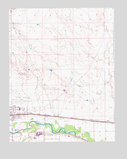
Devine, CO USGS Topographic Map
Click on map above to begin viewing in our Map Viewer.

This topographic map contains these locations and features:
Feature Name Type Latitude Longitude GNIS ID View Map
Andy CreekStreamN38.3225°W104.3819°193901View Map
BaxterPopulated PlaceN38.2758°W104.4916°203691View Map
Chico CemeteryCemeteryN38.2795°W104.3907°2750938View Map
DevinePopulated PlaceN38.2750°W104.4575°204799View Map
Excelsior DitchCanalN38.2694°W104.4344°203692View Map
NybergPopulated PlaceN38.2683°W104.3980°193753View Map
Pueblo Army Air Base (historical)MilitaryN38.2939°W104.4992°2093993View Map
Pueblo Fire Department Station 10BuildingN38.2839°W104.4939°2667204View Map
Pueblo Memorial AirportAirportN38.2904°W104.4992°204561View Map
Saint Charles RiverStreamN38.2656°W104.4597°193752View Map
Thunderbird LakeLakeN38.2609°W104.4929°193751View Map
TravelAire Air AmbulanceBuildingN38.2813°W104.4995°2716941View Map
Wolf ArroyoStreamN38.2900°W104.3764°193720View Map

Note: Coordinates in the location and feature list above are referenced to NAD83 datum.


Copyright (C) 2008-2025 Ryan Niemi / Sunset Dynamics ... All Rights Reserved