TopoQuest Logo
Do you find TopoQuest useful?
Help keep TopoQuest running and adding new maps/features by donating!
Bitcoin:  19c7KJd3qBynnjoSw5npx9KScwjBe4ifkT
Litecoin:  LXs6TkuXGGXo1vDsWCkWVdjQX94eUKd6ui
Home View Maps Find Maps Find Places Resources & Links


Southeast Pueblo, Colorado Topographic Map

USGS Map Title: Southeast Pueblo, CO
USGS Map MRC: 38104B5
DRG (GeoTIFF) Download: o38104b5.tif


Neighboring USGS Topographic Map Quads:


  Northwest Pueblo, CO  
38104C6
 

  Northeast Pueblo, CO  
38104C5
 

  Devine, CO  
38104C4
 

  Southwest Pueblo, CO  
38104B6
 

  Southeast Pueblo, CO  
38104B5
 

  Vineland, CO  
38104B4
 

  Verde School, CO  
38104A6
 

  Goat Butte, CO  
38104A5
 

  Doyle Bridge, CO  
38104A4


Map MRC Location:

N39°
W105°
N39°
W104°
H8 H7 H6 H5 H4 H3 H2 H1
G8 G7 G6 G5 G4 G3 G2 G1
F8 F7 F6 F5 F4 F3 F2 F1
E8 E7 E6 E5 E4 E3 E2 E1
D8 D7 D6 D5 D4 D3 D2 D1
C8 C7 C6 C5 C4 C3 C2 C1
B8 B7 B6 B5 B4 B3 B2 B1
A8 A7 A6 A5 A4 A3 A2 A1
N38°
W105°
N38°
W104°

Southeast Pueblo, CO USGS 1:24K Topographic Map Preview:
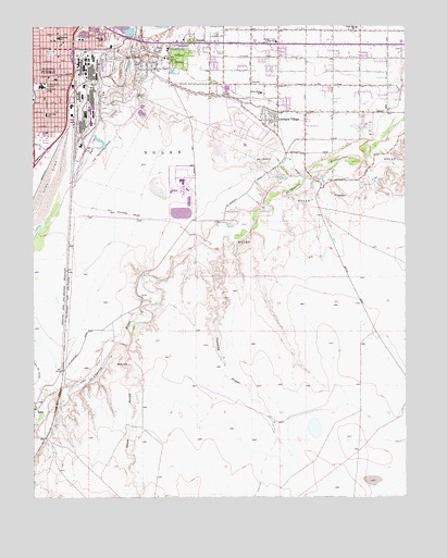
Southeast Pueblo, CO USGS Topographic Map
Click on map above to begin viewing in our Map Viewer.

This topographic map contains these locations and features:
Feature Name Type Latitude Longitude GNIS ID View Map
Bessemer AcademySchoolN38.2467°W104.6165°193783View Map
Bessemer DitchCanalN38.2367°W104.5866°193702View Map
Bessemer ParkParkN38.2431°W104.6197°193784View Map
BlendePopulated PlaceN38.2458°W104.5686°193790View Map
Blende Census Designated PlaceCensusN38.2469°W104.5692°2583212View Map
Comanche DamDamN38.2017°W104.5772°199062View Map
Comanche ReservoirReservoirN38.2004°W104.5759°199063View Map
Edison SchoolSchoolN38.2464°W104.6022°193785View Map
Edson ArroyoValleyN38.1658°W104.5950°193799View Map
Edson ArroyoStreamN38.1650°W104.5936°193800View Map
EVRAZ Rocky Mountain Steel Fire / EMSBuildingN38.2383°W104.6128°2667374View Map
Flight for Life Colorado 4 Medical TransportBuildingN38.2338°W104.6246°2695584View Map
Fulton Heights SchoolSchoolN38.2389°W104.5844°193787View Map
Grace ChurchChurchN38.2342°W104.5433°193796View Map
Lake MinnequaReservoirN38.2325°W104.6250°203694View Map
Lake View SchoolSchoolN38.2264°W104.6211°193789View Map
LimeLocaleN38.1486°W104.6247°193798View Map
Lombard VillagePopulated PlaceN38.2250°W104.5450°193795View Map
North Mesa Elementary SchoolSchoolN38.2496°W104.5163°193797View Map
North Mills Clarifying DamDamN38.2483°W104.5955°200510View Map
Park SchoolSchoolN38.2350°W104.5519°193793View Map
Pueblo CountyCivilN38.1734°W104.5128°198166View Map
Pueblo Fire Department Station 4BuildingN38.2458°W104.6153°2667206View Map
Pueblo Rural Fire District Station 1BuildingN38.2456°W104.5442°2666912View Map
Pueblo Rural Fire Protection District Station 4BuildingN38.2444°W104.5072°2666892View Map
Roselawn CemeteryCemeteryN38.2403°W104.5766°193791View Map
Saint CharlesPopulated PlaceN38.1389°W104.6214°196521View Map
Saint Charles Mesa DamDamN38.2317°W104.5622°199064View Map
Saint Charles Mesa DivisionCivilN38.2240°W104.5598°1935559View Map
Saint Charles Mesa Number 2 DamDamN38.2233°W104.5105°200514View Map
Saint Charles Mesa ReservoirReservoirN38.2317°W104.5622°199065View Map
Saint Charles Mesa Reservoir Number 2ReservoirN38.2233°W104.5105°200515View Map
Saint Mary - Corwin Medical CenterHospitalN38.2339°W104.6227°193788View Map
Saint Mary-Corwin Hospital HeliportAirportN38.2336°W104.6236°204559View Map
Salt CreekPopulated PlaceN38.2384°W104.5871°193786View Map
Salt Creek Census Designated PlaceCensusN38.2389°W104.5882°2409241View Map
South Mesa SchoolSchoolN38.2322°W104.5489°193794View Map
Thomkins ArroyoValleyN38.1897°W104.5664°193801View Map
Thomkins ArroyoStreamN38.1908°W104.5650°193802View Map
Wiggins Saint Charles CemeteryCemeteryN38.2032°W104.5501°2750943View Map

Note: Coordinates in the location and feature list above are referenced to NAD83 datum.


Copyright (C) 2008-2024 Ryan Niemi / Sunset Dynamics ... All Rights Reserved