TopoQuest Logo
Do you find TopoQuest useful?
Help keep TopoQuest running and adding new maps/features by donating!
Bitcoin:  19c7KJd3qBynnjoSw5npx9KScwjBe4ifkT
Litecoin:  LXs6TkuXGGXo1vDsWCkWVdjQX94eUKd6ui
Home View Maps Find Maps Find Places Resources & Links


Dewey Marsh, Wisconsin Topographic Map

USGS Map Title: Dewey Marsh, WI
USGS Map MRC: 44089F5
DRG (GeoTIFF) Download: o44089f5.tif


Neighboring USGS Topographic Map Quads:


  Mosinee, WI  
44089G6
 

  Peplin, WI  
44089G5
 

  Bevent, WI  
44089G4
 

  Dancy, WI  
44089F6
 

  Dewey Marsh, WI  
44089F5
 

  Rosholt NW, WI  
44089F4
 

  Rocky Run, WI  
44089E6
 

  Stevens Point, WI  
44089E5
 

  Polonia, WI  
44089E4


Map MRC Location:

N45°
W90°
N45°
W89°
H8 H7 H6 H5 H4 H3 H2 H1
G8 G7 G6 G5 G4 G3 G2 G1
F8 F7 F6 F5 F4 F3 F2 F1
E8 E7 E6 E5 E4 E3 E2 E1
D8 D7 D6 D5 D4 D3 D2 D1
C8 C7 C6 C5 C4 C3 C2 C1
B8 B7 B6 B5 B4 B3 B2 B1
A8 A7 A6 A5 A4 A3 A2 A1
N44°
W90°
N44°
W89°

Dewey Marsh, WI USGS 1:24K Topographic Map Preview:
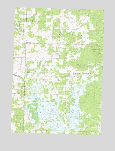
Dewey Marsh, WI USGS Topographic Map
Click on map above to begin viewing in our Map Viewer.

This topographic map contains these locations and features:
Feature Name Type Latitude Longitude GNIS ID View Map
AshleyPopulated PlaceN44.6927°W89.6082°1577497View Map
Blackberry HillSummitN44.7075°W89.5071°1561892View Map
Cisewski FarmsLocaleN44.6872°W89.5525°2723846View Map
Cole School (historical)SchoolN44.7427°W89.6085°1844080View Map
Dewey MarshSwampN44.6444°W89.5618°1563954View Map
Dewey Marsh State Natural AreaParkN44.6600°W89.5371°2061070View Map
Guenther School (historical)SchoolN44.7405°W89.5496°1844140View Map
Hajec FarmLocaleN44.7150°W89.5986°2723844View Map
Jet D RanchLocaleN44.7344°W89.6044°2723859View Map
Kolodziez FarmLocaleN44.7158°W89.5783°2723847View Map
Lake Du Bay Berry FarmsLocaleN44.7153°W89.6214°2723857View Map
Lassa Dairy FarmsLocaleN44.6842°W89.5278°2723860View Map
Little Eau Claire School (historical)SchoolN44.6925°W89.5815°1844180View Map
Philippine IslandsRidgeN44.6372°W89.5696°1571292View Map
Quarry Lookout TowerTowerN44.7102°W89.5101°1581324View Map
Rockland School (historical)SchoolN44.6644°W89.5501°1851549View Map
Rocky CornersPopulated PlaceN44.7141°W89.6079°1581568View Map
Ryan School (historical)SchoolN44.7002°W89.6079°1845241View Map
Town of DeweyCivilN44.6439°W89.5700°1583080View Map
Town of GuentherCivilN44.7290°W89.5493°1583330View Map

Note: Coordinates in the location and feature list above are referenced to NAD83 datum.


Copyright (C) 2008-2025 Ryan Niemi / Sunset Dynamics ... All Rights Reserved