TopoQuest Logo
Do you find TopoQuest useful?
Help keep TopoQuest running and adding new maps/features by donating!
Bitcoin:  19c7KJd3qBynnjoSw5npx9KScwjBe4ifkT
Litecoin:  LXs6TkuXGGXo1vDsWCkWVdjQX94eUKd6ui
Home View Maps Find Maps Find Places Resources & Links


Dexter, New York Topographic Map

USGS Map Title: Dexter, NY
USGS Map MRC: 44076A1
DRG (GeoTIFF) Download: o44076a1.tif


Neighboring USGS Topographic Map Quads:


  Saint Lawrence, NY  
44076B2
 

  Clayton, NY  
44076B1
 

  La Fargeville, NY  
44075B8
 

  Chaumont, NY  
44076A2
 

  Dexter, NY  
44076A1
 

  Brownville, NY  
44075A8
 

  Henderson Bay, NY  
43076H2
 

  Sackets Harbor, NY  
43076H1
 

  Watertown, NY  
43075H8


Map MRC Location:

N45°
W77°
N45°
W76°
H8 H7 H6 H5 H4 H3 H2 H1
G8 G7 G6 G5 G4 G3 G2 G1
F8 F7 F6 F5 F4 F3 F2 F1
E8 E7 E6 E5 E4 E3 E2 E1
D8 D7 D6 D5 D4 D3 D2 D1
C8 C7 C6 C5 C4 C3 C2 C1
B8 B7 B6 B5 B4 B3 B2 B1
A8 A7 A6 A5 A4 A3 A2 A1
N44°
W77°
N44°
W76°

Dexter, NY USGS 1:24K Topographic Map Preview:
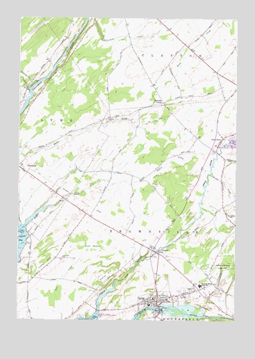
Dexter, NY USGS Topographic Map
Click on map above to begin viewing in our Map Viewer.

This topographic map contains these locations and features:
Feature Name Type Latitude Longitude GNIS ID View Map
Bar Z FarmLocaleN44.0639°W76.0919°2702805View Map
Breezy Knoll Mobile Home ParkPopulated PlaceN44.0130°W76.0298°2618206View Map
Brownville State Game FarmParkN44.0214°W76.0091°944966View Map
DexterPopulated PlaceN44.0078°W76.0444°948392View Map
Dexter CemeteryCemeteryN44.0131°W76.0238°948393View Map
Dexter Elementary SchoolSchoolN44.0118°W76.0375°2668831View Map
Dexter Free LibraryBuildingN44.0076°W76.0438°2617257View Map
Dexter Police DepartmentBuildingN44.0055°W76.0439°2780348View Map
Dexter Presbyterian ChurchChurchN44.0081°W76.0459°2615844View Map
Dexter Sewage Treatment PlantLocaleN44.0059°W76.0477°2617719View Map
Dexter United Methodist ChurchChurchN44.0072°W76.0512°2615845View Map
Dexter Volunteer Fire Department Dexter Station 1BuildingN44.0056°W76.0437°2718646View Map
Doanes HillSummitN44.0189°W76.0721°948511View Map
Freeman CemeteryCemeteryN44.0835°W76.0738°950664View Map
General Brown High SchoolSchoolN44.0145°W76.0199°950986View Map
Guffin CreekStreamN44.0384°W76.1213°951891View Map
Gum SwampSwampN44.0306°W76.0824°951943View Map
LimerickPopulated PlaceN44.0292°W76.0430°972725View Map
Luther HillSummitN44.0237°W76.1083°956154View Map
Luther Hill CemeteryCemeteryN44.0259°W76.0997°956155View Map
Natural Bridge of New YorkArchN44.0173°W76.0635°958295View Map
Parker Family FarmsLocaleN44.0892°W76.0431°2702865View Map
Perch RiverPopulated PlaceN44.0753°W76.0080°972932View Map
Reynolds CornerPopulated PlaceN44.0903°W76.0424°972998View Map
School Number 1 (historical)SchoolN44.0942°W76.1217°2105944View Map
School Number 12 (historical)SchoolN44.1028°W76.0111°2105949View Map
School Number 13 (historical)SchoolN44.0014°W76.0436°2105950View Map
School Number 15 (historical)SchoolN44.0839°W76.0725°2105951View Map
School Number 16 (historical)SchoolN44.0617°W76.0708°2105952View Map
School Number 17 (historical)SchoolN44.0161°W76.0128°2105953View Map
School Number 18 (historical)SchoolN44.0722°W76.0108°2105954View Map
School Number 4 (historical)SchoolN44.0925°W76.0444°2105945View Map
School Number 6 (historical)SchoolN44.0472°W76.0075°2105946View Map
School Number 8 (historical)SchoolN44.0292°W76.0492°2105947View Map
School Number 9 (historical)SchoolN44.0433°W76.0858°2105948View Map
Slaughter HillSummitN44.0439°W76.0010°965393View Map
Sucker CreekStreamN44.0606°W76.0147°966694View Map
Town of BrownvilleCivilN44.0272°W76.0601°978761View Map
Trout CreekStreamN44.0028°W76.0185°967875View Map
Village of DexterCivilN44.0112°W76.0425°2391642View Map
WXIK-AM (Brownville)TowerN44.0128°W76.1235°977578View Map

Note: Coordinates in the location and feature list above are referenced to NAD83 datum.


Copyright (C) 2008-2024 Ryan Niemi / Sunset Dynamics ... All Rights Reserved