TopoQuest Logo
Do you find TopoQuest useful?
Help keep TopoQuest running and adding new maps/features by donating!
Bitcoin:  19c7KJd3qBynnjoSw5npx9KScwjBe4ifkT
Litecoin:  LXs6TkuXGGXo1vDsWCkWVdjQX94eUKd6ui
Home View Maps Find Maps Find Places Resources & Links


Diamond Lake, Oregon Topographic Map

USGS Map Title: Diamond Lake, OR
USGS Map MRC: 43122B2
DRG (GeoTIFF) Download: o43122b2.tif


Neighboring USGS Topographic Map Quads:


  Potter Mountain, OR  
43122C3
 

  Lemolo Lake, OR  
43122C2
 

  Tolo Mountain, OR  
43122C1
 

  Garwood Butte, OR  
43122B3
 

  Diamond Lake, OR  
43122B2
 

  Mount Thielsen, OR  
43122B1
 

  Hamaker Butte, OR  
43122A3
 

  Pumice Desert West, OR  
43122A2
 

  Pumice Desert East, OR  
43122A1


Map MRC Location:

N44°
W123°
N44°
W122°
H8 H7 H6 H5 H4 H3 H2 H1
G8 G7 G6 G5 G4 G3 G2 G1
F8 F7 F6 F5 F4 F3 F2 F1
E8 E7 E6 E5 E4 E3 E2 E1
D8 D7 D6 D5 D4 D3 D2 D1
C8 C7 C6 C5 C4 C3 C2 C1
B8 B7 B6 B5 B4 B3 B2 B1
A8 A7 A6 A5 A4 A3 A2 A1
N43°
W123°
N43°
W122°

Diamond Lake, OR USGS 1:24K Topographic Map Preview:
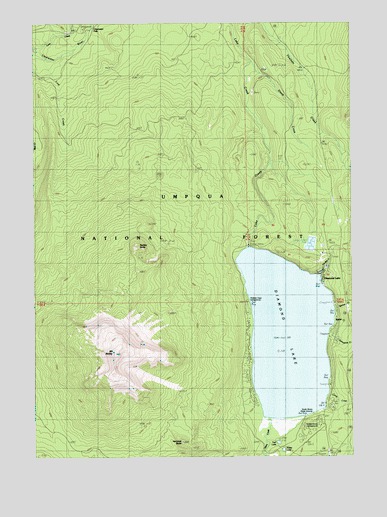
Diamond Lake, OR USGS Topographic Map
Click on map above to begin viewing in our Map Viewer.

This topographic map contains these locations and features:
Feature Name Type Latitude Longitude GNIS ID View Map
Beartrap TrailTrailN43.1962°W122.2414°1137786View Map
Broken Arrow Recreation SiteLocaleN43.1346°W122.1442°1155237View Map
Camp CreekStreamN43.1426°W122.1370°1139222View Map
Camp Creek Forest CampLocaleN43.1437°W122.1370°1139238View Map
Clearwater FallsFallsN43.2487°W122.2279°1139811View Map
Clearwater Falls Recreation SiteLocaleN43.2485°W122.2311°1155801View Map
Diamond LakeLakeN43.1600°W122.1516°1140999View Map
Diamond LakePopulated PlaceN43.1787°W122.1389°1141001View Map
Diamond Lake Campground Boat RampLocaleN43.1402°W122.1372°2668550View Map
Diamond Lake Guard StationLocaleN43.1587°W122.1342°1158207View Map
Diamond Lake Information CenterLocaleN43.1773°W122.1384°1159305View Map
Diamond Lake Post OfficePost OfficeN43.1787°W122.1389°1165158View Map
Diamond Lake Recreation SiteLocaleN43.1610°W122.1345°1159047View Map
Diamond Lake South Shore Boat RampLocaleN43.1369°W122.1441°2668183View Map
Diamond Lake Trailer Camp AreaParkN43.1387°W122.1345°1162509View Map
Diamond Lake Volunteer Fire DepartmentBuildingN43.1772°W122.1371°2576943View Map
Dry CreekStreamN43.1485°W122.1359°1155239View Map
Hemlock ButteSummitN43.1291°W122.1932°1143473View Map
Horse LakeLakeN43.1268°W122.1534°1143768View Map
Howlock Mountain Horse CampLocaleN43.1837°W122.1336°1952968View Map
Lost CreekStreamN43.2393°W122.2431°1145512View Map
Mount BaileySummitN43.1551°W122.2200°1158385View Map
Mount Bailey TrailTrailN43.1376°W122.2017°1146523View Map
North End Boat RampLocaleN43.1747°W122.1381°1952970View Map
Oregon Cascades Recreation AreaLocaleN43.2496°W122.1264°1156360View Map
Porcupine CreekStreamN43.1618°W122.1370°1147894View Map
Pumice BeachBeachN43.1498°W122.1664°1155240View Map
Rabbit and Porcupine Creek Forest CampLocaleN43.1618°W122.1353°1148118View Map
Rabbit CreekStreamN43.1637°W122.1345°1155236View Map
Rodley ButteSummitN43.1852°W122.2103°1148685View Map
Rodley Butte TrailTrailN43.2237°W122.2023°1148686View Map
Sheep CreekStreamN43.2385°W122.1670°1149316View Map
Short CreekStreamN43.1387°W122.1386°1149426View Map
Silent CreekStreamN43.1360°W122.1603°1149472View Map
South Shore Recreation SiteLocaleN43.1360°W122.1470°1155238View Map
Spruce CreekStreamN43.1671°W122.1350°1150207View Map
Teal LakeLakeN43.1289°W122.1556°1150929View Map
Thielsen View Recreation SiteLocaleN43.1693°W122.1678°1155241View Map
Two Bear CreekStreamN43.1760°W122.1398°1151603View Map
White Fir Forest CampLocaleN43.1690°W122.1353°1152232View Map

Note: Coordinates in the location and feature list above are referenced to NAD83 datum.


Copyright (C) 2008-2024 Ryan Niemi / Sunset Dynamics ... All Rights Reserved