TopoQuest Logo
Do you find TopoQuest useful?
Help keep TopoQuest running and adding new maps/features by donating!
Bitcoin:  19c7KJd3qBynnjoSw5npx9KScwjBe4ifkT
Litecoin:  LXs6TkuXGGXo1vDsWCkWVdjQX94eUKd6ui
Home View Maps Find Maps Find Places Resources & Links


Potter Mountain, Oregon Topographic Map

USGS Map Title: Potter Mountain, OR
USGS Map MRC: 43122C3
DRG (GeoTIFF) Download: o43122c3.tif


Neighboring USGS Topographic Map Quads:


  Staley Ridge, OR  
43122D4
 

  Rigdon Point, OR  
43122D3
 

  Emigrant Butte, OR  
43122D2
 

  Toketee Falls, OR  
43122C4
 

  Potter Mountain, OR  
43122C3
 

  Lemolo Lake, OR  
43122C2
 

  Fish Creek Desert, OR  
43122B4
 

  Garwood Butte, OR  
43122B3
 

  Diamond Lake, OR  
43122B2


Map MRC Location:

N44°
W123°
N44°
W122°
H8 H7 H6 H5 H4 H3 H2 H1
G8 G7 G6 G5 G4 G3 G2 G1
F8 F7 F6 F5 F4 F3 F2 F1
E8 E7 E6 E5 E4 E3 E2 E1
D8 D7 D6 D5 D4 D3 D2 D1
C8 C7 C6 C5 C4 C3 C2 C1
B8 B7 B6 B5 B4 B3 B2 B1
A8 A7 A6 A5 A4 A3 A2 A1
N43°
W123°
N43°
W122°

Potter Mountain, OR USGS 1:24K Topographic Map Preview:
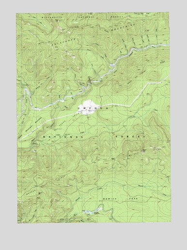
Potter Mountain, OR USGS Topographic Map
Click on map above to begin viewing in our Map Viewer.

This topographic map contains these locations and features:
Feature Name Type Latitude Longitude GNIS ID View Map
Alvin CreekStreamN43.3193°W122.3317°1155261View Map
Barkenberger CreekStreamN43.3318°W122.3150°1155262View Map
Beverly CreekStreamN43.3543°W122.2667°1137960View Map
Calapooya TrailTrailN43.3571°W122.3509°1139149View Map
Charlie CreekStreamN43.3185°W122.3422°1155260View Map
Clearwater Number One ForebayReservoirN43.2553°W122.3158°1159107View Map
Clearwater Number One Forebay DamDamN43.2565°W122.3211°1133489View Map
Clearwater Number Two Forebay DamDamN43.2515°W122.3345°1155539View Map
Clearwater Powerplant Number 1BuildingN43.2512°W122.3373°1134851View Map
Deer Creek Diversion DamDamN43.3326°W122.3720°1134853View Map
Dorothy CreekStreamN43.3493°W122.2848°1141196View Map
Dread and Terror RidgeRidgeN43.3460°W122.2567°1141233View Map
Helen CreekStreamN43.3532°W122.2695°1143454View Map
Karen CreekStreamN43.3332°W122.3720°1155263View Map
Laura CreekStreamN43.3382°W122.2995°1144862View Map
Lemolo Number 2 CanalCanalN43.3235°W122.3400°1155264View Map
Loafer CreekStreamN43.2998°W122.3606°1145308View Map
Mowich CreekStreamN43.2510°W122.3389°1146555View Map
Mowich ParkFlatN43.2582°W122.2706°1146556View Map
Nancy CreekStreamN43.3548°W122.2609°1146723View Map
Norma CreekStreamN43.3518°W122.2773°1146876View Map
Nurse CreekStreamN43.3346°W122.3059°1147091View Map
Patricia CreekStreamN43.3271°W122.3200°1147488View Map
Pig Iron MountainSummitN43.2674°W122.3603°1147662View Map
Pig Iron TrailTrailN43.2815°W122.3231°1147663View Map
Potter CreekStreamN43.3435°W122.2959°1147946View Map
Potter MountainSummitN43.3701°W122.3413°1147948View Map
Potter Mountain TrailTrailN43.3382°W122.3462°1147949View Map
Sally CreekStreamN43.3471°W122.2903°1148960View Map
Thorn PrairieFlatN43.3087°W122.3325°1151132View Map
Umpqua Hot SpringsSpringN43.2967°W122.3639°1151641View Map
Upper Mountain MeadowsFlatN43.3087°W122.3612°1151692View Map
Watson ButteSummitN43.2919°W122.2744°1151963View Map
Watson RidgeRidgeN43.2818°W122.3220°1134865View Map
Watson SaddleGapN43.2868°W122.2970°1134852View Map
Winter Knight CampLocaleN43.3012°W122.3456°1155259View Map

Note: Coordinates in the location and feature list above are referenced to NAD83 datum.


Copyright (C) 2008-2025 Ryan Niemi / Sunset Dynamics ... All Rights Reserved