TopoQuest Logo
Do you find TopoQuest useful?
Help keep TopoQuest running and adding new maps/features by donating!
Bitcoin:  19c7KJd3qBynnjoSw5npx9KScwjBe4ifkT
Litecoin:  LXs6TkuXGGXo1vDsWCkWVdjQX94eUKd6ui
Home View Maps Find Maps Find Places Resources & Links


Dickie Peak, Montana Topographic Map

USGS Map Title: Dickie Peak, MT
USGS Map MRC: 45112H8
DRG (GeoTIFF) Download: o45112h8.tif


Neighboring USGS Topographic Map Quads:


  Mount Haggin, MT  
46113A1
 

  Anaconda South, MT  
46112A8
 

  Opportunity, MT  
46112A7
 

  Lincoln Gulch, MT  
45113H1
 

  Dickie Peak, MT  
45112H8
 

  Burnt Mountain, MT  
45112H7
 

  Dickie Hills, MT  
45113G1
 

  Wise River, MT  
45112G8
 

  Dewey, MT  
45112G7


Map MRC Location:

N46°
W113°
N46°
W112°
H8 H7 H6 H5 H4 H3 H2 H1
G8 G7 G6 G5 G4 G3 G2 G1
F8 F7 F6 F5 F4 F3 F2 F1
E8 E7 E6 E5 E4 E3 E2 E1
D8 D7 D6 D5 D4 D3 D2 D1
C8 C7 C6 C5 C4 C3 C2 C1
B8 B7 B6 B5 B4 B3 B2 B1
A8 A7 A6 A5 A4 A3 A2 A1
N45°
W113°
N45°
W112°

Dickie Peak, MT USGS 1:24K Topographic Map Preview:
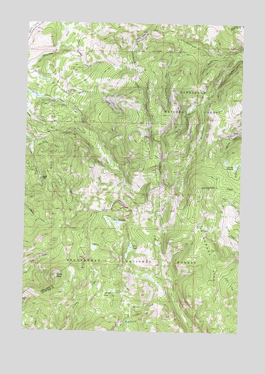
Dickie Peak, MT USGS Topographic Map
Click on map above to begin viewing in our Map Viewer.

This topographic map contains these locations and features:
Feature Name Type Latitude Longitude GNIS ID View Map
Beals HillSummitN45.9691°W112.8759°802016View Map
Clear CreekStreamN45.9899°W112.9100°781347View Map
Coyote GulchValleyN45.9869°W112.8925°781822View Map
Crooked John CreekStreamN45.9908°W112.9834°781913View Map
Dickie PeakSummitN45.8974°W112.9823°782375View Map
Fish LakeLakeN45.9093°W112.9388°783438View Map
French TownPopulated PlaceN45.9371°W112.9917°783744View Map
Hanson CreekStreamN45.8869°W112.9111°784528View Map
Hungry HillSummitN45.9085°W112.8914°785159View Map
Hungry Hill MineMineN45.9305°W112.9295°785160View Map
Johnson PeakFlatN45.8899°W112.9517°785544View Map
Julius GulchValleyN45.9513°W112.9967°785589View Map
Larkspur SpringSpringN45.9185°W112.9011°785968View Map
Minnesota GulchValleyN45.9863°W112.8795°787483View Map
Mud LakeLakeN45.9165°W112.8988°787793View Map
New MeadowsSwampN45.9191°W112.9475°787964View Map
Patsy Ann MineMineN45.9110°W112.9178°788693View Map
Patsy Ann MineMineN45.9110°W112.9175°805251View Map
Pine Dale Cow CabinLocaleN45.8910°W112.9431°788892View Map
Pine Dale MineMineN45.8908°W112.9403°805250View Map
Selway MeadowsFlatN45.9421°W112.8798°790215View Map
Spring CreekStreamN45.9683°W112.8981°791205View Map

Note: Coordinates in the location and feature list above are referenced to NAD83 datum.


Copyright (C) 2008-2025 Ryan Niemi / Sunset Dynamics ... All Rights Reserved