TopoQuest Logo
Do you find TopoQuest useful?
Help keep TopoQuest running and adding new maps/features by donating!
Bitcoin:  19c7KJd3qBynnjoSw5npx9KScwjBe4ifkT
Litecoin:  LXs6TkuXGGXo1vDsWCkWVdjQX94eUKd6ui
Home View Maps Find Maps Find Places Resources & Links


Dill City, Oklahoma Topographic Map

USGS Map Title: Dill City, OK
USGS Map MRC: 35099C2
DRG (GeoTIFF) Download: o35099c2.tif


Neighboring USGS Topographic Map Quads:


  Canute, OK  
35099D3
 

  Foss, OK  
35099D2
 

  Dill City NE, OK  
35099D1
 

  Elk City SE, OK  
35099C3
 

  Dill City, OK  
35099C2
 

  Dill City SE, OK  
35099C1
 

  Retrop, OK  
35099B3
 

  Sentinel, OK  
35099B2
 

  Rocky, OK  
35099B1


Map MRC Location:

N36°
W100°
N36°
W99°
H8 H7 H6 H5 H4 H3 H2 H1
G8 G7 G6 G5 G4 G3 G2 G1
F8 F7 F6 F5 F4 F3 F2 F1
E8 E7 E6 E5 E4 E3 E2 E1
D8 D7 D6 D5 D4 D3 D2 D1
C8 C7 C6 C5 C4 C3 C2 C1
B8 B7 B6 B5 B4 B3 B2 B1
A8 A7 A6 A5 A4 A3 A2 A1
N35°
W100°
N35°
W99°

Dill City, OK USGS 1:24K Topographic Map Preview:
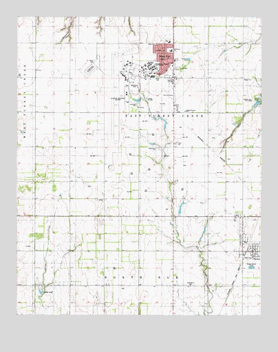
Dill City, OK USGS Topographic Map
Click on map above to begin viewing in our Map Viewer.

This topographic map contains these locations and features:
Feature Name Type Latitude Longitude GNIS ID View Map
Adams LakeReservoirN35.3388°W99.1278°1091685View Map
Adams Lake City ParkParkN35.3398°W99.1254°1777370View Map
Arrowhead ParkParkN35.3381°W99.1887°1777371View Map
Boggy CemeteryCemeteryN35.3488°W99.1345°1090333View Map
Burns FlatPopulated PlaceN35.3489°W99.1704°1090724View Map
Burns Flat - Dill City High SchoolSchoolN35.3484°W99.1708°1790277View Map
Burns Flat Police DepartmentBuildingN35.3458°W99.1699°2757643View Map
Burns Flat Post OfficePost OfficeN35.3557°W99.1707°1813391View Map
Burns Flat Volunteer Fire Department and Emergency Medical ServicesBuildingN35.3461°W99.1699°2658682View Map
Clinton Sherman Fire DepartmentBuildingN35.3504°W99.1938°2658385View Map
Clinton-Sherman AirportAirportN35.3425°W99.1944°1102123View Map
Clinton-Sherman Industrial ParkLocaleN35.3531°W99.2151°1763770View Map
Clinton-Sherman Reservoir DamDamN35.3401°W99.1870°1756028View Map
Clinton-Sherman Reservoir ReservoirReservoirN35.3401°W99.1870°1756029View Map
Cordell ReservoirReservoirN35.3401°W99.1254°1751553View Map
Cordell Reservoir DamDamN35.3401°W99.1254°1751552View Map
Crystal LakeReservoirN35.2597°W99.2381°1091878View Map
Dill CityPopulated PlaceN35.2767°W99.1351°1092088View Map
Dill City Post OfficePost OfficeN35.2774°W99.1296°1813835View Map
Dill City Volunteer Fire DepartmentBuildingN35.2759°W99.1295°2658676View Map
Naval Air Station Clinton (historical)MilitaryN35.3425°W99.1997°2576412View Map
North Burns CemeteryCemeteryN35.3199°W99.1786°1095925View Map
Novis CemeteryCemeteryN35.3635°W99.1795°1096068View Map
Oknoname 149030 DamDamN35.3317°W99.1820°1756000View Map
Oknoname 149030 ReservoirReservoirN35.3317°W99.1820°1756001View Map
Oknoname 149032 DamDamN35.2934°W99.1670°1756004View Map
Oknoname 149032 ReservoirReservoirN35.2934°W99.1670°1756005View Map
Ross SchoolSchoolN35.3642°W99.1726°1777375View Map
South Burns CemeteryCemeteryN35.2626°W99.1613°1098215View Map
Town of Burns FlatCivilN35.3548°W99.1750°2411747View Map
Town of Dill CityCivilN35.2820°W99.1336°2412430View Map
Western Technology CenterSchoolN35.3529°W99.1808°1777373View Map
Will Rogers Elementary SchoolSchoolN35.3607°W99.1714°1777374View Map

Note: Coordinates in the location and feature list above are referenced to NAD83 datum.


Copyright (C) 2008-2025 Ryan Niemi / Sunset Dynamics ... All Rights Reserved