TopoQuest Logo
Do you find TopoQuest useful?
Help keep TopoQuest running and adding new maps/features by donating!
Bitcoin:  19c7KJd3qBynnjoSw5npx9KScwjBe4ifkT
Litecoin:  LXs6TkuXGGXo1vDsWCkWVdjQX94eUKd6ui
Home View Maps Find Maps Find Places Resources & Links


Retrop, Oklahoma Topographic Map

USGS Map Title: Retrop, OK
USGS Map MRC: 35099B3
DRG (GeoTIFF) Download: o35099b3.tif


Neighboring USGS Topographic Map Quads:


  Hocker, OK  
35099C4
 

  Elk City SE, OK  
35099C3
 

  Dill City, OK  
35099C2
 

  Carter East, OK  
35099B4
 

  Retrop, OK  
35099B3
 

  Sentinel, OK  
35099B2
 

  Lake Creek, OK  
35099A4
 

  Retrop SE, OK  
35099A3
 

  Cambridge, OK  
35099A2


Map MRC Location:

N36°
W100°
N36°
W99°
H8 H7 H6 H5 H4 H3 H2 H1
G8 G7 G6 G5 G4 G3 G2 G1
F8 F7 F6 F5 F4 F3 F2 F1
E8 E7 E6 E5 E4 E3 E2 E1
D8 D7 D6 D5 D4 D3 D2 D1
C8 C7 C6 C5 C4 C3 C2 C1
B8 B7 B6 B5 B4 B3 B2 B1
A8 A7 A6 A5 A4 A3 A2 A1
N35°
W100°
N35°
W99°

Retrop, OK USGS 1:24K Topographic Map Preview:
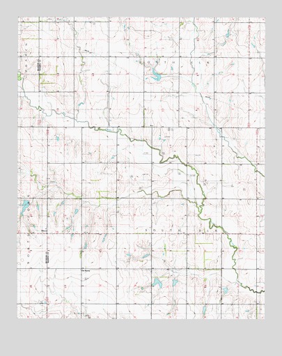
Retrop, OK USGS Topographic Map
Click on map above to begin viewing in our Map Viewer.

This topographic map contains these locations and features:
Feature Name Type Latitude Longitude GNIS ID View Map
Clark CemeteryCemeteryN35.2478°W99.3379°1091389View Map
Oknoname 149016 DamDamN35.1384°W99.2870°1755972View Map
Oknoname 149016 ReservoirReservoirN35.1384°W99.2870°1755973View Map
Old RetropPopulated PlaceN35.1453°W99.3426°1100695View Map
PortPopulated PlaceN35.2045°W99.3073°1096839View Map
Port CemeteryCemeteryN35.2038°W99.2988°1100153View Map
Port School (historical)SchoolN35.2037°W99.2629°1100155View Map
RetropPopulated PlaceN35.1598°W99.3598°1097177View Map
Retrop CemeteryCemeteryN35.1414°W99.3420°1100154View Map
Upper Elk Creek Site 13 DamDamN35.2251°W99.3037°1756729View Map
Upper Elk Creek Site 13 ReservoirReservoirN35.2251°W99.3037°1756730View Map
Upper Elk Creek Site 32 DamDamN35.1734°W99.3687°1757833View Map
Upper Elk Creek Site 32 ReservoirReservoirN35.1734°W99.3687°1757834View Map
Upper Elk Creek Site 33 DamDamN35.1717°W99.3537°1756711View Map
Upper Elk Creek Site 33 ReservoirReservoirN35.1717°W99.3537°1756712View Map
Upper Elk Creek Site 34 DamDamN35.1701°W99.3454°1756709View Map
Upper Elk Creek Site 34 ReservoirReservoirN35.1701°W99.3454°1756710View Map
Upper Elk Creek Site 37 DamDamN35.1484°W99.3004°1754578View Map
Upper Elk Creek Site 37 ReservoirReservoirN35.1484°W99.3004°1754579View Map
Upper Elk Creek Site 38 DamDamN35.1434°W99.2987°1756707View Map
Upper Elk Creek Site 38 ReservoirReservoirN35.1434°W99.2987°1756708View Map
Upper Elk Creek Site 39 DamDamN35.1417°W99.2954°1754576View Map
Upper Elk Creek Site 39 ReservoirReservoirN35.1417°W99.2954°1754577View Map
Upper Elk Creek Site 40 DamDamN35.1284°W99.2820°1754574View Map
Upper Elk Creek Site 40 ReservoirReservoirN35.1284°W99.2820°1754575View Map
West Sentinel Oil FieldOilfieldN35.1798°W99.3251°1100159View Map

Note: Coordinates in the location and feature list above are referenced to NAD83 datum.


Copyright (C) 2008-2025 Ryan Niemi / Sunset Dynamics ... All Rights Reserved