TopoQuest Logo
Do you find TopoQuest useful?
Help keep TopoQuest running and adding new maps/features by donating!
Bitcoin:  19c7KJd3qBynnjoSw5npx9KScwjBe4ifkT
Litecoin:  LXs6TkuXGGXo1vDsWCkWVdjQX94eUKd6ui
Home View Maps Find Maps Find Places Resources & Links


Dinkey Creek, California Topographic Map

USGS Map Title: Dinkey Creek, CA
USGS Map MRC: 37119A2
DRG (GeoTIFF) Download: o37119a2.tif


Neighboring USGS Topographic Map Quads:


  Musick Mountain, CA  
37119B3
 

  Huntington Lake, CA  
37119B2
 

  Dogtooth Peak, CA  
37119B1
 

  Shaver Lake, CA  
37119A3
 

  Dinkey Creek, CA  
37119A2
 

  Nelson Mountain, CA  
37119A1
 

  Trimmer, CA  
36119H3
 

  Sacate Ridge, CA  
36119H2
 

  Patterson Mountain, CA  
36119H1


Map MRC Location:

N38°
W120°
N38°
W119°
H8 H7 H6 H5 H4 H3 H2 H1
G8 G7 G6 G5 G4 G3 G2 G1
F8 F7 F6 F5 F4 F3 F2 F1
E8 E7 E6 E5 E4 E3 E2 E1
D8 D7 D6 D5 D4 D3 D2 D1
C8 C7 C6 C5 C4 C3 C2 C1
B8 B7 B6 B5 B4 B3 B2 B1
A8 A7 A6 A5 A4 A3 A2 A1
N37°
W120°
N37°
W119°

Dinkey Creek, CA USGS 1:24K Topographic Map Preview:
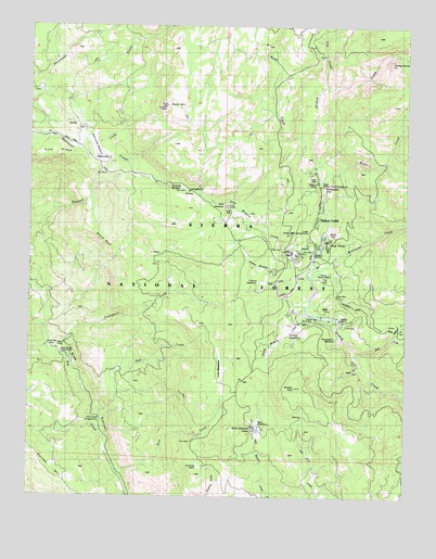
Dinkey Creek, CA USGS Topographic Map
Click on map above to begin viewing in our Map Viewer.

This topographic map contains these locations and features:
Feature Name Type Latitude Longitude GNIS ID View Map
Arkansas CreekStreamN37.1174°W119.1293°266386View Map
Bald MountainSummitN37.1038°W119.2057°218583View Map
Bald Mountain LookoutLocaleN37.1036°W119.2060°275650View Map
Barnes MountainSummitN37.0061°W119.2429°256538View Map
Bear CreekStreamN37.0372°W119.1423°266425View Map
Bear MeadowFlatN37.0197°W119.1760°256680View Map
Blue Canyon Work CenterLocaleN37.0383°W119.2401°1667386View Map
Bretz MillPopulated PlaceN37.0374°W119.2398°1655842View Map
Byles Johnson CampLocaleN37.0177°W119.1740°257792View Map
Camp EL-O-WinLocaleN37.0474°W119.1560°1667387View Map
Camp FresnoLocaleN37.0697°W119.1537°257877View Map
Camp Mary-Y-MacLocaleN37.0577°W119.1529°1667389View Map
Cow CreekStreamN37.1088°W119.1546°258800View Map
D and D Pack StationLocaleN37.0616°W119.1548°275657View Map
Dinkey CreekPopulated PlaceN37.0861°W119.1576°1655969View Map
Dinkey Creek Post Office (historical)Post OfficeN37.0861°W119.1576°1940069View Map
Dinkey Creek Ranger StationLocaleN37.0658°W119.1565°259379View Map
Dinkey Creek ResortLocaleN37.0694°W119.1543°275660View Map
Dinkey Creek TrailheadLocaleN37.0869°W119.1557°275653View Map
Dinkey Creek Work CenterLocaleN37.0613°W119.1548°275662View Map
Dinkey DomeSummitN37.1152°W119.1329°259380View Map
Dinkey Fisherman Picnic AreaLocaleN37.0661°W119.1532°275661View Map
Dinkey MeadowFlatN37.0430°W119.1660°259381View Map
Dinkey Meadow CreekStreamN37.0483°W119.1579°259382View Map
Dinkey MountainSummitN37.0294°W119.1635°259383View Map
Duff CreekStreamN37.0208°W119.2279°259602View Map
Duff Creek CampgroundLocaleN37.0205°W119.2273°1667392View Map
Exchequer CreekStreamN37.0577°W119.1582°271088View Map
Forked MeadowFlatN37.0569°W119.1740°1667395View Map
Forked Meadow CreekStreamN37.0586°W119.1579°260267View Map
Glen MeadowFlatN37.0766°W119.1898°260601View Map
Glen Meadow CreekStreamN37.0647°W119.1573°260602View Map
Glenn Meadow Forest Service FacilityLocaleN37.0769°W119.1854°275652View Map
Grand BluffCliffN37.0677°W119.2296°260735View Map
Honeymoon PoolLakeN37.0826°W119.1533°1667397View Map
Laurel CreekStreamN37.0427°W119.1315°266900View Map
Lost CreekStreamN37.0052°W119.2196°262930View Map
Lost MeadowFlatN37.0338°W119.1873°262959View Map
Lower Dinkey Creek CampgroundLocaleN37.0674°W119.1582°275655View Map
Lower Dinkey Creek CampgroundLocaleN37.0716°W119.1557°275656View Map
Markwood MeadowFlatN37.0924°W119.2323°263221View Map
Nutmeg GlenValleyN37.0064°W119.1908°264260View Map
Oakie Bear CampgroundLocaleN37.0111°W119.2287°275642View Map
Pine Logging CampLocaleN37.0641°W119.1640°264767View Map
Pollard CampLocaleN37.0897°W119.2246°1667405View Map
Providence CreekStreamN37.0383°W119.2435°231074View Map
Providence QuarryMineN37.0528°W119.1592°2677528View Map
Reese CreekStreamN37.0844°W119.1551°267173View Map
Rock CreekStreamN37.0883°W119.1571°267184View Map
Sawmill CampgroundLocaleN37.0369°W119.2410°275658View Map
Soaproot CampgroundLocaleN37.0313°W119.2354°275659View Map
Strawberry MeadowAreaN37.0436°W119.1476°1667410View Map
Strawberry Meadow CreekStreamN37.0427°W119.1485°267807View Map
Summit MeadowFlatN37.0819°W119.2068°267940View Map
Summit Meadow CampgroundLocaleN37.0808°W119.1979°275651View Map
Upper Dinkey Creek CampgroundLocaleN37.0824°W119.1543°275654View Map

Note: Coordinates in the location and feature list above are referenced to NAD83 datum.


Copyright (C) 2008-2025 Ryan Niemi / Sunset Dynamics ... All Rights Reserved