TopoQuest Logo
Do you find TopoQuest useful?
Help keep TopoQuest running and adding new maps/features by donating!
Bitcoin:  19c7KJd3qBynnjoSw5npx9KScwjBe4ifkT
Litecoin:  LXs6TkuXGGXo1vDsWCkWVdjQX94eUKd6ui
Home View Maps Find Maps Find Places Resources & Links


Trimmer, California Topographic Map

USGS Map Title: Trimmer, CA
USGS Map MRC: 36119H3
DRG (GeoTIFF) Download: o36119h3.tif


Neighboring USGS Topographic Map Quads:


  Auberry, CA  
37119A4
 

  Shaver Lake, CA  
37119A3
 

  Dinkey Creek, CA  
37119A2
 

  Humphreys Station, CA  
36119H4
 

  Trimmer, CA  
36119H3
 

  Sacate Ridge, CA  
36119H2
 

  Piedra, CA  
36119G4
 

  Pine Flat Dam, CA  
36119G3
 

  Luckett Mountain, CA  
36119G2


Map MRC Location:

N37°
W120°
N37°
W119°
H8 H7 H6 H5 H4 H3 H2 H1
G8 G7 G6 G5 G4 G3 G2 G1
F8 F7 F6 F5 F4 F3 F2 F1
E8 E7 E6 E5 E4 E3 E2 E1
D8 D7 D6 D5 D4 D3 D2 D1
C8 C7 C6 C5 C4 C3 C2 C1
B8 B7 B6 B5 B4 B3 B2 B1
A8 A7 A6 A5 A4 A3 A2 A1
N36°
W120°
N36°
W119°

Trimmer, CA USGS 1:24K Topographic Map Preview:
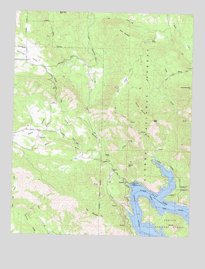
Trimmer, CA USGS Topographic Map
Click on map above to begin viewing in our Map Viewer.

This topographic map contains these locations and features:
Feature Name Type Latitude Longitude GNIS ID View Map
Billy CreekStreamN36.8902°W119.2951°219297View Map
Bobs FlatFlatN36.9649°W119.2954°219566View Map
Bobs Flat TrailTrailN36.9338°W119.2901°219567View Map
Branford MountainSummitN36.9516°W119.2910°219780View Map
Burrough ValleyBasinN36.9752°W119.3671°220248View Map
Cats Head MountainSummitN36.9588°W119.2515°220736View Map
Cherry FlatFlatN36.9947°W119.2957°220953View Map
Cold Springs RancheriaCivilN36.9716°W119.3242°276284View Map
Cole SpringSpringN36.9850°W119.2798°221360View Map
Davis MountainSummitN36.9916°W119.3040°222055View Map
Deep Creek TrailTrailN36.9669°W119.2604°233770View Map
Duncan CanyonValleyN36.9847°W119.3685°222713View Map
Eagle PeakSummitN36.9399°W119.2773°222819View Map
Granite RidgeRidgeN36.8805°W119.3604°224418View Map
Hacker MountainSummitN36.9152°W119.2943°224763View Map
Hog MountainSummitN36.8858°W119.3132°225406View Map
Lakeview Picnic GroundLocaleN36.8986°W119.2607°226823View Map
Lakeview Picnic GroundLocaleN36.8988°W119.2607°276285View Map
Little Dry CreekStreamN36.9236°W119.3204°227249View Map
Mountain View School (historical)SchoolN36.9719°W119.3718°276283View Map
Owl MountainSummitN36.8816°W119.2610°230181View Map
Sycamore CreekStreamN36.9199°W119.2776°235921View Map
Sycamore Creek Indian School (historical)SchoolN36.9752°W119.3343°1702958View Map
Sycamore Flat Campground OneLocaleN36.9030°W119.2582°253955View Map
Sycamore Flat Campground TwoLocaleN36.9013°W119.2593°253956View Map
TrimmerPopulated PlaceN36.9049°W119.2962°1660028View Map
Trimmer Ranger StationLocaleN36.9111°W119.3057°236541View Map
Trimmer Recreation AreaParkN36.9038°W119.2910°236542View Map
Watts CreekStreamN36.9216°W119.3107°237359View Map
Watts ValleyBasinN36.9338°W119.3585°237361View Map
Watts Valley CemeteryCemeteryN36.9292°W119.3571°237362View Map

Note: Coordinates in the location and feature list above are referenced to NAD83 datum.


Copyright (C) 2008-2025 Ryan Niemi / Sunset Dynamics ... All Rights Reserved