TopoQuest Logo
Do you find TopoQuest useful?
Help keep TopoQuest running and adding new maps/features by donating!
Bitcoin:  19c7KJd3qBynnjoSw5npx9KScwjBe4ifkT
Litecoin:  LXs6TkuXGGXo1vDsWCkWVdjQX94eUKd6ui
Home View Maps Find Maps Find Places Resources & Links


Dinsmore, Florida Topographic Map

USGS Map Title: Dinsmore, FL
USGS Map MRC: 30081D7
DRG (GeoTIFF) Download: o30081d7.tif


Neighboring USGS Topographic Map Quads:


  Hilliard SW, FL  
30081E8
 

  Callahan, FL  
30081E7
 

  Italia, FL  
30081E6
 

  Bryceville, FL  
30081D8
 

  Dinsmore, FL  
30081D7
 

  Trout River, FL  
30081D6
 

  Baldwin, FL  
30081C8
 

  Marietta, FL  
30081C7
 

  Jacksonville, FL  
30081C6


Map MRC Location:

N31°
W82°
N31°
W81°
H8 H7 H6 H5 H4 H3 H2 H1
G8 G7 G6 G5 G4 G3 G2 G1
F8 F7 F6 F5 F4 F3 F2 F1
E8 E7 E6 E5 E4 E3 E2 E1
D8 D7 D6 D5 D4 D3 D2 D1
C8 C7 C6 C5 C4 C3 C2 C1
B8 B7 B6 B5 B4 B3 B2 B1
A8 A7 A6 A5 A4 A3 A2 A1
N30°
W82°
N30°
W81°

Dinsmore, FL USGS 1:24K Topographic Map Preview:
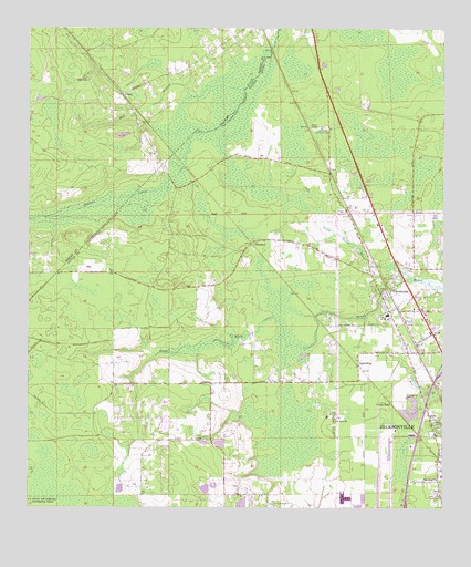
Dinsmore, FL USGS Topographic Map
Click on map above to begin viewing in our Map Viewer.

This topographic map contains these locations and features:
Feature Name Type Latitude Longitude GNIS ID View Map
Ben BranchStreamN30.4847°W81.8098°278473View Map
Calvary Chapel Church of GodChurchN30.4383°W81.7716°2476094View Map
CaryPopulated PlaceN30.4627°W81.7843°294705View Map
Cotton Rawles GrantCivilN30.4013°W81.8101°300975View Map
D Bloodworth GrantCivilN30.4652°W81.7579°300982View Map
Dinsmoore Church of GodChurchN30.4292°W81.7573°2476173View Map
Dinsmore Baptist ChurchChurchN30.4249°W81.7656°2476174View Map
Dinsmore Elementary SchoolSchoolN30.4259°W81.7665°297715View Map
Dinsmore Lookout TowerTowerN30.4741°W81.7848°281580View Map
Dinsmore United Methodist ChurchChurchN30.4263°W81.7672°2476175View Map
Jacksonville Fire and Rescue Department Station 33BuildingN30.4301°W81.7596°2475992View Map
Joseph Rain and William Bailey GrantCivilN30.4377°W81.7673°300984View Map
Keen CemeteryCemeteryN30.4866°W81.8570°285025View Map
KeenePopulated PlaceN30.4833°W81.8468°295386View Map
Kings RoadLocaleN30.4019°W81.7651°285124View Map
Kings Road Baptist ChurchChurchN30.4212°W81.7509°2476370View Map
Levi Sparkman GrantCivilN30.4569°W81.7901°300983View Map
Little Trout RiverStreamN30.4380°W81.7640°285844View Map
Nassau County Fire and Rescue Station 10BuildingN30.4981°W81.8125°2644198View Map
PlummerPopulated PlaceN30.4438°W81.8076°294892View Map
Saint Pauls ChurchChurchN30.3977°W81.7820°290359View Map
School Number 45SchoolN30.4255°W81.7662°290747View Map
Silver Dolphin Mobile Home ParkPopulated PlaceN30.4367°W81.7639°2449525View Map
SpauldingPopulated PlaceN30.4122°W81.7748°295639View Map
Study Estates Mobile Home ParkPopulated PlaceN30.3998°W81.7529°2448306View Map
Wayside Assembly of God ChurchChurchN30.4240°W81.7555°2476623View Map
West Side ChurchChurchN30.3827°W81.7512°293120View Map

Note: Coordinates in the location and feature list above are referenced to NAD83 datum.


Copyright (C) 2008-2025 Ryan Niemi / Sunset Dynamics ... All Rights Reserved