TopoQuest Logo
Do you find TopoQuest useful?
Help keep TopoQuest running and adding new maps/features by donating!
Bitcoin:  19c7KJd3qBynnjoSw5npx9KScwjBe4ifkT
Litecoin:  LXs6TkuXGGXo1vDsWCkWVdjQX94eUKd6ui
Home View Maps Find Maps Find Places Resources & Links


Dixie Hot Springs, Nevada Topographic Map

USGS Map Title: Dixie Hot Springs, NV
USGS Map MRC: 39118G1
DRG (GeoTIFF) Download: o39118g1.tif


Neighboring USGS Topographic Map Quads:


  Buena Vista Hills South, NV  
39118H2
 

  Dixie Hot Springs NE, NV  
39118H1
 

  Bolivia, NV  
39117H8
 

  Fondaway Canyon, NV  
39118G2
 

  Dixie Hot Springs, NV  
39118G1
 

  Humboldt Salt Marsh, NV  
39117G8
 

  I X L Canyon, NV  
39118F2
 

  Dixie Valley, NV  
39118F1
 

  Cow Canyon, NV  
39117F8


Map MRC Location:

N40°
W119°
N40°
W118°
H8 H7 H6 H5 H4 H3 H2 H1
G8 G7 G6 G5 G4 G3 G2 G1
F8 F7 F6 F5 F4 F3 F2 F1
E8 E7 E6 E5 E4 E3 E2 E1
D8 D7 D6 D5 D4 D3 D2 D1
C8 C7 C6 C5 C4 C3 C2 C1
B8 B7 B6 B5 B4 B3 B2 B1
A8 A7 A6 A5 A4 A3 A2 A1
N39°
W119°
N39°
W118°

Dixie Hot Springs, NV USGS 1:24K Topographic Map Preview:
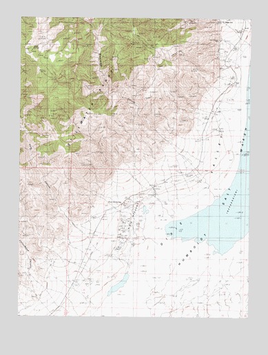
Dixie Hot Springs, NV USGS Topographic Map
Click on map above to begin viewing in our Map Viewer.

This topographic map contains these locations and features:
Feature Name Type Latitude Longitude GNIS ID View Map
Cold SpringsSpringN39.7752°W118.0749°839621View Map
Cottonwood CanyonValleyN39.7710°W118.1190°839730View Map
DixiePopulated PlaceN39.8738°W118.0160°856014View Map
Dixie Comstock MineMineN39.8610°W118.0132°863188View Map
Dixie Hot SpringsSpringN39.7970°W118.0678°840066View Map
Dixie Valley Mining DistrictCivilN39.8649°W118.0415°855610View Map
Eagle SpringsSpringN39.8607°W118.1201°848541View Map
Fault Scarp of 1954RidgeN39.7552°W118.1151°848545View Map
Fork Mississippi CanyonValleyN39.8421°W118.0787°847596View Map
Hare CanyonValleyN39.8630°W118.1199°840901View Map
Mississippi CanyonValleyN39.8224°W118.0437°848589View Map
North Fork Mississippi CanyonValleyN39.8671°W118.0849°863192View Map
Star PeakSummitN39.8632°W118.0660°847616View Map
Stillwater RangeRangeN39.8566°W118.1060°848654View Map

Note: Coordinates in the location and feature list above are referenced to NAD83 datum.


Copyright (C) 2008-2024 Ryan Niemi / Sunset Dynamics ... All Rights Reserved