TopoQuest Logo
Do you find TopoQuest useful?
Help keep TopoQuest running and adding new maps/features by donating!
Bitcoin:  19c7KJd3qBynnjoSw5npx9KScwjBe4ifkT
Litecoin:  LXs6TkuXGGXo1vDsWCkWVdjQX94eUKd6ui
Home View Maps Find Maps Find Places Resources & Links


Dolores Ranch, Texas Topographic Map

USGS Map Title: Dolores Ranch, TX
USGS Map MRC: 27099F6
DRG (GeoTIFF) Download: o27099f6.tif


Neighboring USGS Topographic Map Quads:


  San Pedro Hill, TX  
27099G7
 

  Cerritos Blancos, TX  
27099G6
 

  Nido Ranch, TX  
27099G5
 

  South of San Pedro Hill, TX  
27099F7
 

  Dolores Ranch, TX  
27099F6
 

  Cuervo Creek, TX  
27099F5


  Laredo West, TX  
27099E5


Map MRC Location:

N28°
W100°
N28°
W99°
H8 H7 H6 H5 H4 H3 H2 H1
G8 G7 G6 G5 G4 G3 G2 G1
F8 F7 F6 F5 F4 F3 F2 F1
E8 E7 E6 E5 E4 E3 E2 E1
D8 D7 D6 D5 D4 D3 D2 D1
C8 C7 C6 C5 C4 C3 C2 C1
B8 B7 B6 B5 B4 B3 B2 B1
A8 A7 A6 A5 A4 A3 A2 A1
N27°
W100°
N27°
W99°

Dolores Ranch, TX USGS 1:24K Topographic Map Preview:
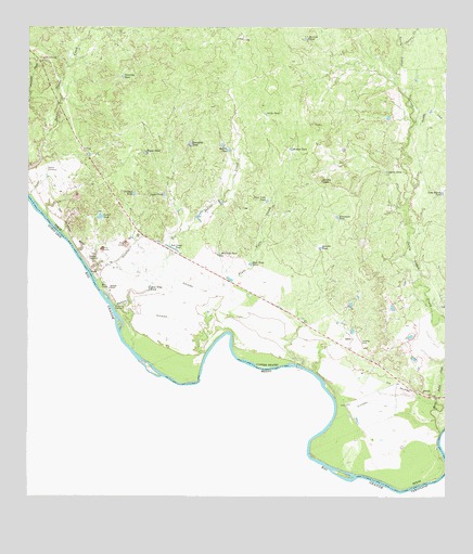
Dolores Ranch, TX USGS Topographic Map
Click on map above to begin viewing in our Map Viewer.

This topographic map contains these locations and features:
Feature Name Type Latitude Longitude GNIS ID View Map
Aguila TankReservoirN27.7128°W99.6446°1329273View Map
Anita TankReservoirN27.7275°W99.6794°1329557View Map
Bull Trap TankReservoirN27.6807°W99.7138°1331614View Map
Cannel TankReservoirN27.6996°W99.7288°1332097View Map
Carlos TankReservoirN27.7057°W99.7097°1332163View Map
Casa Blanca TankReservoirN27.7064°W99.6265°1332268View Map
Darwin CemeteryCemeteryN27.7122°W99.7450°1334057View Map
Deer Trap TankReservoirN27.6871°W99.6837°1334223View Map
Dolores CemeteryCemeteryN27.6889°W99.7325°1334469View Map
Dolores RanchLocaleN27.6811°W99.7267°1334471View Map
Ernesto TankReservoirN27.6916°W99.6628°1335485View Map
Escondido TankReservoirN27.7190°W99.7018°1335502View Map
Estaban TankReservoirN27.7057°W99.7185°1335521View Map
Fransesca TankReservoirN27.6999°W99.6578°1336164View Map
IslitasPopulated PlaceN27.6672°W99.6531°1378485View Map
Javelina TankReservoirN27.7473°W99.6671°1338669View Map
KGNS-TV (Laredo)TowerN27.6731°W99.6567°1388152View Map
Laredo Fire Department Station 13BuildingN27.6918°W99.6708°2551315View Map
Los Indios CreekStreamN27.6645°W99.7187°1340602View Map
Lovers LeapCliffN27.7095°W99.6623°1340669View Map
Pinto Valle CreekStreamN27.6633°W99.6970°1344110View Map
Pinto Valle TankReservoirN27.7041°W99.6789°1344111View Map
Ranchita TankReservoirN27.6896°W99.6928°1344754View Map
Rincon TankReservoirN27.7180°W99.6716°1345230View Map
Sandia TankReservoirN27.7175°W99.6903°1346567View Map
Santa Isabel CreekStreamN27.6422°W99.6267°1346650View Map
Scot Camp TankReservoirN27.6920°W99.7079°1346807View Map
Tasita TankReservoirN27.7167°W99.7148°1348266View Map
Tejones CreekStreamN27.7450°W99.6384°1348335View Map
Tordillo CreekStreamN27.7242°W99.6356°1348648View Map
United States Border Patrol StationBuildingN27.7012°W99.7421°2750814View Map
Venancio TankReservoirN27.7371°W99.7222°1349237View Map

Note: Coordinates in the location and feature list above are referenced to NAD83 datum.


Copyright (C) 2008-2025 Ryan Niemi / Sunset Dynamics ... All Rights Reserved