TopoQuest Logo
Do you find TopoQuest useful?
Help keep TopoQuest running and adding new maps/features by donating!
Bitcoin:  19c7KJd3qBynnjoSw5npx9KScwjBe4ifkT
Litecoin:  LXs6TkuXGGXo1vDsWCkWVdjQX94eUKd6ui
Home View Maps Find Maps Find Places Resources & Links


Cuervo Creek, Texas Topographic Map

USGS Map Title: Cuervo Creek, TX
USGS Map MRC: 27099F5
DRG (GeoTIFF) Download: o27099f5.tif


Neighboring USGS Topographic Map Quads:


  Cerritos Blancos, TX  
27099G6
 

  Nido Ranch, TX  
27099G5
 

  Callaghan Ranch South, TX  
27099G4
 

  Dolores Ranch, TX  
27099F6
 

  Cuervo Creek, TX  
27099F5
 

  Orvil, TX  
27099F4


  Laredo West, TX  
27099E5
 

  Laredo East, TX  
27099E4


Map MRC Location:

N28°
W100°
N28°
W99°
H8 H7 H6 H5 H4 H3 H2 H1
G8 G7 G6 G5 G4 G3 G2 G1
F8 F7 F6 F5 F4 F3 F2 F1
E8 E7 E6 E5 E4 E3 E2 E1
D8 D7 D6 D5 D4 D3 D2 D1
C8 C7 C6 C5 C4 C3 C2 C1
B8 B7 B6 B5 B4 B3 B2 B1
A8 A7 A6 A5 A4 A3 A2 A1
N27°
W100°
N27°
W99°

Cuervo Creek, TX USGS 1:24K Topographic Map Preview:
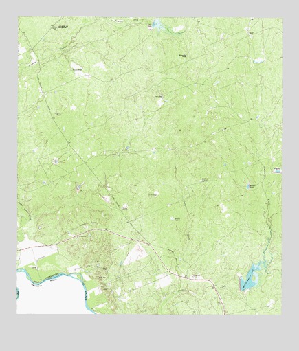
Cuervo Creek, TX USGS Topographic Map
Click on map above to begin viewing in our Map Viewer.

This topographic map contains these locations and features:
Feature Name Type Latitude Longitude GNIS ID View Map
Antonio Santos ColoniaPopulated PlaceN27.6514°W99.6192°2010681View Map
Big TankReservoirN27.7471°W99.5593°1330665View Map
Cuervo CreekStreamN27.6347°W99.5484°1333788View Map
Huasache TankReservoirN27.7341°W99.5455°1338199View Map
Loma de las PotrancasSummitN27.7461°W99.6067°1340342View Map
Los Corralitos Census Designated PlaceCensusN27.6412°W99.5575°2584683View Map
Los Corralitos ColoniaPopulated PlaceN27.6422°W99.5564°2010698View Map
Los Minerales Census Designated PlaceCensusN27.6555°W99.6178°2584688View Map
Los Minerales ColoniaPopulated PlaceN27.6514°W99.6184°2010701View Map
Middle Pasture LakeReservoirN27.6403°W99.5153°1341509View Map
Middle Pasture Lake DamDamN27.6386°W99.5203°1858722View Map
Old Ranch WindmillLocaleN27.6811°W99.5378°1343202View Map
Ranchos Penitas WestPopulated PlaceN27.6742°W99.6109°1852758View Map
Ranchos Penitas West Census Designated PlaceCensusN27.6745°W99.6035°2409141View Map
Retama Lake DamDamN27.7470°W99.5620°1858720View Map
Retama RanchLocaleN27.7442°W99.5162°1345109View Map
Salinas TankReservoirN27.6651°W99.5518°1346177View Map
Santa Elena RanchLocaleN27.7158°W99.5562°1346639View Map
Sauses TankReservoirN27.7282°W99.5998°1346726View Map
Surprise TankReservoirN27.6863°W99.5013°1348105View Map
Tiendas WindmillLocaleN27.6697°W99.5756°1348554View Map
Tordillo CemeteryCemeteryN27.7364°W99.6187°1348647View Map
Wonder TankReservoirN27.6791°W99.5164°1350501View Map

Note: Coordinates in the location and feature list above are referenced to NAD83 datum.


Copyright (C) 2008-2025 Ryan Niemi / Sunset Dynamics ... All Rights Reserved