TopoQuest Logo
Do you find TopoQuest useful?
Help keep TopoQuest running and adding new maps/features by donating!
Bitcoin:  19c7KJd3qBynnjoSw5npx9KScwjBe4ifkT
Litecoin:  LXs6TkuXGGXo1vDsWCkWVdjQX94eUKd6ui
Home View Maps Find Maps Find Places Resources & Links


Dome Hill, California Topographic Map

USGS Map Title: Dome Hill, CA
USGS Map MRC: 38119C1
DRG (GeoTIFF) Download: o38119c1.tif


Neighboring USGS Topographic Map Quads:


  Sweetwater Creek, NV  
38119D2
 

  The Elbow, NV  
38119D1
 

  Ninemile Ranch, NV  
38118D8
 

  Bridgeport, CA  
38119C2
 

  Dome Hill, CA  
38119C1
 

  Aurora, NV  
38118C8
 

  Big Alkali, CA  
38119B2
 

  Bodie, CA  
38119B1
 

  Kirkwood Spring, CA  
38118B8


Map MRC Location:

N39°
W120°
N39°
W119°
H8 H7 H6 H5 H4 H3 H2 H1
G8 G7 G6 G5 G4 G3 G2 G1
F8 F7 F6 F5 F4 F3 F2 F1
E8 E7 E6 E5 E4 E3 E2 E1
D8 D7 D6 D5 D4 D3 D2 D1
C8 C7 C6 C5 C4 C3 C2 C1
B8 B7 B6 B5 B4 B3 B2 B1
A8 A7 A6 A5 A4 A3 A2 A1
N38°
W120°
N38°
W119°

Dome Hill, CA USGS 1:24K Topographic Map Preview:
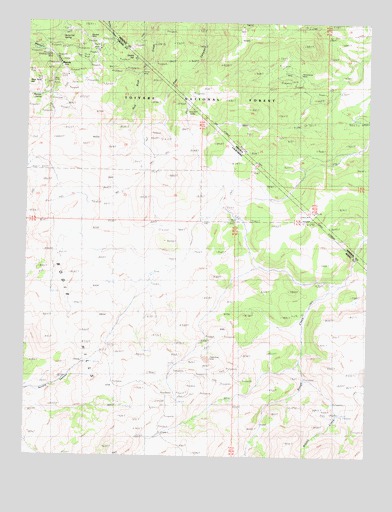
Dome Hill, CA USGS Topographic Map
Click on map above to begin viewing in our Map Viewer.

This topographic map contains these locations and features:
Feature Name Type Latitude Longitude GNIS ID View Map
Atastra CreekStreamN38.2719°W119.0229°256361View Map
Bodie HillsRangeN38.2558°W119.0901°266473View Map
Bridgeport Ranger DistrictForestN38.3685°W119.0254°864269View Map
Burnt Hill SpringSpringN38.3702°W119.1134°257727View Map
Chinese CampLocaleN38.3424°W119.0407°859240View Map
Dome HillSummitN38.3641°W119.0874°259462View Map
Dry LakeLakeN38.2738°W119.0001°1655198View Map
Halfway CampLocaleN38.3091°W119.0446°261018View Map
Hefler Tungsten MineMineN38.3582°W119.0276°853415View Map
Homestead MineMineN38.3616°W119.0324°860018View Map
Lower TownPopulated PlaceN38.3674°W119.1199°1656145View Map
MasonicLocaleN38.3621°W119.1146°263258View Map
Masonic SpringSpringN38.3527°W119.1224°263260View Map
Maybell MineMineN38.3705°W119.1049°263284View Map
Mellor MineMineN38.3671°W119.1007°263449View Map
Paramount MineMineN38.2783°W119.0604°230335View Map
Perrini MineMineN38.3608°W119.0885°230533View Map
Pittsburg Liberty MineMineN38.3652°W119.1176°230781View Map
Upper TownPopulated PlaceN38.3544°W119.1179°1656379View Map

Note: Coordinates in the location and feature list above are referenced to NAD83 datum.


Copyright (C) 2008-2025 Ryan Niemi / Sunset Dynamics ... All Rights Reserved