TopoQuest Logo
Do you find TopoQuest useful?
Help keep TopoQuest running and adding new maps/features by donating!
Bitcoin:  19c7KJd3qBynnjoSw5npx9KScwjBe4ifkT
Litecoin:  LXs6TkuXGGXo1vDsWCkWVdjQX94eUKd6ui
Home View Maps Find Maps Find Places Resources & Links


Dora, Oregon Topographic Map

USGS Map Title: Dora, OR
USGS Map MRC: 43123B8
DRG (GeoTIFF) Download: o43123b8.tif


Neighboring USGS Topographic Map Quads:


  Daniels Creek, OR  
43124C1
 

  Coos Mountain, OR  
43123C8
 

  Tioga, OR  
43123C7
 

  McKinley, OR  
43124B1
 

  Dora, OR  
43123B8
 

  Sitkum, OR  
43123B7
 

  Bridge, OR  
43124A1
 

  Remote, OR  
43123A8
 

  Kenyon Mountain, OR  
43123A7


Map MRC Location:

N44°
W124°
N44°
W123°
H8 H7 H6 H5 H4 H3 H2 H1
G8 G7 G6 G5 G4 G3 G2 G1
F8 F7 F6 F5 F4 F3 F2 F1
E8 E7 E6 E5 E4 E3 E2 E1
D8 D7 D6 D5 D4 D3 D2 D1
C8 C7 C6 C5 C4 C3 C2 C1
B8 B7 B6 B5 B4 B3 B2 B1
A8 A7 A6 A5 A4 A3 A2 A1
N43°
W124°
N43°
W123°

Dora, OR USGS 1:24K Topographic Map Preview:
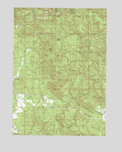
Dora, OR USGS Topographic Map
Click on map above to begin viewing in our Map Viewer.

This topographic map contains these locations and features:
Feature Name Type Latitude Longitude GNIS ID View Map
4H CampLocaleN43.2318°W123.9970°1132531View Map
Abernathy Station (historical)LocaleN43.1596°W123.9832°1154829View Map
Alder CreekStreamN43.2490°W123.9365°1116823View Map
Bills CreekStreamN43.1615°W123.9248°1117703View Map
Brewster CanyonValleyN43.1571°W123.9668°1118059View Map
Brewster RockPillarN43.1630°W123.8853°1118062View Map
Brewster ValleyValleyN43.1471°W123.8845°1132518View Map
Cherry Creek Myrtle PreserveReserveN43.2165°W123.9262°1132838View Map
Cherry Creek Recreation SiteParkN43.2179°W123.9373°1132527View Map
Cherry Creek RidgeRidgeN43.2098°W123.9520°1157226View Map
China CreekStreamN43.1607°W123.9198°1118905View Map
DoraPopulated PlaceN43.1559°W123.9562°1136227View Map
Dora - Sitkum Rural Fire Protection DistrictBuildingN43.1545°W123.9551°2576882View Map
Dora Post Office (historical)Post OfficeN43.1559°W123.9562°1165171View Map
Dora Public LibraryBuildingN43.1515°W123.9529°2661295View Map
East Fork China CreekStreamN43.1665°W123.9123°1132522View Map
Frona County ParkParkN43.1624°W123.9801°1121009View Map
Ham Bunch - Cherry Creek County ParkParkN43.1808°W123.9968°1118856View Map
Hantz CreekStreamN43.1615°W123.9909°1121573View Map
Karl CreekStreamN43.2040°W123.8804°1132524View Map
Little Cherry CreekStreamN43.2071°W123.9809°1123152View Map
Lost CreekStreamN43.2365°W123.9745°1123493View Map
Maple CreekStreamN43.1471°W123.8859°1132521View Map
McKinley CemeteryCemeteryN43.1557°W123.9964°1160664View Map
McKinley Grange HallBuildingN43.1812°W123.9959°1639280View Map
Middle Creek Recreation AreaLocaleN43.2373°W123.9740°1638501View Map
Middle Creek Recreation SiteParkN43.2359°W123.9748°1132530View Map
Nellie CreekStreamN43.1943°W123.9915°1132517View Map
North Fork Cherry CreekStreamN43.2179°W123.9387°1132529View Map
Park CreekStreamN43.2484°W123.8987°1132537View Map
Park Creek Recreation SiteParkN43.2459°W123.8962°1132526View Map
Reeves CreekStreamN43.1818°W123.8776°1132523View Map
Sheeps HeadSummitN43.1335°W123.9256°1157227View Map
South Fork Cherry CreekStreamN43.2179°W123.9373°1132528View Map
Steel CreekStreamN43.1571°W123.9634°1127568View Map
Vaughns CreekStreamN43.2471°W123.9332°1128517View Map

Note: Coordinates in the location and feature list above are referenced to NAD83 datum.


Copyright (C) 2008-2024 Ryan Niemi / Sunset Dynamics ... All Rights Reserved