TopoQuest Logo
Do you find TopoQuest useful?
Help keep TopoQuest running and adding new maps/features by donating!
Bitcoin:  19c7KJd3qBynnjoSw5npx9KScwjBe4ifkT
Litecoin:  LXs6TkuXGGXo1vDsWCkWVdjQX94eUKd6ui
Home View Maps Find Maps Find Places Resources & Links


Bridge, Oregon Topographic Map

USGS Map Title: Bridge, OR
USGS Map MRC: 43124A1
DRG (GeoTIFF) Download: o43124a1.tif


Neighboring USGS Topographic Map Quads:


  Coquille, OR  
43124B2
 

  McKinley, OR  
43124B1
 

  Dora, OR  
43123B8
 

  Myrtle Point, OR  
43124A2
 

  Bridge, OR  
43124A1
 

  Remote, OR  
43123A8
 

  Dement Creek, OR  
42124H2
 

  Powers, OR  
42124H1
 

  Rasler Creek, OR  
42123H8


Map MRC Location:

N44°
W125°
N44°
W124°
H8 H7 H6 H5 H4 H3 H2 H1
G8 G7 G6 G5 G4 G3 G2 G1
F8 F7 F6 F5 F4 F3 F2 F1
E8 E7 E6 E5 E4 E3 E2 E1
D8 D7 D6 D5 D4 D3 D2 D1
C8 C7 C6 C5 C4 C3 C2 C1
B8 B7 B6 B5 B4 B3 B2 B1
A8 A7 A6 A5 A4 A3 A2 A1
N43°
W125°
N43°
W124°

Bridge, OR USGS 1:24K Topographic Map Preview:
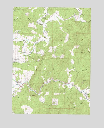
Bridge, OR USGS Topographic Map
Click on map above to begin viewing in our Map Viewer.

This topographic map contains these locations and features:
Feature Name Type Latitude Longitude GNIS ID View Map
Anderson MountainSummitN43.0391°W124.0127°1116936View Map
Angora Post Office (historical)Post OfficeN43.0359°W124.0287°1164184View Map
Bennett County ParkParkN43.1121°W124.0784°1117527View Map
Big CreekStreamN43.0262°W124.0112°1117603View Map
Brack CemeteryCemeteryN43.0279°W124.0890°1156887View Map
Brewer CemeteryCemeteryN43.0188°W124.0808°1132157View Map
BridgePopulated PlaceN43.0240°W124.0070°1118065View Map
Bridge Post Office (historical)Post OfficeN43.0240°W124.0070°1164954View Map
Bridge Rural Fire DepartmentBuildingN43.0258°W124.0099°2576880View Map
Brights SpringSpringN43.0957°W124.0740°1118081View Map
Buzzard RockPillarN43.0725°W124.0141°1118420View Map
Carey CreekStreamN43.0687°W124.0998°1118603View Map
Cooper BridgeBridgeN43.0714°W124.1074°1119246View Map
Crosby BridgeBridgeN43.1172°W124.0174°1119572View Map
East Fork Coquille RiverStreamN43.1059°W124.0768°1120301View Map
Echo ValleyValleyN43.0873°W124.1226°1120382View Map
Elk CreekStreamN43.1115°W124.0215°1120445View Map
Enchanted Prairie Post Office (historical)Post OfficeN43.0368°W124.0337°1164338View Map
Endicott CreekStreamN43.0359°W124.0695°1120504View Map
Garrett CemeteryCemeteryN43.0400°W124.1152°1156888View Map
GravelfordPopulated PlaceN43.1051°W124.0782°1121336View Map
Gravelford CemeteryCemeteryN43.1113°W124.0701°1121337View Map
Gravelford Post Office (historical)Post OfficeN43.1051°W124.0782°1165343View Map
Hermansville Post Office (historical)Post OfficeN43.0334°W124.1234°1164407View Map
Hoffman Memorial State ParkParkN43.0362°W124.1179°1121869View Map
Indian CreekStreamN43.0234°W124.0862°1144039View Map
Johns CreekStreamN43.0843°W124.0695°1122462View Map
Kessler CreekStreamN43.0771°W124.0923°1122713View Map
King CreekStreamN43.0346°W124.0290°1122743View Map
McMullen CreekStreamN43.0343°W124.0393°1124008View Map
Middle Fork Coquille RiverStreamN43.0337°W124.1170°1146140View Map
Mill CreekStreamN43.0368°W124.1004°1124153View Map
Mullen SpringSpringN43.0658°W124.0862°1124532View Map
Myrtle Point Fire Department Station 3BuildingN43.1053°W124.0810°2576877View Map
Myrtle Point Water Treatment PlantLocaleN43.0632°W124.1184°2660779View Map
Oak Post Office (historical)Post OfficeN43.0257°W124.0812°1164556View Map
Old Myrtle Point CemeteryCemeteryN43.0638°W124.1174°1132156View Map
Salmon CreekStreamN43.0193°W124.0079°1148975View Map
Schneider ButteSummitN43.0212°W124.0959°1126646View Map
Smith CreekStreamN43.0482°W124.0209°1127107View Map
Spring CreekStreamN43.0509°W124.0162°1127416View Map
Sugarloaf MountainSummitN43.0465°W124.0871°1127700View Map
Weekly CreekStreamN43.1129°W124.0537°1128774View Map
Wimer CreekStreamN43.1229°W124.0737°1129209View Map
Yankee RunStreamN43.1243°W124.0251°1129354View Map

Note: Coordinates in the location and feature list above are referenced to NAD83 datum.


Copyright (C) 2008-2024 Ryan Niemi / Sunset Dynamics ... All Rights Reserved