TopoQuest Logo
Do you find TopoQuest useful?
Help keep TopoQuest running and adding new maps/features by donating!
Bitcoin:  19c7KJd3qBynnjoSw5npx9KScwjBe4ifkT
Litecoin:  LXs6TkuXGGXo1vDsWCkWVdjQX94eUKd6ui
Home View Maps Find Maps Find Places Resources & Links


Double Point, California Topographic Map

USGS Map Title: Double Point, CA
USGS Map MRC: 37122H7
DRG (GeoTIFF) Download: o37122h7.tif


Neighboring USGS Topographic Map Quads:


  Drakes Bay, CA  
38122A8
 

  Inverness, CA  
38122A7
 

  San Geronimo, CA  
38122A6


  Double Point, CA  
37122H7
 

  Bolinas, CA  
37122H6


Map MRC Location:

N38°
W123°
N38°
W122°
H8 H7 H6 H5 H4 H3 H2 H1
G8 G7 G6 G5 G4 G3 G2 G1
F8 F7 F6 F5 F4 F3 F2 F1
E8 E7 E6 E5 E4 E3 E2 E1
D8 D7 D6 D5 D4 D3 D2 D1
C8 C7 C6 C5 C4 C3 C2 C1
B8 B7 B6 B5 B4 B3 B2 B1
A8 A7 A6 A5 A4 A3 A2 A1
N37°
W123°
N37°
W122°

Double Point, CA USGS 1:24K Topographic Map Preview:
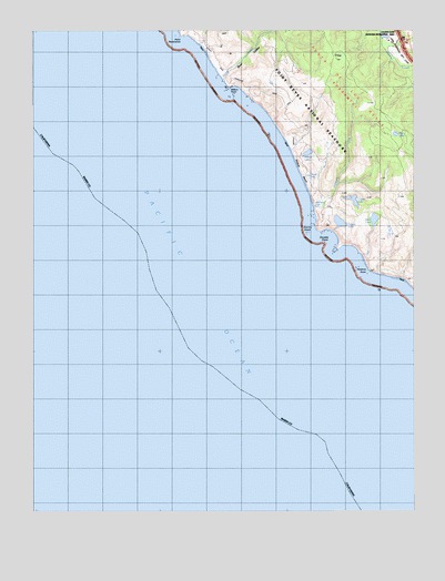
Double Point, CA USGS Topographic Map
Click on map above to begin viewing in our Map Viewer.

This topographic map contains these locations and features:
Feature Name Type Latitude Longitude GNIS ID View Map
Abalone PointCapeN37.9380°W122.7661°233396View Map
Alamere CreekStreamN37.9544°W122.7842°233404View Map
Alamere FallsFallsN37.9542°W122.7834°233406View Map
Arch RockArchN37.9872°W122.8133°253369View Map
Bass LakeLakeN37.9507°W122.7641°233463View Map
Bear ValleyValleyN37.9869°W122.8133°233470View Map
Bear Valley DamDamN37.9933°W122.8144°1664790View Map
Bolema TrailTrailN37.9858°W122.7558°1808922View Map
Coast CreekStreamN37.9860°W122.8130°233695View Map
Crystal LakeLakeN37.9558°W122.7709°233745View Map
Double PointCapeN37.9477°W122.7822°233794View Map
FirtopSummitN37.9929°W122.7760°233880View Map
Glen Camp TrailTrailN37.9919°W122.7947°1808941View Map
Glen CampgroundLocaleN37.9888°W122.7892°233929View Map
Glenn Ranch (historical)LocaleN37.9899°W122.7892°1732473View Map
Highland TrailTrailN37.9863°W122.7978°234012View Map
Kelham BeachBeachN37.9924°W122.8161°253370View Map
KeyholeArchN37.9850°W122.8117°2709990View Map
Lake RanchLocaleN37.9471°W122.7580°234128View Map
Lake Ranch TrailTrailN37.9602°W122.7539°1808944View Map
Mill PondReservoirN37.9966°W122.7578°1664780View Map
Mill Pond DamDamN37.9966°W122.7578°1664779View Map
Millers PointCapeN37.9846°W122.8117°234306View Map
Mud LakeLakeN37.9726°W122.7570°234340View Map
Ocean LakeLakeN37.9616°W122.7858°234403View Map
Ocean Lake LoopTrailN37.9577°W122.7819°1808951View Map
Old Out Road TrailTrailN37.9783°W122.7775°1808952View Map
Pelican LakeLakeN37.9502°W122.7753°234445View Map
Point ResistanceCapeN37.9983°W122.8269°234492View Map
Stormy StackIslandN37.9469°W122.7858°235555View Map
TempleArchN37.9814°W122.8033°2709991View Map
Wildcat BeachBeachN37.9633°W122.7883°237770View Map
Wildcat CampLocaleN37.9699°W122.7889°1808971View Map
Wildcat LakeLakeN37.9681°W122.7857°237798View Map
Wildcat Ranch (historical)LocaleN37.9710°W122.7875°1732488View Map
Wildcat TrailTrailN37.9771°W122.7922°237807View Map
Y Ranch (historical)LocaleN37.9974°W122.8214°1732489View Map

Note: Coordinates in the location and feature list above are referenced to NAD83 datum.


Copyright (C) 2008-2025 Ryan Niemi / Sunset Dynamics ... All Rights Reserved