TopoQuest Logo
Do you find TopoQuest useful?
Help keep TopoQuest running and adding new maps/features by donating!
Bitcoin:  19c7KJd3qBynnjoSw5npx9KScwjBe4ifkT
Litecoin:  LXs6TkuXGGXo1vDsWCkWVdjQX94eUKd6ui
Home View Maps Find Maps Find Places Resources & Links


Downey West, Idaho Topographic Map

USGS Map Title: Downey West, ID
USGS Map MRC: 42112D2
DRG (GeoTIFF) Download: o42112d2.tif


Neighboring USGS Topographic Map Quads:


  Hawkins, ID  
42112E3
 

  Arimo, ID  
42112E2
 

  Lava Hot Springs, ID  
42112E1
 

  Wakley Peak, ID  
42112D3
 

  Downey West, ID  
42112D2
 

  Downey East, ID  
42112D1
 

  Elkhorn Peak, ID  
42112C3
 

  Malad Summit, ID  
42112C2
 

  Oxford, ID  
42112C1


Map MRC Location:

N43°
W113°
N43°
W112°
H8 H7 H6 H5 H4 H3 H2 H1
G8 G7 G6 G5 G4 G3 G2 G1
F8 F7 F6 F5 F4 F3 F2 F1
E8 E7 E6 E5 E4 E3 E2 E1
D8 D7 D6 D5 D4 D3 D2 D1
C8 C7 C6 C5 C4 C3 C2 C1
B8 B7 B6 B5 B4 B3 B2 B1
A8 A7 A6 A5 A4 A3 A2 A1
N42°
W113°
N42°
W112°

Downey West, ID USGS 1:24K Topographic Map Preview:
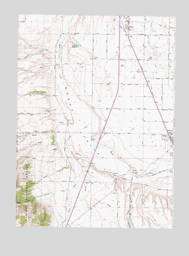
Downey West, ID USGS Topographic Map
Click on map above to begin viewing in our Map Viewer.

This topographic map contains these locations and features:
Feature Name Type Latitude Longitude GNIS ID View Map
Aspen CreekStreamN42.4069°W112.1569°376752View Map
Big CreekStreamN42.4219°W112.2105°377478View Map
Birch CreekStreamN42.4374°W112.1889°377660View Map
Cherry CreekStreamN42.4146°W112.2058°379227View Map
Downey Volunteer Fire DepartmentBuildingN42.4255°W112.1267°2619122View Map
Mines CanyonValleyN42.4313°W112.2202°387012View Map
Portneuf Marsh Valley CanalCanalN42.4783°W112.1422°388791View Map
Potter CreekStreamN42.4794°W112.2177°388821View Map
Reese CreekStreamN42.4544°W112.2166°389275View Map
Rowley CanyonValleyN42.3930°W112.2327°389683View Map
Rowley CreekStreamN42.3960°W112.2069°389684View Map
Station CreekStreamN42.4127°W112.2061°391371View Map
VirginiaPopulated PlaceN42.4941°W112.1655°397295View Map
Wiregrass DamDamN42.4824°W112.2047°398622View Map
Wiregrass ReservoirReservoirN42.4820°W112.2028°398376View Map
Wiregrass Reservoir Access AreaLocaleN42.4824°W112.2016°399635View Map
Woodland CemeteryCemeteryN42.4363°W112.2131°393670View Map
Yago CreekStreamN42.4949°W112.1708°393729View Map

Note: Coordinates in the location and feature list above are referenced to NAD83 datum.


Copyright (C) 2008-2024 Ryan Niemi / Sunset Dynamics ... All Rights Reserved