TopoQuest Logo
Do you find TopoQuest useful?
Help keep TopoQuest running and adding new maps/features by donating!
Bitcoin:  19c7KJd3qBynnjoSw5npx9KScwjBe4ifkT
Litecoin:  LXs6TkuXGGXo1vDsWCkWVdjQX94eUKd6ui
Home View Maps Find Maps Find Places Resources & Links


Arimo, Idaho Topographic Map

USGS Map Title: Arimo, ID
USGS Map MRC: 42112E2
DRG (GeoTIFF) Download: o42112e2.tif


Neighboring USGS Topographic Map Quads:


  Scout Mountain, ID  
42112F3
 

  McCammon, ID  
42112F2
 

  Haystack Mountain, ID  
42112F1
 

  Hawkins, ID  
42112E3
 

  Arimo, ID  
42112E2
 

  Lava Hot Springs, ID  
42112E1
 

  Wakley Peak, ID  
42112D3
 

  Downey West, ID  
42112D2
 

  Downey East, ID  
42112D1


Map MRC Location:

N43°
W113°
N43°
W112°
H8 H7 H6 H5 H4 H3 H2 H1
G8 G7 G6 G5 G4 G3 G2 G1
F8 F7 F6 F5 F4 F3 F2 F1
E8 E7 E6 E5 E4 E3 E2 E1
D8 D7 D6 D5 D4 D3 D2 D1
C8 C7 C6 C5 C4 C3 C2 C1
B8 B7 B6 B5 B4 B3 B2 B1
A8 A7 A6 A5 A4 A3 A2 A1
N42°
W113°
N42°
W112°

Arimo, ID USGS 1:24K Topographic Map Preview:
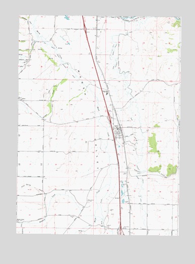
Arimo, ID USGS Topographic Map
Click on map above to begin viewing in our Map Viewer.

This topographic map contains these locations and features:
Feature Name Type Latitude Longitude GNIS ID View Map
ArimoPopulated PlaceN42.5599°W112.1714°397389View Map
Arimo DitchCanalN42.5641°W112.1611°371288View Map
Arimo Fire DepartmentBuildingN42.5608°W112.1712°2619320View Map
Arimo Post OfficePost OfficeN42.5614°W112.1752°2781773View Map
Arkansas CreekStreamN42.5383°W112.1769°371290View Map
Birch CreekStreamN42.6152°W112.2369°377661View Map
City of ArimoCivilN42.5599°W112.1726°2409729View Map
Cottonwood CreekStreamN42.6199°W112.2394°379840View Map
Ellis CreekStreamN42.5999°W112.2416°381427View Map
Garden CreekStreamN42.5949°W112.2119°382173View Map
Hawkins CreekStreamN42.5119°W112.1902°382969View Map
Lost CreekStreamN42.6060°W112.2402°386143View Map
Marsh CenterLocaleN42.5082°W112.2497°373835View Map
Marsh Center CemeteryCemeteryN42.5187°W112.1946°373836View Map
Marsh ValleyPopulated PlaceN42.5177°W112.1558°399135View Map
MARSH VALLEY HIGH SCHOOLSchoolN42.5807°W112.1815°373839View Map
Marsh Valley Middle SchoolSchoolN42.5783°W112.1804°401601View Map
Nats CanyonValleyN42.5388°W112.1252°374101View Map
Peck CreekStreamN42.5288°W112.1783°388316View Map
Pilot Spring CreekStreamN42.5213°W112.2233°388463View Map
RobinPopulated PlaceN42.5771°W112.2466°397104View Map
Rough CanyonValleyN42.5519°W112.1255°374796View Map
South Bannock DivisionCivilN42.5432°W112.1607°1936809View Map

Note: Coordinates in the location and feature list above are referenced to NAD83 datum.


Copyright (C) 2008-2025 Ryan Niemi / Sunset Dynamics ... All Rights Reserved