TopoQuest Logo
Do you find TopoQuest useful?
Help keep TopoQuest running and adding new maps/features by donating!
Bitcoin:  19c7KJd3qBynnjoSw5npx9KScwjBe4ifkT
Litecoin:  LXs6TkuXGGXo1vDsWCkWVdjQX94eUKd6ui
Home View Maps Find Maps Find Places Resources & Links


Dozier, Alabama Topographic Map

USGS Map Title: Dozier, AL
USGS Map MRC: 31086D3
DRG (GeoTIFF) Download: o31086d3.tif


Neighboring USGS Topographic Map Quads:


  Leon, AL  
31086E4
 

  Brantley, AL  
31086E3
 

  Bullock, AL  
31086E2
 

  Gantt, AL  
31086D4
 

  Dozier, AL  
31086D3
 

  Danleys Crossroads, AL  
31086D2
 

  Andalusia, AL  
31086C4
 

  Opp West, AL  
31086C3
 

  Opp East, AL  
31086C2


Map MRC Location:

N32°
W87°
N32°
W86°
H8 H7 H6 H5 H4 H3 H2 H1
G8 G7 G6 G5 G4 G3 G2 G1
F8 F7 F6 F5 F4 F3 F2 F1
E8 E7 E6 E5 E4 E3 E2 E1
D8 D7 D6 D5 D4 D3 D2 D1
C8 C7 C6 C5 C4 C3 C2 C1
B8 B7 B6 B5 B4 B3 B2 B1
A8 A7 A6 A5 A4 A3 A2 A1
N31°
W87°
N31°
W86°

Dozier, AL USGS 1:24K Topographic Map Preview:
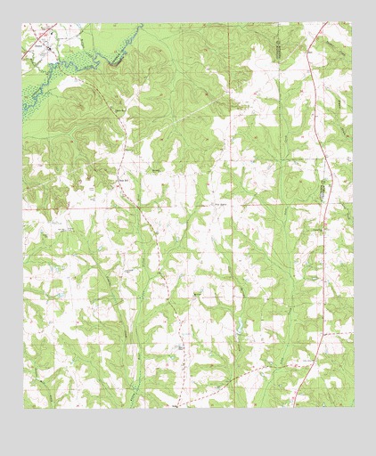
Dozier, AL USGS Topographic Map
Click on map above to begin viewing in our Map Viewer.

This topographic map contains these locations and features:
Feature Name Type Latitude Longitude GNIS ID View Map
Bailey School (historical)SchoolN31.4766°W86.2644°133898View Map
Bethel ChurchChurchN31.4435°W86.3480°114038View Map
Bryant CemeteryCemeteryN31.4313°W86.3647°115082View Map
Burnt Out School (historical)SchoolN31.4827°W86.2788°133373View Map
Corinth School (historical)SchoolN31.4213°W86.3094°133384View Map
County Line Church of ChristChurchN31.4324°W86.2616°116722View Map
DozierPopulated PlaceN31.4921°W86.3650°117451View Map
Dozier CemeteryCemeteryN31.4982°W86.3652°1805647View Map
Dozier High SchoolSchoolN31.4968°W86.3638°133918View Map
Dozier Post OfficePost OfficeN31.4928°W86.3652°168334View Map
Dozier Volunteer Fire DepartmentBuildingN31.4973°W86.3632°2691189View Map
Feagins CreekStreamN31.3816°W86.3316°118231View Map
Five PointsPopulated PlaceN31.4407°W86.3033°118331View Map
Friendship ChurchChurchN31.4954°W86.2630°154619View Map
Good News ChapelChurchN31.4196°W86.3372°119126View Map
Hornet CreekStreamN31.4843°W86.3641°120400View Map
HostLocaleN31.4910°W86.2672°120450View Map
Macedonia ChurchChurchN31.4518°W86.3236°152179View Map
Mount Chapel Baptist ChurchChurchN31.3946°W86.3144°164082View Map
Mount Gilead ChurchChurchN31.4116°W86.3111°123192View Map
Pilgrim Rest CemeteryCemeteryN31.4732°W86.3413°163423View Map
Pilgrims Rest Primitive Baptist ChurchChurchN31.4716°W86.3408°164097View Map
Pleasant Call ChurchChurchN31.4949°W86.3619°124931View Map
Rose HillPopulated PlaceN31.4493°W86.3394°125934View Map
Rose Hill CemeteryCemeteryN31.4524°W86.3391°163424View Map
Rose Hill ChurchChurchN31.4329°W86.3588°125935View Map
Rose Hill Volunteer Fire DepartmentBuildingN31.4505°W86.3253°2691528View Map
Sassers CrossroadsLocaleN31.4032°W86.3150°1730328View Map
Scofields Mill (historical)LocaleN31.4071°W86.2730°133439View Map
Stewart CemeteryCemeteryN31.4332°W86.3583°127379View Map
Valley Grove ChurchChurchN31.3904°W86.2644°128393View Map
Wolfpit CreekStreamN31.4888°W86.3486°129179View Map

Note: Coordinates in the location and feature list above are referenced to NAD83 datum.


Copyright (C) 2008-2025 Ryan Niemi / Sunset Dynamics ... All Rights Reserved