TopoQuest Logo
Do you find TopoQuest useful?
Help keep TopoQuest running and adding new maps/features by donating!
Bitcoin:  19c7KJd3qBynnjoSw5npx9KScwjBe4ifkT
Litecoin:  LXs6TkuXGGXo1vDsWCkWVdjQX94eUKd6ui
Home View Maps Find Maps Find Places Resources & Links


Opp East, Alabama Topographic Map

USGS Map Title: Opp East, AL
USGS Map MRC: 31086C2
DRG (GeoTIFF) Download: o31086c2.tif


Neighboring USGS Topographic Map Quads:


  Dozier, AL  
31086D3
 

  Danleys Crossroads, AL  
31086D2
 

  Elba, AL  
31086D1
 

  Opp West, AL  
31086C3
 

  Opp East, AL  
31086C2
 

  Ino, AL  
31086C1
 

  Onycha, AL  
31086B3
 

  Kinston, AL  
31086B2
 

  Sellersville, AL  
31086B1


Map MRC Location:

N32°
W87°
N32°
W86°
H8 H7 H6 H5 H4 H3 H2 H1
G8 G7 G6 G5 G4 G3 G2 G1
F8 F7 F6 F5 F4 F3 F2 F1
E8 E7 E6 E5 E4 E3 E2 E1
D8 D7 D6 D5 D4 D3 D2 D1
C8 C7 C6 C5 C4 C3 C2 C1
B8 B7 B6 B5 B4 B3 B2 B1
A8 A7 A6 A5 A4 A3 A2 A1
N31°
W87°
N31°
W86°

Opp East, AL USGS 1:24K Topographic Map Preview:
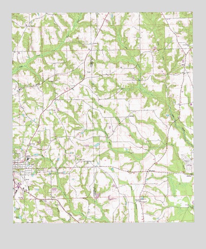
Opp East, AL USGS Topographic Map
Click on map above to begin viewing in our Map Viewer.

This topographic map contains these locations and features:
Feature Name Type Latitude Longitude GNIS ID View Map
AlbertonPopulated PlaceN31.2779°W86.1258°112969View Map
Alberton Baptist ChurchChurchN31.2799°W86.1333°157639View Map
Alberton CemeteryCemeteryN31.2785°W86.1308°137054View Map
Alberton Methodist ChurchChurchN31.2791°W86.1316°154102View Map
Barkers PondLakeN31.2587°W86.2484°113476View Map
BasinPopulated PlaceN31.3416°W86.1308°113547View Map
Basin SchoolSchoolN31.3474°W86.1305°135293View Map
Bethany Baptist ChurchChurchN31.2918°W86.2405°2580385View Map
Bethany CemeteryCemeteryN31.2610°W86.2180°1730213View Map
Bethany ChurchChurchN31.2607°W86.2177°113989View Map
BlairsPopulated PlaceN31.2641°W86.2233°114472View Map
BrooklynPopulated PlaceN31.3129°W86.1711°114957View Map
Brooklyn Baptist ChurchChurchN31.3127°W86.1708°157640View Map
Brooklyn CemeteryCemeteryN31.3166°W86.1655°137060View Map
Brooklyn Congregational Methodist ChurchChurchN31.3157°W86.1649°154104View Map
Capitol Hill Baptist ChurchChurchN31.2646°W86.2341°2580388View Map
Charles Gibeaut Lake DamDamN31.2952°W86.1966°129767View Map
Church of ChristChurchN31.2832°W86.2406°2580389View Map
City of Opp Eastside Sewage LagoonLocaleN31.2706°W86.2214°2579654View Map
Cool Springs ChurchChurchN31.2968°W86.2386°116543View Map
County LinePopulated PlaceN31.2835°W86.1949°133385View Map
County Line ChurchChurchN31.2871°W86.2041°116721View Map
DuvallPopulated PlaceN31.2763°W86.2419°117703View Map
East Fork Cripple CreekStreamN31.2813°W86.2191°117758View Map
Faith Chapel ChurchChurchN31.3066°W86.1419°135331View Map
Fleeta Junior High SchoolSchoolN31.3296°W86.2450°165421View Map
Gibeaut LakeReservoirN31.2961°W86.1990°129766View Map
Green Horn Saddle ClubLocaleN31.2510°W86.1805°135340View Map
Holly Grove Methodist ChurchChurchN31.2993°W86.2325°133125View Map
Joe B Johnson DamDamN31.3068°W86.2183°129768View Map
Kingdom Hall of Jehovahs WitnessesChurchN31.2981°W86.2375°2580514View Map
Kinston DivisionCivilN31.2757°W86.1529°165711View Map
Kinston Full Gospel ChurchChurchN31.2552°W86.1813°2580371View Map
Lakeview Village Mobile Home ParkPopulated PlaceN31.2950°W86.2287°2579769View Map
Leo WilliamsDamN31.2535°W86.2450°129739View Map
Little Hays CreekStreamN31.3196°W86.1422°121796View Map
Mallory LakeReservoirN31.2663°W86.1914°129748View Map
Mallory Lake DamDamN31.2635°W86.1916°129749View Map
Mount Zion CemeteryCemeteryN31.3566°W86.1949°135384View Map
Mount Zion Methodist ChurchChurchN31.3568°W86.1958°152522View Map
New Chapel CemeteryCemeteryN31.2635°W86.1608°157724View Map
New Chapel ChurchChurchN31.2624°W86.1616°123739View Map
New Home CemeteryCemeteryN31.3552°W86.1269°137087View Map
New Home Primitive Baptist ChurchChurchN31.3554°W86.1277°149992View Map
New Life ChurchChurchN31.2788°W86.1316°1699935View Map
Old Town CemeteryCemeteryN31.2602°W86.1277°124260View Map
Opp Fishing Club DamDamN31.2902°W86.2333°129761View Map
Opp Fishing Club LakeReservoirN31.2911°W86.2336°129760View Map
Opp High SchoolSchoolN31.2885°W86.2397°133430View Map
Opp Industrial Park Number 3LocaleN31.2605°W86.2327°2579567View Map
Opp Post OfficePost OfficeN31.2785°W86.2451°167637View Map
Peaceful Acres Memorial GardensCemeteryN31.2638°W86.2327°124541View Map
Perry StorePopulated PlaceN31.2802°W86.1572°152874View Map
Pine Grove ChurchChurchN31.3343°W86.2227°164101View Map
Providence Primitive Baptist ChurchChurchN31.2635°W86.1616°150007View Map
RhoadesPopulated PlaceN31.2627°W86.1619°125584View Map
Rhoades CemeteryCemeteryN31.2637°W86.1606°137093View Map
Rhoades School (historical)SchoolN31.2629°W86.1616°135408View Map
Skelly FieldParkN31.2860°W86.1286°126925View Map
Stanley Mill CreekStreamN31.2943°W86.1541°127310View Map
Sweetwater Baptist ChurchChurchN31.3321°W86.2341°153628View Map
Union Grove ChurchChurchN31.3671°W86.2391°128309View Map
Union Grove Fire DepartmentBuildingN31.3286°W86.2455°2331004View Map
West County Line Baptist ChurchChurchN31.2866°W86.1991°153938View Map
West Fork Cripple CreekStreamN31.2813°W86.2191°128771View Map
Williams PondLakeN31.2539°W86.2451°129031View Map
WOPP-AM (Opp)TowerN31.2910°W86.2308°160928View Map

Note: Coordinates in the location and feature list above are referenced to NAD83 datum.


Copyright (C) 2008-2024 Ryan Niemi / Sunset Dynamics ... All Rights Reserved