TopoQuest Logo
Do you find TopoQuest useful?
Help keep TopoQuest running and adding new maps/features by donating!
Bitcoin:  19c7KJd3qBynnjoSw5npx9KScwjBe4ifkT
Litecoin:  LXs6TkuXGGXo1vDsWCkWVdjQX94eUKd6ui
Home View Maps Find Maps Find Places Resources & Links


Driscoll East, Texas Topographic Map

USGS Map Title: Driscoll East, TX
USGS Map MRC: 27097F6
DRG (GeoTIFF) Download: o27097f6.tif


Neighboring USGS Topographic Map Quads:


  Banquete, TX  
27097G7
 

  Robstown, TX  
27097G6
 

  Annaville, TX  
27097G5
 

  Driscoll West, TX  
27097F7
 

  Driscoll East, TX  
27097F6
 

  Petronila NE, TX  
27097F5
 

  Kingsville East, TX  
27097E7
 

  Concordia, TX  
27097E6
 

  Laureles Ranch, TX  
27097E5


Map MRC Location:

N28°
W98°
N28°
W97°
H8 H7 H6 H5 H4 H3 H2 H1
G8 G7 G6 G5 G4 G3 G2 G1
F8 F7 F6 F5 F4 F3 F2 F1
E8 E7 E6 E5 E4 E3 E2 E1
D8 D7 D6 D5 D4 D3 D2 D1
C8 C7 C6 C5 C4 C3 C2 C1
B8 B7 B6 B5 B4 B3 B2 B1
A8 A7 A6 A5 A4 A3 A2 A1
N27°
W98°
N27°
W97°

Driscoll East, TX USGS 1:24K Topographic Map Preview:
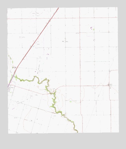
Driscoll East, TX USGS Topographic Map
Click on map above to begin viewing in our Map Viewer.

This topographic map contains these locations and features:
Feature Name Type Latitude Longitude GNIS ID View Map
City of PetronilaCivilN27.6712°W97.6322°2411410View Map
Clara Driscoll Oil FieldOilfieldN27.6584°W97.7300°1332876View Map
Coastal Bend Youth CityLocaleN27.6911°W97.7414°1333029View Map
Coastal Bend Youth City SchoolSchoolN27.6914°W97.7422°2434515View Map
DriscollPopulated PlaceN27.6745°W97.7486°1334624View Map
Driscoll DivisionCivilN27.6425°W97.6652°1938694View Map
Flinn CemeteryCemeteryN27.6511°W97.6986°1335956View Map
Florida Gas CampLocaleN27.7167°W97.6853°1335975View Map
Gandy FarmsLocaleN27.7214°W97.7350°1336363View Map
KMIQ-FM (Robstown)TowerN27.6778°W97.6392°1385984View Map
La Paloma-Lost Creek Census Designated PlaceCensusN27.7195°W97.7391°2408508View Map
Minnie Bock Oil FieldOilfieldN27.7439°W97.7181°1341725View Map
North Clara Driscoll Oil FieldOilfieldN27.6931°W97.7156°1342708View Map
PetronilaPopulated PlaceN27.6720°W97.6358°1343913View Map
Petronila Elementary SchoolSchoolN27.6725°W97.6367°2434477View Map

Note: Coordinates in the location and feature list above are referenced to NAD83 datum.


Copyright (C) 2008-2024 Ryan Niemi / Sunset Dynamics ... All Rights Reserved