TopoQuest Logo
Do you find TopoQuest useful?
Help keep TopoQuest running and adding new maps/features by donating!
Bitcoin:  19c7KJd3qBynnjoSw5npx9KScwjBe4ifkT
Litecoin:  LXs6TkuXGGXo1vDsWCkWVdjQX94eUKd6ui
Home View Maps Find Maps Find Places Resources & Links


Driscoll West, Texas Topographic Map

USGS Map Title: Driscoll West, TX
USGS Map MRC: 27097F7
DRG (GeoTIFF) Download: o27097f7.tif


Neighboring USGS Topographic Map Quads:


  Agua Dulce, TX  
27097G8
 

  Banquete, TX  
27097G7
 

  Robstown, TX  
27097G6
 

  Kingsville NW, TX  
27097F8
 

  Driscoll West, TX  
27097F7
 

  Driscoll East, TX  
27097F6
 

  Kingsville West, TX  
27097E8
 

  Kingsville East, TX  
27097E7
 

  Concordia, TX  
27097E6


Map MRC Location:

N28°
W98°
N28°
W97°
H8 H7 H6 H5 H4 H3 H2 H1
G8 G7 G6 G5 G4 G3 G2 G1
F8 F7 F6 F5 F4 F3 F2 F1
E8 E7 E6 E5 E4 E3 E2 E1
D8 D7 D6 D5 D4 D3 D2 D1
C8 C7 C6 C5 C4 C3 C2 C1
B8 B7 B6 B5 B4 B3 B2 B1
A8 A7 A6 A5 A4 A3 A2 A1
N27°
W98°
N27°
W97°

Driscoll West, TX USGS 1:24K Topographic Map Preview:
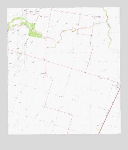
Driscoll West, TX USGS Topographic Map
Click on map above to begin viewing in our Map Viewer.

This topographic map contains these locations and features:
Feature Name Type Latitude Longitude GNIS ID View Map
Agua Dulce Pumping StationLocaleN27.7459°W97.8436°1384282View Map
Bishop DivisionCivilN27.7035°W97.8245°1938538View Map
City of DriscollCivilN27.6730°W97.7510°2410358View Map
Coastal Bend Detention CenterBuildingN27.7360°W97.7543°2738777View Map
Driscoll City OfficeBuildingN27.6708°W97.7517°2753755View Map
Driscoll Elementary SchoolSchoolN27.6713°W97.7536°2434310View Map
Driscoll Police DepartmentBuildingN27.6713°W97.7537°2335156View Map
Harlan Tank FarmLocaleN27.6853°W97.8331°1384388View Map
KBIC-FM (Alice)TowerN27.7075°W97.7819°1385745View Map
La Paloma-Lost Creek Census Designated Place (historical)CensusN27.7206°W97.7566°2632929View Map
Lost CreekPopulated PlaceN27.7142°W97.7552°2652327View Map
Lost Creek Census Designated PlaceCensusN27.7206°W97.7566°2586956View Map
Palo AltoPopulated PlaceN27.6617°W97.7975°1378826View Map
Perry FoundationLocaleN27.7409°W97.7781°1343876View Map
Pintas CreekStreamN27.7353°W97.7650°1344105View Map
Robstown Pumping StationLocaleN27.7053°W97.8631°1384469View Map
Saint James CemeteryCemeteryN27.6809°W97.7725°1345904View Map
TGP 1 HeliportAirportN27.7447°W97.8464°1386121View Map

Note: Coordinates in the location and feature list above are referenced to NAD83 datum.


Copyright (C) 2008-2025 Ryan Niemi / Sunset Dynamics ... All Rights Reserved