TopoQuest Logo
Do you find TopoQuest useful?
Help keep TopoQuest running and adding new maps/features by donating!
Bitcoin:  19c7KJd3qBynnjoSw5npx9KScwjBe4ifkT
Litecoin:  LXs6TkuXGGXo1vDsWCkWVdjQX94eUKd6ui
Home View Maps Find Maps Find Places Resources & Links


Drumm Summit, Nevada Topographic Map

USGS Map Title: Drumm Summit, NV
USGS Map MRC: 39118C2
DRG (GeoTIFF) Download: o39118c2.tif


Neighboring USGS Topographic Map Quads:


  La Plata Canyon, NV  
39118D3
 

  Pirouette Mountain, NV  
39118D2
 

  Wonder Mountain, NV  
39118D1
 

  Frenchman, NV  
39118C3
 

  Drumm Summit, NV  
39118C2
 

  West Gate, NV  
39118C1
 

  Chukar Canyon, NV  
39118B3
 

  Bell Canyon, NV  
39118B2
 

  Bell Mountain, NV  
39118B1


Map MRC Location:

N40°
W119°
N40°
W118°
H8 H7 H6 H5 H4 H3 H2 H1
G8 G7 G6 G5 G4 G3 G2 G1
F8 F7 F6 F5 F4 F3 F2 F1
E8 E7 E6 E5 E4 E3 E2 E1
D8 D7 D6 D5 D4 D3 D2 D1
C8 C7 C6 C5 C4 C3 C2 C1
B8 B7 B6 B5 B4 B3 B2 B1
A8 A7 A6 A5 A4 A3 A2 A1
N39°
W119°
N39°
W118°

Drumm Summit, NV USGS 1:24K Topographic Map Preview:
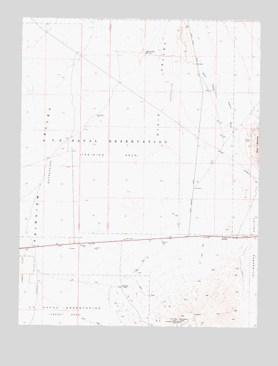
Drumm Summit, NV USGS Topographic Map
Click on map above to begin viewing in our Map Viewer.

This topographic map contains these locations and features:
Feature Name Type Latitude Longitude GNIS ID View Map
Cyclone MineMineN39.2619°W118.1907°852687View Map
Dixie Valley Reservoir Number OneReservoirN39.3724°W118.1621°847863View Map
Dixie Valley Reservoir Number TwoReservoirN39.3613°W118.1876°840068View Map
Dromedary HumpSummitN39.2530°W118.1685°840131View Map
Dromedary Hump MineMineN39.2519°W118.1679°840132View Map
Dromedary MillLocaleN39.2549°W118.1879°852693View Map
Drumm SummitGapN39.2869°W118.1437°840134View Map
Eagles Nest Fairview MineMineN39.2619°W118.1907°852691View Map
Fairfield (historical)LocaleN39.2805°W118.1315°852686View Map
Fairfield Post Office (historical)Post OfficeN39.2805°W118.1315°864761View Map
FairviewLocaleN39.2663°W118.1976°840404View Map
Fairview CemeteryCemeteryN39.2719°W118.1885°857445View Map
Fairview Consolidated MineMineN39.2619°W118.1907°852692View Map
Fairview Eagle MineMineN39.2619°W118.1907°852684View Map
Fairview Golden Boulder MineMineN39.2619°W118.1907°852685View Map
Fairview Post Office (historical)Post OfficeN39.2663°W118.1976°864762View Map
Fairview Station (historical)LocaleN39.3491°W118.2001°848222View Map
Ida MinesMineN39.2619°W118.1907°852688View Map
Lena Fairview MineMineN39.2619°W118.1907°852690View Map
Lena Nevada MineMineN39.2619°W118.1907°852689View Map
North WellWellN39.3358°W118.2121°842565View Map
Sand Dune PassGapN39.3110°W118.1274°847932View Map
Wonder WashStreamN39.3519°W118.1537°845020View Map

Note: Coordinates in the location and feature list above are referenced to NAD83 datum.


Copyright (C) 2008-2025 Ryan Niemi / Sunset Dynamics ... All Rights Reserved