TopoQuest Logo
Do you find TopoQuest useful?
Help keep TopoQuest running and adding new maps/features by donating!
Bitcoin:  19c7KJd3qBynnjoSw5npx9KScwjBe4ifkT
Litecoin:  LXs6TkuXGGXo1vDsWCkWVdjQX94eUKd6ui
Home View Maps Find Maps Find Places Resources & Links


Wonder Mountain, Nevada Topographic Map

USGS Map Title: Wonder Mountain, NV
USGS Map MRC: 39118D1
DRG (GeoTIFF) Download: o39118d1.tif


Neighboring USGS Topographic Map Quads:


  Job Peak, NV  
39118E2
 

  Dixie Valley SE, NV  
39118E1
 

  Mount Augusta, NV  
39117E8
 

  Pirouette Mountain, NV  
39118D2
 

  Wonder Mountain, NV  
39118D1
 

  Camp Creek Canyon, NV  
39117D8
 

  Drumm Summit, NV  
39118C2
 

  West Gate, NV  
39118C1
 

  Eastgate, NV  
39117C8


Map MRC Location:

N40°
W119°
N40°
W118°
H8 H7 H6 H5 H4 H3 H2 H1
G8 G7 G6 G5 G4 G3 G2 G1
F8 F7 F6 F5 F4 F3 F2 F1
E8 E7 E6 E5 E4 E3 E2 E1
D8 D7 D6 D5 D4 D3 D2 D1
C8 C7 C6 C5 C4 C3 C2 C1
B8 B7 B6 B5 B4 B3 B2 B1
A8 A7 A6 A5 A4 A3 A2 A1
N39°
W119°
N39°
W118°

Wonder Mountain, NV USGS 1:24K Topographic Map Preview:
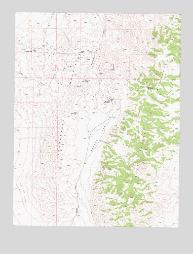
Wonder Mountain, NV USGS Topographic Map
Click on map above to begin viewing in our Map Viewer.

This topographic map contains these locations and features:
Feature Name Type Latitude Longitude GNIS ID View Map
Badger FlatFlatN39.4283°W118.0621°838556View Map
Camelback PeakSummitN39.4571°W118.0801°839286View Map
Crown PeakSummitN39.4094°W118.0926°845419View Map
Dickey PeakSummitN39.4774°W118.1121°845430View Map
Driscoll PeakSummitN39.4410°W118.0818°840130View Map
Geiger GapGapN39.4769°W118.0774°840624View Map
HerculesLocaleN39.4646°W118.0632°840955View Map
Hercules Post Office (historical)Post OfficeN39.4646°W118.0632°864756View Map
Hercules SpringSpringN39.4574°W118.0626°847668View Map
Jack Pot MineMineN39.4677°W118.0601°852701View Map
Kingston (historical)Populated PlaceN39.4899°W118.1015°852698View Map
Kingston Post Office (historical)Post OfficeN39.4899°W118.1015°864757View Map
Louderback MountainsRangeN39.4391°W118.0857°845547View Map
Nevada Wonder Mill (historical)LocaleN39.4499°W118.0540°852702View Map
Porphyry PeakSummitN39.4599°W118.0737°842937View Map
Queen PeakSummitN39.4685°W118.0532°845607View Map
Red Top (historical)Populated PlaceN39.4602°W118.1104°852699View Map
Round MountainSummitN39.4560°W118.0262°845637View Map
Strayhorse GulchValleyN39.4874°W118.0585°857570View Map
Twin PeaksSummitN39.4094°W118.0571°844483View Map
Victor (historical)LocaleN39.4794°W118.1043°844585View Map
Victor Post Office (historical)Post OfficeN39.4794°W118.1043°864754View Map
Vulcher MineMineN39.4699°W118.0660°852700View Map
WonderLocaleN39.4394°W118.0532°845018View Map
Wonder MineMineN39.4496°W118.0537°854677View Map
Wonder Mining DistrictCivilN39.4549°W118.0732°864686View Map
Wonder MountainSummitN39.4494°W118.0543°845019View Map
Wonder Post Office (historical)Post OfficeN39.4394°W118.0532°864755View Map

Note: Coordinates in the location and feature list above are referenced to NAD83 datum.


Copyright (C) 2008-2025 Ryan Niemi / Sunset Dynamics ... All Rights Reserved