TopoQuest Logo
Do you find TopoQuest useful?
Help keep TopoQuest running and adding new maps/features by donating!
Bitcoin:  19c7KJd3qBynnjoSw5npx9KScwjBe4ifkT
Litecoin:  LXs6TkuXGGXo1vDsWCkWVdjQX94eUKd6ui
Home View Maps Find Maps Find Places Resources & Links


Dry Lakes Peak, Utah Topographic Map

USGS Map Title: Dry Lakes Peak, UT
USGS Map MRC: 38110B7
DRG (GeoTIFF) Download: o38110b7.tif


Neighboring USGS Topographic Map Quads:


  Town Point, UT  
38110C8
 

  Steamboat Point, UT  
38110C7
 

  Hanksville, UT  
38110C6
 

  Stevens Mesa, UT  
38110B8
 

  Dry Lakes Peak, UT  
38110B7
 

  Bull Mountain, UT  
38110B6
 

  Steele Butte, UT  
38110A8
 

  Mount Ellen, UT  
38110A7
 

  Raggy Canyon, UT  
38110A6


Map MRC Location:

N39°
W111°
N39°
W110°
H8 H7 H6 H5 H4 H3 H2 H1
G8 G7 G6 G5 G4 G3 G2 G1
F8 F7 F6 F5 F4 F3 F2 F1
E8 E7 E6 E5 E4 E3 E2 E1
D8 D7 D6 D5 D4 D3 D2 D1
C8 C7 C6 C5 C4 C3 C2 C1
B8 B7 B6 B5 B4 B3 B2 B1
A8 A7 A6 A5 A4 A3 A2 A1
N38°
W111°
N38°
W110°

Dry Lakes Peak, UT USGS 1:24K Topographic Map Preview:
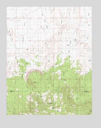
Dry Lakes Peak, UT USGS Topographic Map
Click on map above to begin viewing in our Map Viewer.

This topographic map contains these locations and features:
Feature Name Type Latitude Longitude GNIS ID View Map
Bacon SlideSlopeN38.1572°W110.7984°1425221View Map
Birch SpringSpringN38.1761°W110.7904°1425615View Map
Cold SpringSpringN38.1533°W110.8015°1426787View Map
Cottonwood PassGapN38.1328°W110.8104°1426927View Map
Cottonwood SpringSpringN38.1483°W110.8274°1426938View Map
Deer HeavenSummitN38.1297°W110.8313°1427306View Map
Dry Lakes AreaFlatN38.1600°W110.8065°1427571View Map
Dry Lakes PeakSummitN38.1383°W110.8135°1427572View Map
Dugout BenchBenchN38.2000°W110.7829°1427611View Map
Dugout Bench SpringSpringN38.2053°W110.7868°1427612View Map
East SaddleGapN38.1292°W110.8038°1427720View Map
Horseshoe BasinBasinN38.1419°W110.7743°1428881View Map
Horseshoe RidgeRidgeN38.1355°W110.7790°1428891View Map
Jet BasinBasinN38.1869°W110.8146°1429160View Map
Little MeadowBasinN38.1842°W110.7546°1429760View Map
Lost SpringSpringN38.1845°W110.8472°1429948View Map
McClellan WashValleyN38.2175°W110.7582°1430161View Map
Oak Creek BenchBenchN38.1866°W110.8702°1430910View Map
Oak SpringSpringN38.1553°W110.8421°1430922View Map
Rock CorralLocaleN38.2011°W110.8479°1431904View Map
Side Hill SpringsSpringN38.2114°W110.7732°1432442View Map
Table MountainSummitN38.1622°W110.8365°1433162View Map
The NarrowsGapN38.1644°W110.7940°1433376View Map
Willow SpringSpringN38.1683°W110.8504°1434342View Map

Note: Coordinates in the location and feature list above are referenced to NAD83 datum.


Copyright (C) 2008-2025 Ryan Niemi / Sunset Dynamics ... All Rights Reserved