TopoQuest Logo
Do you find TopoQuest useful?
Help keep TopoQuest running and adding new maps/features by donating!
Bitcoin:  19c7KJd3qBynnjoSw5npx9KScwjBe4ifkT
Litecoin:  LXs6TkuXGGXo1vDsWCkWVdjQX94eUKd6ui
Home View Maps Find Maps Find Places Resources & Links


Mount Ellen, Utah Topographic Map

USGS Map Title: Mount Ellen, UT
USGS Map MRC: 38110A7
DRG (GeoTIFF) Download: o38110a7.tif


Neighboring USGS Topographic Map Quads:


  Stevens Mesa, UT  
38110B8
 

  Dry Lakes Peak, UT  
38110B7
 

  Bull Mountain, UT  
38110B6
 

  Steele Butte, UT  
38110A8
 

  Mount Ellen, UT  
38110A7
 

  Raggy Canyon, UT  
38110A6
 

  Cave Flat, UT  
37110H8
 

  Mount Pennell, UT  
37110H7
 

  Cass Creek Peak, UT  
37110H6


Map MRC Location:

N39°
W111°
N39°
W110°
H8 H7 H6 H5 H4 H3 H2 H1
G8 G7 G6 G5 G4 G3 G2 G1
F8 F7 F6 F5 F4 F3 F2 F1
E8 E7 E6 E5 E4 E3 E2 E1
D8 D7 D6 D5 D4 D3 D2 D1
C8 C7 C6 C5 C4 C3 C2 C1
B8 B7 B6 B5 B4 B3 B2 B1
A8 A7 A6 A5 A4 A3 A2 A1
N38°
W111°
N38°
W110°

Mount Ellen, UT USGS 1:24K Topographic Map Preview:
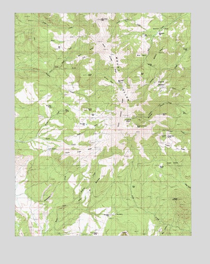
Mount Ellen, UT USGS Topographic Map
Click on map above to begin viewing in our Map Viewer.

This topographic map contains these locations and features:
Feature Name Type Latitude Longitude GNIS ID View Map
Airplane SpringSpringN38.0018°W110.8206°1425060View Map
Bartons PeakSummitN38.0675°W110.7710°1425309View Map
Birch SpringSpringN38.0486°W110.8515°1425614View Map
Blue BasinBasinN38.0997°W110.7824°1425781View Map
Box SpringSpringN38.0123°W110.8038°1425934View Map
Bromide BasinBasinN38.0653°W110.7904°1425992View Map
Bromide CanyonValleyN38.0730°W110.7590°1425993View Map
Bromide MineMineN38.0669°W110.7929°1425994View Map
Bull Creek PassGapN38.0861°W110.8027°1426114View Map
Burned RidgeRidgeN38.0850°W110.8071°1426168View Map
Copper BasinBasinN38.0589°W110.7668°1426846View Map
Copper Basin SpringSpringN38.0557°W110.7672°1426847View Map
Copper RidgeRidgeN38.0480°W110.7607°1426862View Map
Corral PointSummitN38.0897°W110.8240°1426886View Map
Dandelion FlatFlatN38.1139°W110.7707°1427200View Map
Dark CanyonValleyN38.0061°W110.7671°1425003View Map
Desert OverlookLocaleN38.0833°W110.8018°1435412View Map
Dry Lake FlatFlatN38.0625°W110.8249°1427568View Map
Durfey ButteSummitN38.0703°W110.8240°1427633View Map
Garden BasinBasinN38.0389°W110.7718°1428132View Map
Granite HoleBasinN38.1030°W110.7529°1428319View Map
Granite RidgesRidgeN38.0858°W110.7693°1428330View Map
Head of BullfrogRidgeN38.0258°W110.8215°1428612View Map
Kimble and Turner PeakSummitN38.0611°W110.7888°1429350View Map
Log FlatFlatN38.1119°W110.7829°1429853View Map
Lonesome Beaver CampgroundLocaleN38.0992°W110.7802°1455375View Map
McClellan SpringSpringN38.0725°W110.8490°1430160View Map
McMillan Springs CampgroundLocaleN38.0722°W110.8507°1436020View Map
Mount EllenRangeN38.1097°W110.8138°1427800View Map
Mount Ellen CreekStreamN38.1139°W110.7740°1430520View Map
Mount Ellen PeakSummitN38.1208°W110.8146°1427799View Map
Nasty FlatFlatN38.0672°W110.8152°1430643View Map
North Fork Pistol CreekStreamN38.0944°W110.8440°1430800View Map
North Fork South CreekStreamN38.0530°W110.8413°1430808View Map
North Summit RidgeRidgeN38.1039°W110.8085°1430866View Map
Pearl FlatFlatN38.0900°W110.7865°1431157View Map
Pennellen PassGapN38.0114°W110.8088°1431173View Map
Pistol CreekStreamN38.0911°W110.8527°1431325View Map
Pistol RidgeRidgeN38.1025°W110.8257°1431326View Map
Ragged MountainSummitN38.0203°W110.7593°1431544View Map
Raggy DrawsAreaN38.0367°W110.7593°1431546View Map
Sawmill BasinBasinN38.1169°W110.7699°1432250View Map
Slate FlatFlatN38.0255°W110.7913°1432531View Map
South Creek RidgeRidgeN38.0475°W110.8265°1432664View Map
South Fork Pistol CreekStreamN38.0942°W110.8440°1432704View Map
South Summit RidgeRidgeN38.0703°W110.7974°1432763View Map
Star FlatFlatN38.1058°W110.8432°1432920View Map
Wickiup PassGapN38.0947°W110.7785°1434227View Map
Wickiup RidgeRidgeN38.1005°W110.7732°1434228View Map
Willow CreekStreamN38.0536°W110.8638°1434311View Map
Willow SpringSpringN38.0700°W110.8410°1434340View Map

Note: Coordinates in the location and feature list above are referenced to NAD83 datum.


Copyright (C) 2008-2025 Ryan Niemi / Sunset Dynamics ... All Rights Reserved