TopoQuest Logo
Do you find TopoQuest useful?
Help keep TopoQuest running and adding new maps/features by donating!
Bitcoin:  19c7KJd3qBynnjoSw5npx9KScwjBe4ifkT
Litecoin:  LXs6TkuXGGXo1vDsWCkWVdjQX94eUKd6ui
Home View Maps Find Maps Find Places Resources & Links


Duanesburg, New York Topographic Map

USGS Map Title: Duanesburg, NY
USGS Map MRC: 42074G2
DRG (GeoTIFF) Download: o42074g2.tif


Neighboring USGS Topographic Map Quads:


  Tribes Hill, NY  
42074H3
 

  Amsterdam, NY  
42074H2
 

  Pattersonville, NY  
42074H1
 

  Esperance, NY  
42074G3
 

  Duanesburg, NY  
42074G2
 

  Rotterdam Junction, NY  
42074G1
 

  Schoharie, NY  
42074F3
 

  Gallupville, NY  
42074F2
 

  Altamont, NY  
42074F1


Map MRC Location:

N43°
W75°
N43°
W74°
H8 H7 H6 H5 H4 H3 H2 H1
G8 G7 G6 G5 G4 G3 G2 G1
F8 F7 F6 F5 F4 F3 F2 F1
E8 E7 E6 E5 E4 E3 E2 E1
D8 D7 D6 D5 D4 D3 D2 D1
C8 C7 C6 C5 C4 C3 C2 C1
B8 B7 B6 B5 B4 B3 B2 B1
A8 A7 A6 A5 A4 A3 A2 A1
N42°
W75°
N42°
W74°

Duanesburg, NY USGS 1:24K Topographic Map Preview:
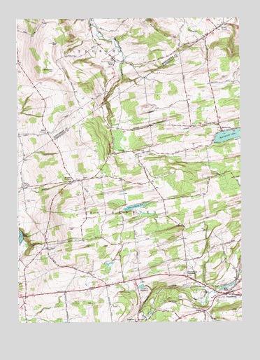
Duanesburg, NY USGS Topographic Map
Click on map above to begin viewing in our Map Viewer.

This topographic map contains these locations and features:
Feature Name Type Latitude Longitude GNIS ID View Map
Batter Street CemeteryCemeteryN42.8196°W74.1793°943166View Map
Bean HillSummitN42.8651°W74.2304°943240View Map
Braman CornersPopulated PlaceN42.8087°W74.2187°944611View Map
County Line CemeteryCemeteryN42.8171°W74.2468°947558View Map
Delanson ReservoirReservoirN42.7647°W74.1813°948262View Map
Dennison CemeteryCemeteryN42.8506°W74.1351°948313View Map
Dorn CemeteryCemeteryN42.8670°W74.1604°948589View Map
DuanePopulated PlaceN42.7542°W74.1485°948711View Map
Duane MansionLocaleN42.7548°W74.1276°948714View Map
DuanesburgPopulated PlaceN42.7620°W74.1337°948718View Map
Duanesburg AirportAirportN42.7606°W74.1331°977988View Map
Duanesburg Census Designated PlaceCensusN42.7637°W74.1349°2389419View Map
Duanesburg ChurchesChurchN42.7690°W74.1551°970079View Map
Duanesburg Florida Baptist ChurchChurchN42.8088°W74.2158°2615850View Map
Duanesburg Post OfficePost OfficeN42.7612°W74.1367°2617894View Map
Duanesburg Town HallBuildingN42.7653°W74.1477°2617607View Map
Duanesburg Volunteer Ambulance CorpsBuildingN42.7522°W74.1601°2720158View Map
Duanesburg Volunteer Fire DepartmentBuildingN42.7604°W74.1376°2718575View Map
Duanespurg ReservoirLakeN42.7975°W74.1845°948719View Map
Eaton CornersPopulated PlaceN42.8059°W74.2468°949317View Map
Eaton Corners CemeteryCemeteryN42.7998°W74.2443°949319View Map
Falling Leaf FarmLocaleN42.8514°W74.1436°2516820View Map
Frydendall CemeteryCemeteryN42.8199°W74.1902°950348View Map
Howard CemeteryCemeteryN42.7808°W74.2317°953304View Map
Jones CemeteryCemeteryN42.7816°W74.2125°954161View Map
MariavillePopulated PlaceN42.8287°W74.1351°956512View Map
Mariaville AerodromeAirportN42.8190°W74.1501°2443137View Map
Mariaville CemeteryCemeteryN42.8266°W74.1386°2437906View Map
Mariaville Elementary SchoolSchoolN42.8325°W74.1394°2437899View Map
Mariaville LakePopulated PlaceN42.8248°W74.1287°1852906View Map
Mariaville LakeLakeN42.8266°W74.1312°956513View Map
Mariaville Lake Census Designated PlaceCensusN42.8252°W74.1286°2390121View Map
McKinney HillSummitN42.8737°W74.1785°956813View Map
Merry Hill FarmLocaleN42.8461°W74.2167°2556299View Map
Mill PondLakeN42.7648°W74.1329°957268View Map
Miller CornersPopulated PlaceN42.8279°W74.2329°957303View Map
Morey CemeteryCemeteryN42.7812°W74.2023°957656View Map
Our Lady of Fatima ChurchChurchN42.7501°W74.1878°2616185View Map
Priddle CampLocaleN42.7862°W74.2487°961133View Map
Rulison Honey FarmLocaleN42.8589°W74.2147°2556289View Map
Scotch BushPopulated PlaceN42.8576°W74.1954°964662View Map
Scotch ChurchPopulated PlaceN42.8717°W74.1351°964664View Map
Scotch Church CemeteryCemeteryN42.8722°W74.1358°2548172View Map
Scotch Ridge Berry FarmLocaleN42.7817°W74.1292°2516824View Map
Shellstone HillSummitN42.8540°W74.2293°965032View Map
Six Ponds AirportAirportN42.8406°W74.1751°2443574View Map
Smith CemeteryCemeteryN42.7581°W74.2090°965462View Map
Stewart CemeteryCemeteryN42.8093°W74.2142°966400View Map
Town of DuanesburgCivilN42.7799°W74.1805°978910View Map
Union CemeteryCemeteryN42.8026°W74.2148°968159View Map
Wood CemeteryCemeteryN42.7665°W74.1812°971592View Map

Note: Coordinates in the location and feature list above are referenced to NAD83 datum.


Copyright (C) 2008-2024 Ryan Niemi / Sunset Dynamics ... All Rights Reserved