TopoQuest Logo
Do you find TopoQuest useful?
Help keep TopoQuest running and adding new maps/features by donating!
Bitcoin:  19c7KJd3qBynnjoSw5npx9KScwjBe4ifkT
Litecoin:  LXs6TkuXGGXo1vDsWCkWVdjQX94eUKd6ui
Home View Maps Find Maps Find Places Resources & Links


Dugway, New York Topographic Map

USGS Map Title: Dugway, NY
USGS Map MRC: 43076D1
DRG (GeoTIFF) Download: o43076d1.tif


Neighboring USGS Topographic Map Quads:


  Pulaski, NY  
43076E2
 

  Richland, NY  
43076E1
 

  Orwell, NY  
43075E8
 

  Mexico, NY  
43076D2
 

  Dugway, NY  
43076D1
 

  Williamstown, NY  
43075D8
 

  Central Square, NY  
43076C2
 

  Mallory, NY  
43076C1
 

  Panther Lake, NY  
43075C8


Map MRC Location:

N44°
W77°
N44°
W76°
H8 H7 H6 H5 H4 H3 H2 H1
G8 G7 G6 G5 G4 G3 G2 G1
F8 F7 F6 F5 F4 F3 F2 F1
E8 E7 E6 E5 E4 E3 E2 E1
D8 D7 D6 D5 D4 D3 D2 D1
C8 C7 C6 C5 C4 C3 C2 C1
B8 B7 B6 B5 B4 B3 B2 B1
A8 A7 A6 A5 A4 A3 A2 A1
N43°
W77°
N43°
W76°

Dugway, NY USGS 1:24K Topographic Map Preview:
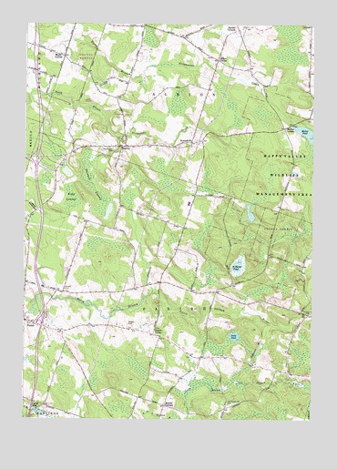
Dugway, NY USGS Topographic Map
Click on map above to begin viewing in our Map Viewer.

This topographic map contains these locations and features:
Feature Name Type Latitude Longitude GNIS ID View Map
Albion CenterPopulated PlaceN43.4887°W76.0416°972155View Map
Albion Center CemeteryCemeteryN43.4895°W76.0440°2542506View Map
Altmar - Parish - Williamstown High SchoolSchoolN43.4435°W76.0534°2713750View Map
Altmar - Parish - Williamstown Middle SchoolSchoolN43.4431°W76.0506°2713743View Map
Barber CornersLocaleN43.4981°W76.0327°942981View Map
Bidwell CemeteryCemeteryN43.4161°W76.1072°943828View Map
Carley MillsPopulated PlaceN43.3787°W76.1213°972299View Map
Chezwick Estates Mobile Home ParkPopulated PlaceN43.3900°W76.0043°2715152View Map
DugwayPopulated PlaceN43.4615°W76.0816°972396View Map
Dugway CemeteryCemeteryN43.4609°W76.0858°956437View Map
Dutch Hill CemeteryCemeteryN43.3802°W76.0360°959272View Map
Faith Church of the NazareneChurchN43.4021°W76.1145°2714724View Map
Fritz PondLakeN43.4014°W76.0331°950745View Map
Getman CemeteryCemeteryN43.4084°W76.0010°951050View Map
HowardvillePopulated PlaceN43.4628°W76.0527°972629View Map
Kipp SwampSwampN43.4451°W76.1044°954703View Map
Liberty Park Mobile Home ParkPopulated PlaceN43.3951°W76.0698°2715173View Map
Maple CornersLocaleN43.4901°W76.1083°956391View Map
Merritt CornersLocaleN43.3792°W76.0633°957013View Map
Mosher CornersLocaleN43.4673°W76.0121°957736View Map
Mosher PondReservoirN43.4660°W76.0033°957739View Map
Paris Hastings Presbyterian ChurchChurchN43.4043°W76.1249°2714759View Map
Parish CenterPopulated PlaceN43.4020°W76.0683°972915View Map
Saint Marys PondLakeN43.4236°W76.0324°963962View Map
School Number 10 (historical)SchoolN43.4014°W76.0653°2101011View Map
School Number 10 (historical)SchoolN43.4978°W76.0328°2101012View Map
School Number 12 (historical)SchoolN43.4608°W76.0825°2101013View Map
School Number 2 (historical)SchoolN43.3925°W76.0239°2101006View Map
School Number 4 (historical)SchoolN43.4422°W76.0836°2101007View Map
School Number 5 (historical)SchoolN43.4150°W76.1078°2101008View Map
School Number 6 (historical)SchoolN43.4178°W76.0603°2101009View Map
School Number 8 (historical)SchoolN43.4806°W76.0944°2101010View Map
Steward SwampSwampN43.4481°W76.0952°966395View Map
Town of AlbionCivilN43.4946°W76.0315°978661View Map
Town of ParishCivilN43.4101°W76.0655°979342View Map
Wright CemeteryCemeteryN43.4050°W76.0794°971749View Map

Note: Coordinates in the location and feature list above are referenced to NAD83 datum.


Copyright (C) 2008-2024 Ryan Niemi / Sunset Dynamics ... All Rights Reserved